
I’M BRIAN ROCHE ON YOUR SIDE. WGAL NEWS EIGHT. NOW THE NEWS EIGHT STORM TEAM FORECAST WITH METEOROLOGIST MIKE SUSKO. GOOD AFTERNOON EVERYONE. A WINTER STORM WATCH HAS BEEN POSTED FOR THE ENTIRE SUSQUEHANNA VALLEY BY THE NATIONAL WEATHER SERVICE FOR THE WEEKEND FROM 10:00 ON SATURDAY THROUGH 1 P.M. ON MONDAY. HERE. AND THIS WILL BE UPGRADED TO A WARNING LIKELY SOMETIME TOMORROW, IF NOT EARLY SATURDAY, BECAUSE WE’RE GOING TO BE GETTING WELL OVER THE THRESHOLD THAT YOU NEED, WHICH IS FIVE INCHES OR MORE. IT’S HIGHLY LIKELY THAT WE’LL BE PICKING UP SIX INCHES OR MORE ACROSS THE AREA. LIKELY THAT WE COULD GET AT LEAST A FOOT FOR MAJORITY OF THE SUSQUEHANNA VALLEY HERE SATURDAY NIGHT THROUGH EARLY MONDAY MORNING. AND THEN ONCE YOU START GETTING 18IN, IT’S POSSIBLE, BUT YOUR CHANCES DO DROP OFF DRASTICALLY, ESPECIALLY ONCE YOU GO TOWARDS THAT TWO FOOT MARK OF 24IN OR MORE HERE. BUT WE ARE EXPECTING A SIGNIFICANT SNOW. NO MATTER HOW YOU SLICE IT. HIGH PRESSURE WILL BE IN CONTROL AS WE GO THROUGH SATURDAY. THAT’S GOING TO PUT THE ARCTIC AIR IN PLACE. THAT IS ALWAYS THE ONE OF THE KEY INGREDIENTS THAT WE NEED, AND IT’S OFTEN THE ONE THAT WE’RE ALWAYS MISSING HERE IN THE SUSQUEHANNA VALLEY. BUT WE HAVE THE ARCTIC AIR IN PLACE A DAY AHEAD OF TIME. THAT JUST MEANS THAT WE GET A LOT OF WINTRY WEATHER, AND IT’S A LONG DURATION EVENT. SO EVEN THOUGH WE WILL HAVE TIMES WHERE IT’S NOT COMING DOWN TOO HARD, IT’S GOING TO BE GOING FROM SATURDAY, LATE SATURDAY NIGHT, EARLY SUNDAY MORNING THROUGH THE ENTIRE DAY SUNDAY WITH SNOW AND MAYBE A LITTLE BIT OF MIX FOR SOUTHEASTERN AREAS. THAT’S THAT PINK THAT YOU’RE SEEING. IT’S A LINE THAT WE DO NEED TO WATCH HERE, AND IT’S ALWAYS A FACTOR INTO THE FORECAST FOR OUR AREA. SO WE’RE WATCHING THAT LINE. SOME MODELS BRING IT AS FAR NORTH AS THE TURNPIKE. OTHERS BRING IT RIGHT TO THE PENNSYLVANIA MARYLAND LINE. BUT WHERE YOU SEE THAT IT WILL BE SLEET. AND THAT’S GOING TO CUT DOWN ON TOTALS A LITTLE BIT. BUT WE ARE AGAIN, DEALING WITH A LONG DURATION EVENT HERE WITH OVER 24 HOURS. SO I DO THINK IT IS ENOUGH WILL PILE UP AND BE ABLE TO GET TO THAT ONE FOOT MARK FOR MOST AREAS. AS WE GO THROUGH YOUR SUNDAY. BY MONDAY MORNING STILL GOT SOME LINGERING SNOW SHOWERS, BUT THINGS BEGIN TO WIND DOWN HERE ACROSS THE AREA. BUT THE DAMAGE WAS DONE, SO TO SPEAK. WE WILL HAVE SNOW COVERED ROADS LATE SATURDAY NIGHT. THIS WILL BE AFTER MIDNIGHT SATURDAY NIGHT, SO IF YOU’RE GOING TO BE OUT EARLY OR IN THE EVENING SATURDAY, YOU’RE GOING TO BE FINE. AS WE GO INTO SUNDAY. THAT’S WHERE WE’RE DEALING WITH HAZARDOUS ROAD CONDITIONS. YOU’RE TALKING SNOW AND SNOW COVERED ROADS THERE ACROSS THE AREA. EVEN MONDAY MORNING. STILL DEALING WITH SNOW COVERED ROADS AND BLOWING AND DRIFTING MONDAY AFTERNOON AS WINDS WILL BE BEHIND IT. SO YOU DO WANT TO MAKE SURE THAT YOU’RE KEEPING THAT IN IN THE BACK OF YOUR MIND HERE AS YOU’RE MAKING PLANS THAT EVEN ON MONDAY, IT MAY BE DIFFICULT TO GET AROUND IN SOME SPOTS HERE BECAUSE WE ARE DEALING WITH A SIGNIFICANT SNOWFALL AS WE GO TOWARDS THE END OF THE WEEKEND, BUT WE ARE WATCHING THAT MIX AGAIN FOR OUR SOUTHEASTERN COUNTIES. TIMING AGAIN WILL BE LATE SATURDAY NIGHT AND EARLY MONDAY MORNING, WITH MAJOR TRAVEL DISRUPTIONS POSSIBLE AND MAYBE EVEN SOME POWER OUTAGES, ESPECIALLY ON MONDAY BEHIND THE SYSTEM WHERE WE COULD SEE A LITTLE BIT OF STRONG WINDS. BUT UNTIL THEN, ENJOY THE MILD WEATHER TODAY. IT’S BEAUTIFUL OUTSIDE, RIGHT? WE’VE GOT MOSTLY SUNNY SKIES HERE IN LANCASTER. CURRENT TEMPERATURES ARE IN THE 40S, 46 IN HARRISBURG, 44 IN LANCASTER. CHECK OUT YORK AND GETTYSBURG ALMOST 50 DEGREES HERE. AND SO WE ARE SEEING THAT MILD WEATHER RIGHT NOW. ENJOY IT WHILE YOU CAN, BECAUSE TODAY IS PRETTY MUCH THE BEST DAY FOR A WHILE. WE’RE GOING TO BE ABOVE AVERAGE ALREADY THERE ACROSS THE AREA. TONIGHT WILL BE PARTLY CLOUDY, BRISK AND BREEZY. FEELING LIKE THE TEENS AS WE DROP BACK INTO THE 20S TOMORROW. WE’RE A LITTLE BIT ABOVE FREEZING, BUT IT WILL ACTUALLY BE A LITTLE BELOW AVERAGE FOR THIS TIME OF YEAR. SHOULD BE CLOSER TO 40 DEGREES, BUT IT’S GOING TO GET WINDY IN BEHIND IT. WE’RE DEALING WITH BELOW ZERO WIND CHILLS TOMORROW NIGHT AND INTO SATURDAY. WE’LL TALK MORE ABOUT THAT HERE. ABOUT ANOTHER 5 TO 10 MINUTES. BUT OUR ATTENTION IS TOWARDS SUNDAY WITH THE ALERT DAY BECAUSE WE WILL HAVE PLENTY OF SNOW TO DEAL WITH. IT WILL BE HEAVY AT TIMES, AND AGAIN, YOU WANT TO MAKE SURE THAT YOU’RE PREPARED FOR THAT AND IT STICKS AROUND. LOOK AT THE T
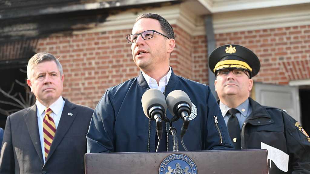
A major snowstorm is expected to hit Pennsylvania this weekend, with a foot or more of snowfall projected. In severe winter weather, the governor may declare a disaster emergency, which people sometimes refer to as a state of emergency. Here’s what a disaster emergency means and what it does NOT mean.Extra resources, efficienciesA declaration would activate and streamline the state’s emergency response, strengthening coordination between PennDOT, PEMA, Pennsylvania State Police, utilities and local governments. Spending The declaration temporarily waives certain purchasing and bidding requirements, allowing the state to quickly buy supplies, hire services, and deploy equipment.Does NOT ban personal travelUnless specific orders are issued, residents can still travel, but are expected to follow any posted restrictions and official guidance. Does NOT close businessesThe declaration also does NOT mean businesses have to close, unless specific orders are later issued. Disaster emergency powersThe governor’s disaster emergency powers come from Article IV, Section 20 of the Pennsylvania Constitution. A general disaster emergency authorizes and directs the Pennsylvania Emergency Management Agency Director to assume command and control of all statewide emergency operations. All Commonwealth departments and agencies, under the direction of the PEMA Director, are directed to use all available powers, resources and personnel as deemed necessary to deal with the relevant emergency.In Pennsylvania, disaster emergencies cannot be in effect for more than 21 days unless extended by the General Assembly. If a disaster emergency expires, the governor is not allowed to issue a new declaration based on the same, or substantially same, facts and circumstances unless the General Assembly approves.
HARRISBURG, Pa. —
A major snowstorm is expected to hit Pennsylvania this weekend, with a foot or more of snowfall projected.
In severe winter weather, the governor may declare a disaster emergency, which people sometimes refer to as a state of emergency.
Here’s what a disaster emergency means and what it does NOT mean.
Extra resources, efficiencies
A declaration would activate and streamline the state’s emergency response, strengthening coordination between PennDOT, PEMA, Pennsylvania State Police, utilities and local governments.
Spending
The declaration temporarily waives certain purchasing and bidding requirements, allowing the state to quickly buy supplies, hire services, and deploy equipment.
Does NOT ban personal travel
Unless specific orders are issued, residents can still travel, but are expected to follow any posted restrictions and official guidance.
Does NOT close businesses
The declaration also does NOT mean businesses have to close, unless specific orders are later issued.
Disaster emergency powers
The governor’s disaster emergency powers come from Article IV, Section 20 of the Pennsylvania Constitution.
A general disaster emergency authorizes and directs the Pennsylvania Emergency Management Agency Director to assume command and control of all statewide emergency operations. All Commonwealth departments and agencies, under the direction of the PEMA Director, are directed to use all available powers, resources and personnel as deemed necessary to deal with the relevant emergency.
In Pennsylvania, disaster emergencies cannot be in effect for more than 21 days unless extended by the General Assembly. If a disaster emergency expires, the governor is not allowed to issue a new declaration based on the same, or substantially same, facts and circumstances unless the General Assembly approves.