Dangerous cold arrives Friday night in the Lehigh Valley region, while a significant winter storm is forecast to bring substantial snow and ice accumulation Saturday night through Monday.
Wind chills will drop below zero across most of the area Friday night, with the Pocono Mountains facing the most severe conditions.
The National Weather Service issued an Extreme Cold Warning for 7 p.m. Friday to 10 a.m. Saturday for Carbon and Monroe counties in the southern Poconos, with dangerous wind chills expected to plummet to as low as minus 20 degrees.
A Cold Weather Advisory is in effect overnight Friday into Saturday morning for a region encompassing Berks, Bucks, Lehigh, Northampton, Warren and Hunterdon counties — warning of very cold wind chills as low as 11 degrees below zero.
Temperatures will rapidly fall from the low 30s on Friday to single digits or below zero by early Saturday morning, accompanied by west-northwest winds gusting 25-35 mph. In the Poconos, the National Weather Service warns that just 30 minutes of exposed skin could cause frostbite and hypothermia.
“The cold wind chills as low as 10 below zero could result in hypothermia if precautions are not taken,” the Lehigh Valley advisory states. “Frostbite and hypothermia will occur if unprotected skin is exposed to these temperatures. Wind chill values can lead to hypothermia with prolonged exposure.”
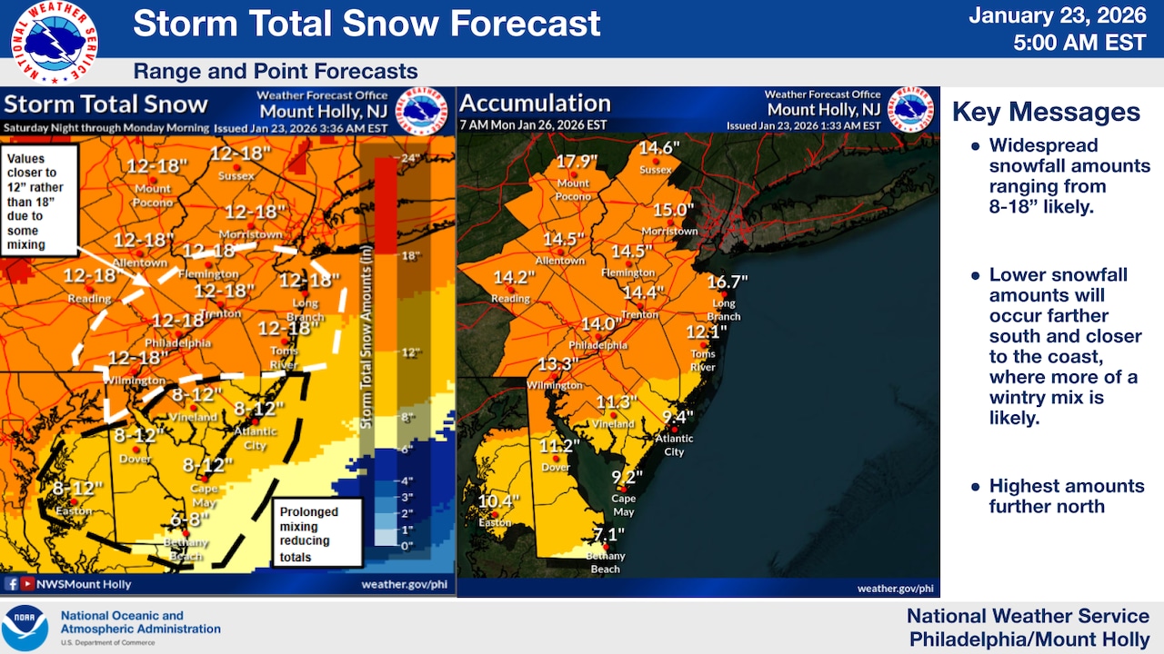
A major winter storm is expected to develop Saturday night, with snowfall expected to reach 12 to 18 inches in eastern Pennsylvania and northwestern New Jersey, with the Poconos potentially seeing over 18 inches.
To the southeast, areas near the I-95 corridor may experience mixed precipitation, including sleet and freezing rain, with potential ice accumulations of 0.10 to 0.25 inches.
The weather service issued a Winter Storm Watch for the entire area from Saturday night through early Monday afternoon.
At Lehigh Valley International Airport outside Allentown, the weather service’s hourly forecast has the snow starting shortly after midnight Saturday, continuing throughout Sunday into Monday morning and ending by about 7 p.m. Monday.
The arctic air mass will persist through late next week, with temperatures likely remaining below freezing through Thursday. Daily high temperatures will struggle to reach the low 20s, with lows in the single digits. Wind chills are expected to remain below zero Monday and Tuesday nights.
Residents are advised to take extreme precautions, including:
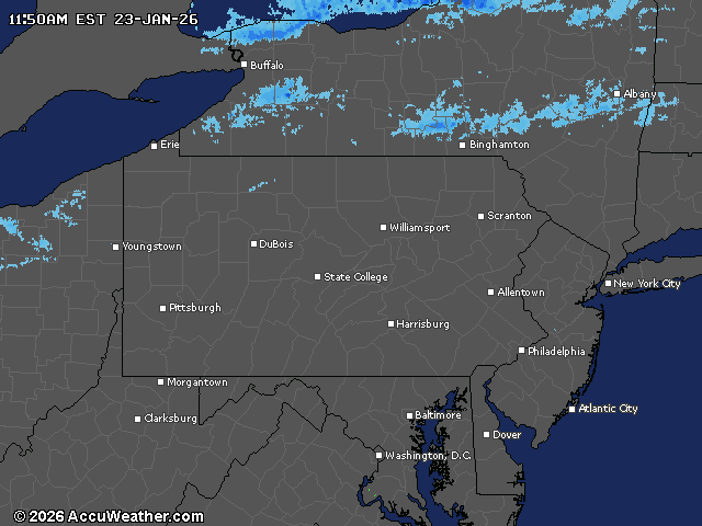
Current weather radar