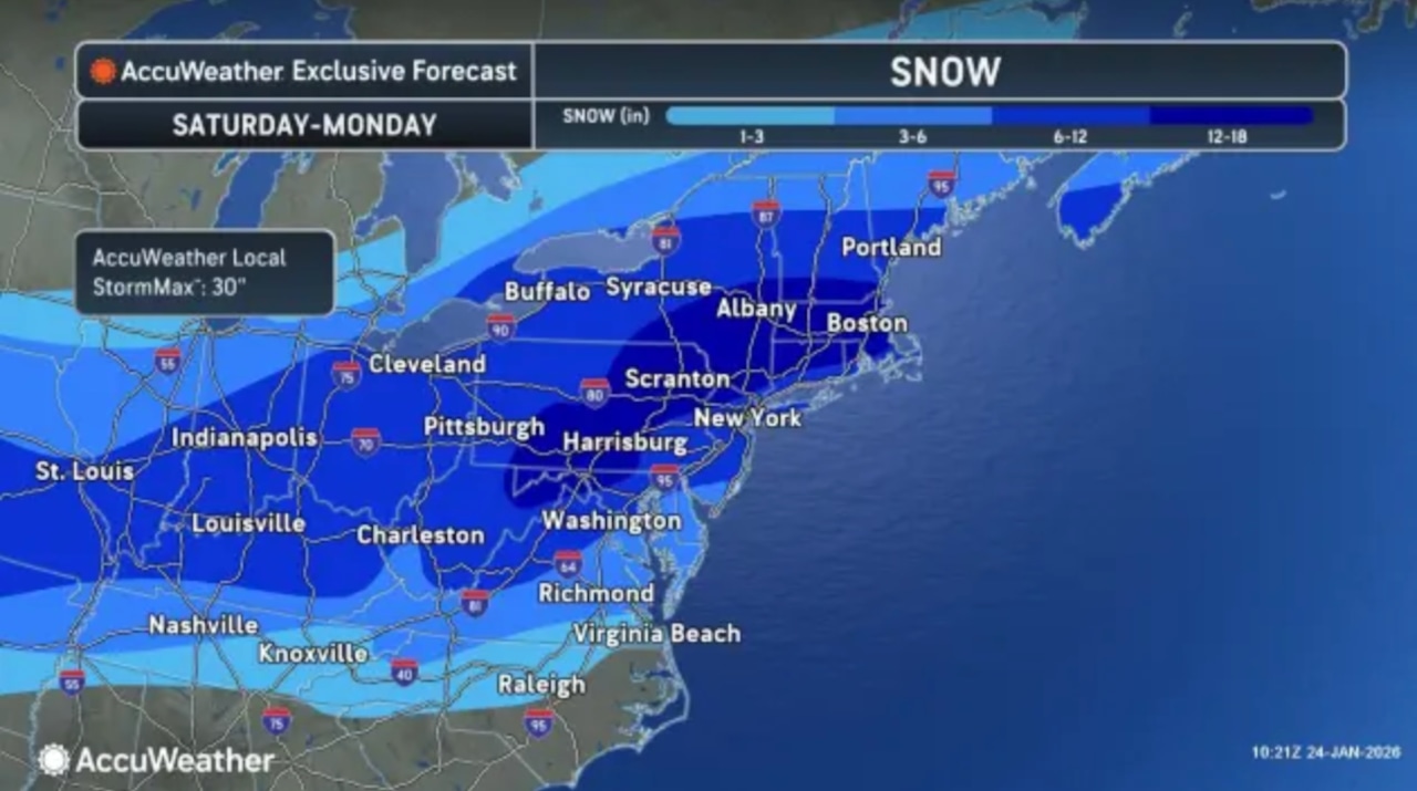
Snowfall projections have been revised for the major winter storm that’s set to impact the Lehigh Valley on Sunday.
The storm is expected to still bring significant snowfall, potential ice accumulation, and dangerously cold temperatures.
The National Weather Service has issued Winter Storm Warnings for the region, with forecasters now predicting 8 to 16 inches of snow and potential ice accumulations that could cause major travel disruptions.
The previous forecast called for 12 to 18 inches of snow.
The storm is expected to begin late Saturday night, with snow spreading across the area by early Sunday morning.
Snowfall rates could reach over one inch per hour, with the highest accumulations likely along the Interstate 78 corridor and points north.
The Lehigh Valley region can expect heavy snow, with total snow and sleet accumulations of 11 to 15 inches, according to a Winter Storm Warning in place from 1 a.m. Sunday to 1 p.m. Monday for Carbon, Lehigh, Monroe, Northampton and Warren counties.
“Travel could be very difficult to impossible,” the warning states. “The hazardous conditions could impact the Monday morning commute.”
Temperatures will remain extremely cold throughout the event, with wind chills potentially dropping below zero degrees. The Poconos may experience wind chills as low as 22 degrees below zero.
Residents are advised to take precautions against the cold, including limiting outdoor exposure, dressing in layers, and protecting pipes from freezing.
The arctic air mass will persist through the week, with temperatures remaining below freezing into Friday.
Monday is expected to be the “mildest” day, with highs in the upper 20s to low 30s.
Strong winds developing Monday night could create wind chills as low as 10 degrees below zero, with the southern Poconos potentially seeing wind chills of 20 degrees below zero.
Residents should prepare for significant travel challenges, potential power outages, and extended periods of extreme cold. The prolonged cold temperatures mean the new snowpack is unlikely to melt quickly, maintaining hazardous winter conditions throughout the week.
Current weather radar