
Live Map: Track power outages across Pennsylvania as massive storm to dump snow on state
NOW, THE ALERT DAY FORECAST FROM THE WGAL NEWS EIGHT STORM TEAM. GOOD MORNING EVERYONE. WE’VE BEEN WATCHING THE SNOW AS IT’S BEEN COMING DOWN THIS MORNING. IT’S BEEN SNOWING FOR A GOOD FOUR HOURS IN MANY SPOTS. AND WE HAVE SOME SNOW TOTALS FOR YOU IN ABBOTTSTOWN. 3.5IN OF SNOW ALREADY. MECHANICSBURG IN CUMBERLAND COUNTY, OVER THREE INCHES THERE AS WELL. AND HIGHSPIRE REPORTING 1.3. IN LANCASTER CITY WE HAVE A REPORT OF TWO INCHES OF SNOW ALREADY, SO IT’S PILING UP QUICKLY. IT’S REAL FINE, CRYSTAL LIKE SNOW, AND IT’S COMING DOWN. IT’S GOING TO START TO PICK UP IN INTENSITY AS WE GO THROUGH THE MORNING HOURS. RIGHT NOW IT’S LIGHT TO POCKETS OF MODERATE SNOW, BUT JUST TO OUR SOUTH IT DOES PICK UP IN INTENSITY. AND WE’RE GOING TO BE SEEING 1 TO 2 INCH SNOWFALL RATES PER HOUR. AND YOU SEE THE BRIGHTER WHITE BANDS TO OUR SOUTH. THAT’S WHERE WE’RE SEEING THAT SNOW INTENSITY INCREASE ACROSS THE AREA. HERE’S A LOOK AT THE POTENTIAL ROAD CONDITIONS. OBVIOUSLY ROADS ARE COVERED THIS MORNING. WITH THE SNOW. IT BECOMES MORE HAZARDOUS. TRAVELING IS JUST GOING TO BE MORE DIFFICULT WITH VISIBILITY. WE’LL ALSO HAVE SOME SLEET MIXING IN THIS AFTERNOON. AND THEN BY TOMORROW MORNING WE’RE LOOKING AT SNOWY AND ICY CONDITIONS. WITH THE WINDS PICKING UP. TOMORROW WE’RE GOING TO BE TALKING ABOUT BLOWING AND DRIFTING CONDITIONS. THAT JUST ADDS TO A WHOLE DIFFERENT LEVEL OF ISSUES WITH DRIVING. EXPECTED SNOW TOTALS, TOTALS. WE’VE BEEN TALKING ABOUT THIS FOR SEVERAL DAYS NOW, 12 TO 18IN FOR THE AREAS. SEEING THAT PURPLE DRAPED ACROSS THE AREA THAT’S MAINLY NORTH AND NORTHWEST OF I-81 AND TO THE SOUTH AND SOUTHEAST, YOU’RE STILL GOING TO GET A PRETTY DECENT AMOUNT OF SNOW, 8 TO 12IN. BUT WE’VE GOT LOWER TOTALS HERE BECAUSE THIS IS WHERE WE COULD SEE THE SLEET MIXING IN. AND DEPENDING ON HOW MUCH SLEET AND HOW FAR NORTH, THAT WILL DETERMINE WHAT KIND OF TOTALS WE END UP WITH. BY THE TIME ALL IS SAID AND DONE. AND FOR AND WE CONTINUE WITH THE WINTER STORM WARNING FOR TODAY AND EVEN INTO TOMORROW, I THINK BECAUSE OF THE WINDS CAUSING SOME BLOWING AND DRIFTING OF THE SNOW. AND FOR MORE ON THE FORECAST AND THE COLD AIR, THE FRIGID AIR THAT’S GOING TO BE STICKING AROUND, WE GO TO CHRISTINE FOR THE LATEST. ALL RIGHT. SO HERE’S A LOOK AT OUR NEWS EIGHT STORM TEAM FORECAST TODAY. WE HAVE THAT WIDESPREAD SNOW THIS MORNING. LIKE MARY ELLEN MENTIONED IT COULD BE HEAVY AT TIMES ESPECIALLY LATE MORNING INTO THE AFTERNOON. NOW IN THE AFTERNOON THAT’S WHEN WE’RE GOING TO SEE THE SLEET MIXING IN FROM SOUTH TO NORTH. AND EVENTUALLY I THINK IT WILL REACH UP TO I-81. BUT THE FARTHER SOUTH YOU ARE, THAT’S WHY WE HAVE YOU IN THE 8 TO 12 INCH SNOWFALL TOTALS, BECAUSE YOU COULD GET A CONSIDERABLE AMOUNT OF SLEET ON TOP OF THAT SNOW. YOU COULD GET 1 TO 2IN OF SLEET. SO THIS EVENING THE SNOW AND SLEET WILL BEGIN TO TAPER. I THINK BY 8:00 WE’LL START TO SEE SOME BREAKS. THE WHOLE STORM STARTS TO WIND DOWN BY MIDNIGHT. IT’S OUT OF HERE AND OVERNIGHT TEMPERATURES ARE GOING TO HOLD STEADY IN THE TEENS. NOW. LUCKILY TONIGHT WINDS WILL BE LIGHT, BUT TOMORROW THOSE WINDS START TO PICK UP AND COULD GUST TO 40MPH OUT OF THE NORTHWEST, WE’LL SEE CLOUDS WITH SOME BREAKS OF SUN AND BLOWING AND DRIFTING SNOW BEING OUR PRIMARY CONCERN. THAT’S WHY WE HAVE AN ALERT DAY TOMORROW. IN ADDITION, IT’S GOING TO FEEL LIKE THE SINGLE DIGITS AND LOWER SINGLE DIGITS TOMORROW. POSSIBLY. HERE’S A LOOK AT OUR TEMPERATURES UNIFORM THIS MORNING WITH THAT LIGHT SNOW COMING DOWN AROUND TEN DEGREES IN MOST SPOTS. ADD JUST A 5 TO 10 MILE PER HOUR BREEZE AND IT FEELS LIKE IT’S SUBZERO. FEELS LIKE ONE BELOW IN HARRISBURG AS MUCH AS THREE BELOW. IN LANCASTER. WE HAVE THE GOOSE EGG THERE IN YORK. FEELS LIKE ZERO RIGHT NOW, SO KEEP THAT IN MIND AS YOU’RE HEADED OUT TO SHOVEL. MAKE SURE YOU’RE LAYERED UP IN ALL EXPOSED SKIN IS COVERED. HERE’S THE STORM TEAM LIVE RADAR NETWORK. WE’VE BEEN SEEING SOME BANDS OF MODERATE SNOW MOVING IN, BUT WE WILL GET THOSE HEAVIER BANDS SHORTLY. LOOK AT THE ENTIRE NATION HERE. COVERED BY THE STORM. THE WHOLE EASTERN HALF. THIS IS A LARGE AND IMPACTFUL SNOWSTORM FOR MUCH OF THE COUNTRY. SO FOR US, HERE’S THE HOUR BY HOUR TIMING. WE’RE LOOKING AT THAT STEADY SNOW THIS MORNING, BECOMING HEAVIER INTO THE AFTERNOON. AND HERE COMES THAT LINE OF SLEET. NOW, A LOT OF YOU ARE SAYING, HOW IN THE WORLD CAN IT SLEET WHEN IT’S 18 DEGREES OUTSIDE FOR A HIGH LATER TODAY? WE HAVE LOW PRESSURE, WHICH IS GOING TO BE HUGGING THE COAST AND SITTING OFF THE COAST OF DELMARVA LATER. AND THAT FUNNELS IN WARMER OCEAN AIR JUST ABOVE OUR HEADS. SO THE SNOWFLAKE WILL MELT AND THEN REFREEZE BEFORE HITTING THE GROUND. THAT’S HOW WE GET SLEET. AND I DO THINK THAT SLEET LINE LOOK AT THIS COMES ALL THE WAY UP TO I-81 AS WE HEAD INTO THE AFTERNOON AND EVENING. SO THAT’S WHY WE HAVE SLIGHTLY LOWER TOTAL SOUTHEAST. BUT THIS IS STILL A MAJOR IMPACTFUL STORM. EVEN IF YOU DO GET THE SLEET. HERE WE ARE AT 8 P.M. IT TAPERS BY MIDNIGHT. I THINK IT’S OUT OF HERE. AND THEN WE WILL JUST BE DEALING WITH THE BLOWING AND DRIFTING SNOW AS WE HEAD INTO TOMORROW. SO IMPACTS AFTER THE STORM. WE COULD HAVE SOME GUSTS OF 40MPH TOMORROW, BUT BLOWING AND DRIFTING SNOW, ESPECIALLY IMPACTING RURAL ROADS. AND IN A FRIGID WEEK AHEAD, WE’RE TALKING ABOUT SUBZERO WIND CHILLS EVERY DAY IN THE MORNING ALL THE WAY THROUGH THE WEEK. LOOK AT THESE OVERNIGHT LOWS. JUST A FIVE MILE PER HOUR BREEZE WILL DRIVE YOUR WIND CHILL WELL BELOW ZERO. LUCKILY. ALSO, WE ARE GOING TO BE TALKING ABOUT QUIET WEATHER THROUGH THE END OF THE WEEK AND FOR THE LAST DAY OF JANUARY. ON SATURDAY IT’S QUIET. SUNDAY IS ALSO QUIET B
Live Map: Track power outages across Pennsylvania as massive storm to dump snow on state

Updated: 9:11 AM EST Jan 25, 2026
Power outages are possible across Pennsylvania as a powerful winter snow storm moves through the region. Bookmark this link for live updates as the outages are reported.Live-updating mapForecast infoA potent winter storm will bring heavy snow, periods of sleet and hazardous travel to South-Central Pennsylvania. Winter storm warningWinter Storm Warning until 1 p.m. Monday for the entire Susquehanna Valley.What’s happening nowWidespread snow this morning, becoming heavy at times with 1–2 inches per hour through the afternoon.Morning temps in the teens; wind chills near 0°F.TimingLow deepens off Delmarva this afternoon, allowing warm air to move into the low levels of the atmosphere.Greatest sleet threat: after noon through the end of the storm, especially south and east of I‑81.Precipitation tapers late evening and should end by midnight.Overnight: mostly cloudy and steady near 16°F.Snow and sleet forecastLancaster, York, Adams, and parts of Franklin counties: 8–12″ snow with up to 2″ sleet.Areas receiving mainly snow: 12–18″.Prolonged sleet most likely south/east of I‑81 where the warm layer aloft is strongest.Monday winds and impactsMonday: northwest winds 15–25 mph with gusts to 40 mph as the low departs.Expect blowing and drifting snow, reduced visibility, and hazardous travel—especially in rural and exposed areas.Impacts and adviceTravel hazardous this afternoon into late evening; expect slick roads and reduced visibility.Prepare for blowing/drifting snow Monday and bitter cold through the week.Related coveragePHNjcmlwdCB0eXBlPSJ0ZXh0L2phdmFzY3JpcHQiPiFmdW5jdGlvbigpeyJ1c2Ugc3RyaWN0Ijt3aW5kb3cuYWRkRXZlbnRMaXN0ZW5lcigibWVzc2FnZSIsKGZ1bmN0aW9uKGUpe2lmKHZvaWQgMCE9PWUuZGF0YVsiZGF0YXdyYXBwZXItaGVpZ2h0Il0pe3ZhciB0PWRvY3VtZW50LnF1ZXJ5U2VsZWN0b3JBbGwoImlmcmFtZSIpO2Zvcih2YXIgYSBpbiBlLmRhdGFbImRhdGF3cmFwcGVyLWhlaWdodCJdKWZvcih2YXIgcj0wO3I8dC5sZW5ndGg7cisrKXtpZih0W3JdLmNvbnRlbnRXaW5kb3c9PT1lLnNvdXJjZSl0W3JdLnN0eWxlLmhlaWdodD1lLmRhdGFbImRhdGF3cmFwcGVyLWhlaWdodCJdW2FdKyJweCJ9fX0pKX0oKTs8L3NjcmlwdD4=
LANCASTER, Pa. —
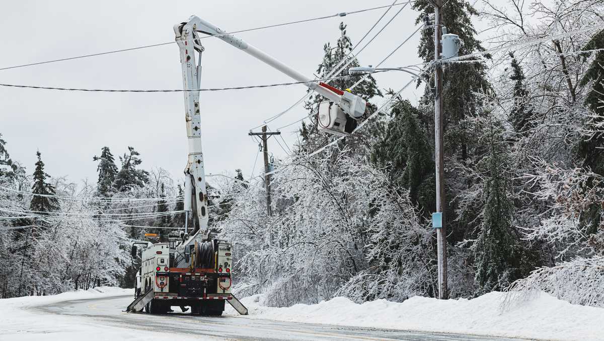
Power outages are possible across Pennsylvania as a powerful winter snow storm moves through the region. Bookmark this link for live updates as the outages are reported.
Live-updating map
Forecast info
A potent winter storm will bring heavy snow, periods of sleet and hazardous travel to South-Central Pennsylvania.
Winter storm warning
Winter Storm Warning until 1 p.m. Monday for the entire Susquehanna Valley.
What’s happening nowWidespread snow this morning, becoming heavy at times with 1–2 inches per hour through the afternoon.Morning temps in the teens; wind chills near 0°F.TimingLow deepens off Delmarva this afternoon, allowing warm air to move into the low levels of the atmosphere.Greatest sleet threat: after noon through the end of the storm, especially south and east of I‑81.Precipitation tapers late evening and should end by midnight.Overnight: mostly cloudy and steady near 16°F.Snow and sleet forecastLancaster, York, Adams, and parts of Franklin counties: 8–12″ snow with up to 2″ sleet.Areas receiving mainly snow: 12–18″.Prolonged sleet most likely south/east of I‑81 where the warm layer aloft is strongest.Monday winds and impactsMonday: northwest winds 15–25 mph with gusts to 40 mph as the low departs.Expect blowing and drifting snow, reduced visibility, and hazardous travel—especially in rural and exposed areas.Impacts and adviceTravel hazardous this afternoon into late evening; expect slick roads and reduced visibility.Prepare for blowing/drifting snow Monday and bitter cold through the week.