
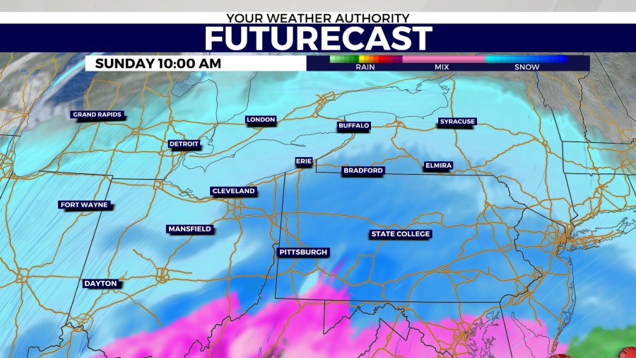
ERIE, PA – As most of the country continues with harsh winter weather, Erie gets its share of snow today through Monday. This is not lake-effect snow as the system moves into the region mainly from the southwest.
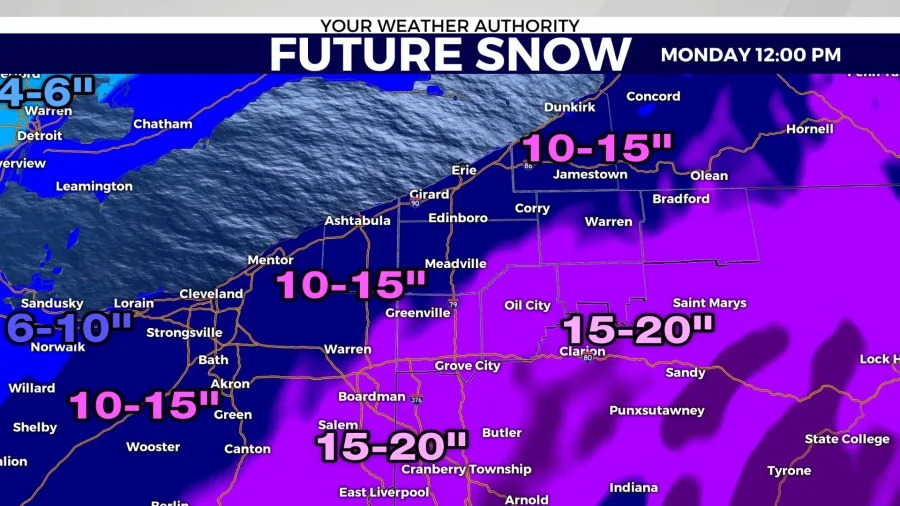
Snowfall totals through Monday afternoon reach close to 10 inches at the lakeshore. Anywhere south of Erie within Northwest Pennsylvania can get up to 15 inches. The higher amounts are found in the higher mountaintops.
Snowfall rates could reach up to 1 inch per hour this afternoon. This not only leads to slippery roads, but also visibility well below 1 mile. Suffice it to say, driving today is very difficult and not recommended unless it’s necessary. If you must drive, take it very slowly on the roads and leave enough space between you and other drivers.

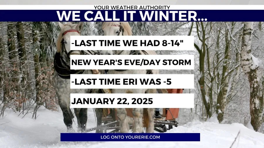
Even though this is not lake effect snow, what Erie is experiencing right now is nothing new. 3 and a half weeks ago, Erie received the kinds of snowfall amounts posted above. The recent cold weather is not new either. The last time Erie hit -5 was over a year ago.
To sum things up from Your Weather Authority:
We’ve included some numbers for you
This is nothing we haven’t seen before
Use common sense when dressing and driving
Take care of those susceptible to the bitter cold air
Get ready to move some snow (or have someone else do it)
We’ll adjust the forecast with time and let you know of any changes in our thinking if need be
It’s Winter, it’s what we do
Copyright 2026 Nexstar Media, Inc. All rights reserved. This material may not be published, broadcast, rewritten, or redistributed.
For the latest news, weather, sports, and streaming video, head to WJET/WFXP/YourErie.com.