
Western Pennsylvania school closings announced for Wednesday
Cold weather advisory issued as many areas still digging out from snowstorm
NEWS FOUR. COLD WEATHER CONTINUES AS WE HEAD INTO THE WEEKEND, WILL BE ON IMPACT DAYS TOMORROW AND THURSDAY AS AGAIN, WINDCHILLS, ESPECIALLY IN THE MORNING, WILL BE IN THE SINGLE DIGITS EITHER SIDE OF ZERO. FRIDAY AND SATURDAY, WE WILL GO BACK TO SEVERE WEATHER ALERT DAYS, AS WE COULD SET RECORD LOW TEMPERATURES FOR PITTSBURGH BOTH MORNINGS AND WIND CHILLS, ESPECIALLY SATURDAY, COULD BE THE COLDEST THEY’VE BEEN SO FAR. COLD WEATHER ADVISORIES UP FOR EVERYBODY TONIGHT. THIS GOES INTO EFFECT AT THE TOP OF THE HOUR, AND THIS WILL LAST INTO TOMORROW MORNING. WIND CHILLS WILL BE BETWEEN ABOUT TEN AND 15 DEGREES BELOW ZERO AS YOU WAKE UP TOMORROW MORNING. AIR TEMPERATURES ARE HOLDING PRETTY STEADY IN THE TEENS. WE HAVEN’T BUDGED MUCH THROUGH THE AFTERNOON, BUT WIND CHILLS ARE SITTING IN THE SINGLE DIGITS A COUPLE DEGREES. EITHER SIDE OF ZERO FEELS LIKE THREE BELOW IN INDIANA, MONROEVILLE AS WELL AS IN BUTLER, TWO BELOW IN FRANKLIN. FEELS LIKE IT’S ONE RIGHT NOW IN WASHINGTON, IT FEELS LIKE TWO FOR GREENSBURG AS WELL AS THE CITY. AS WE CONTINUE THROUGH THROUGH THE NIGHT. TONIGHT AGAIN, WIND CHILLS TOMORROW MORNING WILL BE BETWEEN ABOUT TEN AND 15 DEGREES BELOW ZERO. VERY COLD START, ESPECIALLY IF KIDS ARE HEADING OUT THE DOOR FOR THE FIRST TIME THIS WEEK, TOMORROW MORNING. AND THEN WIND CHILLS WILL SLOWLY GET BETTER THROUGH THE DAY BACK TOWARDS ZERO, AS WE’VE SEEN TODAY. AND THEN AGAIN, WIND CHILLS DROP AS WE HEAD INTO THURSDAY MORNING. WE’LL SEE WIND CHILLS BETWEEN ABOUT EIGHT AND 12 DEGREES BELOW ZERO THURSDAY MORNING BEFORE AGAIN IMPROVEMENT AS WE CONTINUE THROUGH THE AFTERNOON. WE’RE ALSO WATCHING A CLUSTER OF SOME SNOW SQUALLS MOVING OUT OF OHIO. SNOW SQUALL WARNINGS ARE UP AGAINST THE BORDER BETWEEN OHIO AND PENNSYLVANIA. WE’LL WATCH THIS AS IT ARRIVES. IF YOU DO SEE THESE SNOW SQUALLS, IT WILL REDUCE VISIBILITY BRIEFLY AND ALSO COULD DUMP A QUICK HALF AN INCH OR SO OF SNOW. BUT THESE ARE QUICK MOVING AND WEAKENING AS THEY APPROACH. BUT IT’S SOMETHING WE’LL BE WATCHING. 13 IS YOUR HIGH TEMPERATURE TOMORROW. WE’LL START AT ONE BELOW 15 ON THURSDAY, 12 ON FRIDAY WE WILL START AT SEVEN BELOW. THAT WOULD BREAK OUR RECORD. SATURDAY WILL START AT SIX BELOW. THAT WOULD ALSO BREAK THE RECORD. BUT WIND CHILLS COULD BE TERRIBLE. WE COULD BE TALKING 20 TO 30 DEGREES BELOW ZERO ACROSS ALL OF WESTERN PENNSYLVANIA. VERY COLD AIR IN PLACE. THAT WILL BE THE COLDEST WIND CHILLS HAVE BEEN SO FAR THIS WINTER SEASON. AND THEN WE START HEADING IN THE RIGHT DIRECTION. 17 IS YOUR HIGH ON SUNDAY, 24 ON MONDAY, BACK TOWARDS 30 AS WE HEAD TOWARDS NEXT TUESDAY AND WEDNESDAY. BUT OUR LOW TEMPERATURES STAY TOWARDS THE SINGLE DIGITS. WE DO HAVE CLOUDS OUT THERE ON ACTION. CAM 14 IS THE CURRENT TEMPERATURE AT PITTSBURGH. INTERNATIONAL WINDS GUSTING TO 20MPH. AGAIN, IF YOU’RE HEADING OUT TOMORROW MORNING, MAKE SURE YOU BUNDLE UP WHEN CHILLS WILL BE
Western Pennsylvania school closings announced for Wednesday
Cold weather advisory issued as many areas still digging out from snowstorm

Updated: 7:20 PM EST Jan 27, 2026
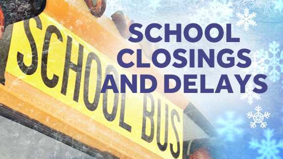
Many schools in Western Pennsylvania will be closed, delayed or operating remotely Wednesday for a third day in a row.Visit this link to view the closings and delays list and refresh that page often for updates.A cold weather advisory will be in effect until 11 a.m. Wednesday. Wind chills in the morning could drop as low as 10 to 15 degrees below zero, according to the Pittsburgh’s Action Weather forecast.Many areas are still digging out from the massive storm that dumped over a foot of snow in parts of Western Pennsylvania.Wednesday is a Severe Weather Alert Day. Pittsburgh’s Action Weather is tracking the full forecast for your area.More: See the current weather alerts for your countyInteractive radar: Track snow in your areaLearn how to enable automatic weather alerts on the WTAE app
PITTSBURGH —
Many schools in Western Pennsylvania will be closed, delayed or operating remotely Wednesday for the third day in a row.
Visit this link to view the closings and delays list and refresh that page often for updates.
A cold weather advisory will be in effect until 11 a.m. Wednesday. Wind chills in the morning could drop as low as 10 to 15 degrees below zero, according to the Pittsburgh’s Action Weather forecast.

Many areas are still digging out from the massive storm that dumped over a foot of snow in parts of Western Pennsylvania.

Wednesday is a Severe Weather Alert Day. Pittsburgh’s Action Weather is tracking the full forecast for your area.