Dangerously cold wind chills in the single digits are again impacting the Lehigh Valley on Monday morning, with the Poconos seeing colder values reaching near 15 degrees below zero.
A Cold Weather Advisory is in effect until 10 a.m. in Carbon and Monroe counties. While there is no advisory for the Lehigh Valley, residents should take precautions against frostbite and hypothermia during the morning hours.
Air temperatures on Monday morning were hovering around 15 degrees in the Lehigh Valley, combining with steady to gusty northwest winds to produce dangerous wind chills, according to the National Weather Service.
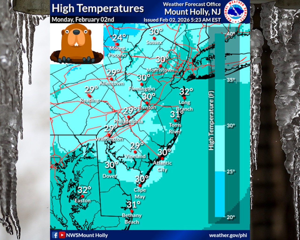
Daytime highs Monday will only reach the upper 20s to low 30s, with some spots possibly touching the freezing mark depending on sunshine.
The region will experience below-normal temperatures throughout the week, with highs generally remaining in the 20s to low 30s through Friday.
Light snow is possible Tuesday night into Wednesday morning, with a coating to an inch of snow possible across the area. This system is moisture-starved but will be accompanied by sufficient cold air and strong upper-level energy. Minimal impacts are expected with snow ending by Wednesday morning.
Another Arctic front will arrive by Friday night, bringing dangerously cold wind chills back to the region for the weekend.
Lows by the weekend are forecast to drop to around zero.
A second chance for light snow and possible snow squalls is forecast for Friday as a strong clipper system passes through ahead of this Arctic front.
Current weather radar