
Lake Erie water temperatures are running slightly above average heading into the heart of lake effect season. Betsy Kling explains what it means for Northeast Ohio.
CLEVELAND — As autumn unfolds across the Great Lakes region, meteorologists are keeping a close eye on a crucial seasonal factor: water temperatures in Lake Erie. While a few extra degrees may seem trivial, science tells a different story — those slightly above-average lake temperatures are a key ingredient in the dramatic weather events known as lake-effect rain and snow.
Lake-effect precipitation occurs when cold, dry air masses sweep over the relatively warmer waters of the Great Lakes. This contrast causes the air to rapidly warm and absorb moisture from the lake surface. As the air rises and cools again over land, it releases this moisture in the form of rain or, when temperatures are low enough, snow.
Lake Erie, the shallowest of the Great Lakes, responds more quickly to atmospheric changes. In fall, it tends to retain summer heat longer than deeper lakes. When its surface temperature remains just a few degrees above the seasonal norm it can supercharge the lake-effect process.
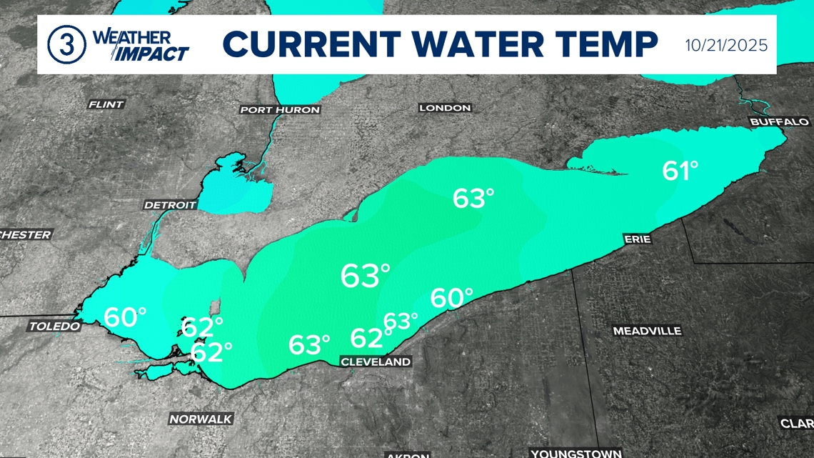
Currently Lake Erie is running a few degrees above average. For October 21, the average water temperature off Cleveland is 60 degrees. Today the surface temperature off Cleveland is sitting at 63 degrees.

It takes cold air to activate lake effect. Air temperatures for the next three days will be between 10 to 20 degrees colder than the Lake (from daytime highs to lows). With a predominantly west wind, we’re expecting persistent lake effect rain showers east of Cleveland through Thursday. As the wind shifts through the day Friday, the lake effect will fade.