Dangerous wind chill values ranging from zero to 10 below zero will persist Monday morning with readings as low as 25 below in the southern Poconos. An Extreme Cold Warning remains in effect until 10 a.m. for Carbon and Monroe counties, while Cold Weather Advisories cover the remainder of the region through the same time.
Bitterly cold temperatures bottomed out in the low single digits to a couple of degrees below zero early Monday morning, with diminishing northwest winds, according to the National Weather Service.
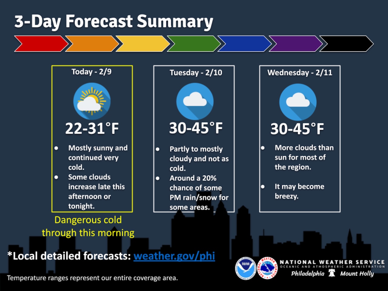
As the arctic high pressure system shifts east and begins to move offshore, conditions will gradually improve throughout the day with highs reaching the mid to upper 20s by afternoon.
Temperatures will moderate significantly by midweek as warm air advection increases. A warm front moving through Tuesday will allow highs to approach 40 degrees Wednesday afternoon, with thawing expected each day through at least Wednesday. However, lows will continue to drop below freezing each night, creating thaw and refreeze cycles that could create icy conditions on surfaces.
A weak system may bring light wintry precipitation to parts of the region Tuesday afternoon and evening, though precipitation chances remained low as of Monday morning. A cold front moving through Tuesday night into Wednesday morning brings a wind shift from southwest to west-northwest with potentially some spotty light precipitation.
Colder air will return for the second half of the week as a secondary cold front moves through Wednesday, though temperatures will not approach the dangerous levels experienced during this Arctic outbreak. Winds will increase out of the west-northwest Wednesday afternoon with gusts reaching 20 to 25 mph.
Looking ahead to the weekend, a system may arrive Sunday with milder air and potential for rain and wintry precipitation.
Current weather radar