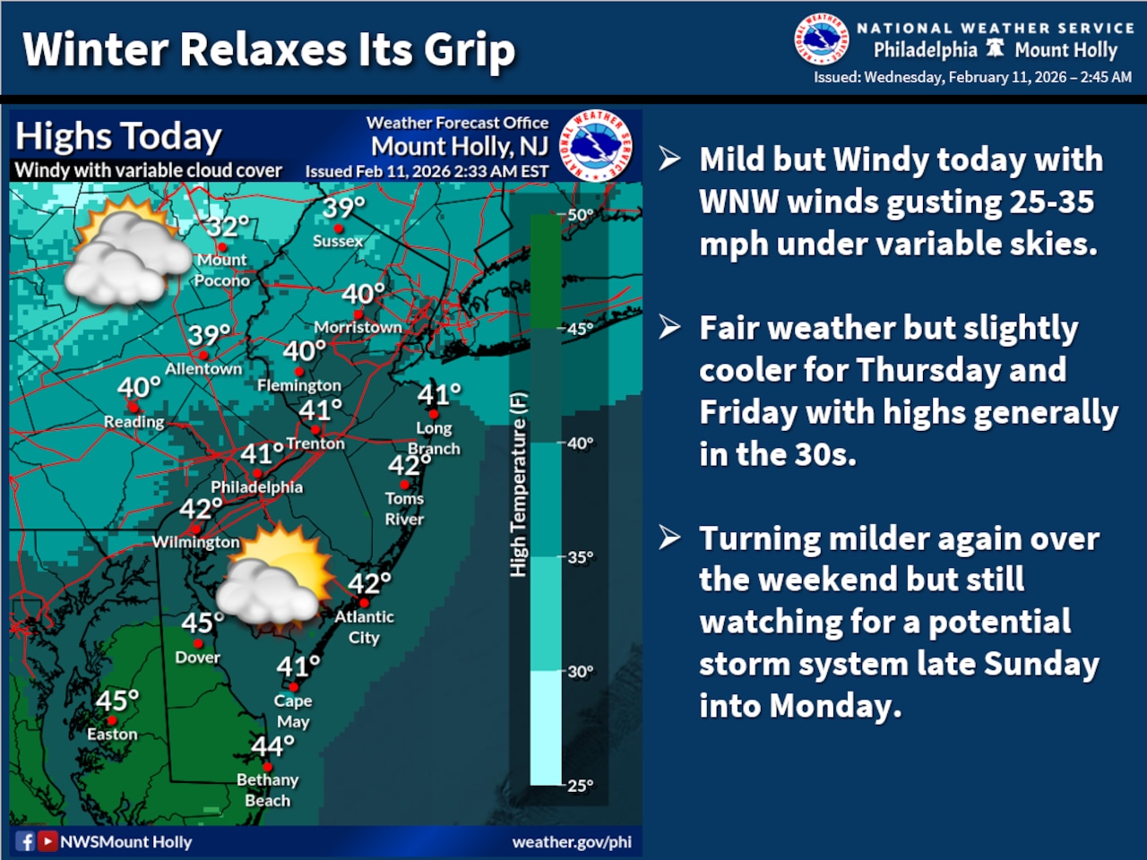
A strong cold front crossing the region early Wednesday will bring gusty west-northwest winds peaking at 25 to 35 mph during the afternoon, creating wind chills in the teens and 20s despite milder air temperatures in the 30s to low 40s.
A secondary cold front arriving later Wednesday and into the night will usher in noticeably colder conditions for Thursday and Friday for the Lehigh Valley region, according to the National Weather Service forecast.
The NWS climate station at Lehigh Valley International Airport on Tuesday recorded a high temperature above the 32-degree freezing mark for the first time since Jan. 23. Tuesday’s maximum temperature was 35 at 5:54 p.m. at the airport outside Allentown.
The mean temperature of 14.3 degrees from Jan. 24 through Monday, Feb. 9, made for the coldest 17-day stretch since Jan. 10-26, 1982. And the first nine days of February were the coldest since 1934.
Winds will remain gusty through Wednesday night with gusts around 20 mph, and wind chills will drop into the single digits across the southern Poconos. A few snow showers are possible in the southern Poconos overnight as colder air moves in.
High pressure will bring generally fair but cooler conditions Thursday and Friday, with highs in the 30s and overnight lows in the teens and 20s. Conditions will moderate over the weekend as high pressure shifts eastward, with Saturday and Sunday highs reaching close to 40.
Forecasters are monitoring a coastal storm system late Sunday into Monday, though the National Weather Service notes chances for significant snowfall continue to diminish.
Most model guidance is trending toward keeping the system farther south and east with less impact on the Lehigh Valley. Current probabilities for at least 2 inches of snow are only 5 to 15%, with rain more likely near the coast and possible snow or a rain-snow mix farther north.
Temperatures are expected to moderate significantly by next Tuesday, with highs well into the 40s across most areas as the storm system departs.
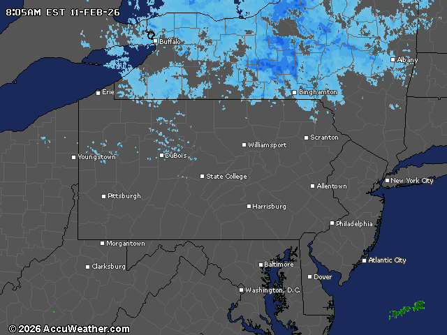
Current weather radar