
Severe storms could bring tornadoes to Pennsylvania | Safety tips, how to prepare
WELL, TODAY COULD POTENTIALLY BE A VERY ACTIVE SEVERE WEATHER DAY. WE ARE IN AN ENHANCED RISK ISSUED BY THE STORM PREDICTION CENTER. THAT’S A THREE. ON A SCALE OF 1 TO 5. WE DON’T OFTEN SEE AN ENHANCED RISK ACROSS THE STATE ABOUT 5 TO 6 TIMES PER SEASON IS WHEN WE SEE THEM. STORMS. WE’RE LOOKING AT 12 TO 4 P.M. IN OUR WESTERN COUNTIES. THEY WILL BE MOVING IN. AND THEN AS WE HEAD TOWARDS DAUPHIN LIKE HARRISBURG, YORK AND YORK COUNTY, HANOVER, EASTERN ADAMS COUNTY, BETWEEN 4 AND 8 P.M. THAT’S WHEN YOU WANT TO KEEP AN EYE TO THE SKY AND THEN FURTHER TO THE EAST, A LITTLE CLOSER TO SEVEN, 8:00. WE COULD STILL HAVE THOSE STORMS MOVING THROUGH PARTS OF LEBANON COUNTY AND LANCASTER COUNTY. THE MAIN THREATS WITH THESE STORMS, THE HIGHEST THREAT WILL BE DAMAGING WINDS. AND WE’RE TALKING ABOUT THE POSSIBILITY OF STRAIGHT-LINE WINDS GREATER THAN 70MPH. THAT’S AS STRONG AS A WEAK TORNADO WITH 65MPH. SO THERE IS ALSO THE CHANCE FOR A FEW TORNADOES TO SPIN UP THIS AFTERNOON. LARGE HAIL WILL BE POSSIBLE AND LOCALLY HEAVY RAINFALL, WHICH COULD LEAD TO SOME PONDING ON ROADWAYS AND ALSO SOME LOW LYING MINOR FLOODING. BUT OVERALL FLOODING THREAT DOES APPEAR TO BE ON THE LOW SIDE. WE DO HAVE A WIND ADVISORY THAT GOES INTO EFFECT AT NOON TODAY, AND THAT’S FOR DAUPHIN, LEBANON, LANCASTER AND YORK COUNTIES UNTIL 11 P.M. THIS IS WHERE WINDS COULD GUST AS HIGH AS 50MPH. THIS IS IN ADDITION TO ANY WINDS FROM THUNDERSTORMS. SO IT IS GOING TO BE VERY WINDY DAY TODAY, ESPECIALLY IN OUR EASTERN COUNTIES. SO JUST KEEP THAT IN MIND. WE DO HAVE SOME LIGHT SHOWERS LIFTING UP THROUGH THE AREA RIGHT NOW. WE GET A LITTLE BIT OF A BREAK AHEAD OF THAT COLD FRONT THAT WILL COME THROUGH THIS AFTERNOON. THAT’S WHEN YOU’RE REALLY GOING TO WANT TO WATCH FOR THOSE STORMS. TEMPERATURES IN THE UPPER 60S WILL FALL VERY FAST. ONCE THAT FRONT MAKES ITS WAY THROUGH THE AREA. AND I’LL HAVE MORE ON THE
Severe storms could bring tornadoes to Pennsylvania | Safety tips, how to prepare

Updated: 8:06 AM EDT Mar 16, 2026
A line of strong to severe thunderstorms could produce tornadoes in south-central Pennsylvania. The WGAL News 8 Storm Team declared Monday an Alert Day as the entire Susquehanna Valley is under an enhanced risk. The York County Office of Emergency Management provides tips on what to do if a tornado touches down. What to doGet off the road as soon as it’s safe.Best option: drive to a designated shelter, basement, or safe room.Next best option: take shelter in a small, windowless room or hallway on the lowest floor of a sturdy building. What NOT to doDo not seek refuge in a vehicle, outside or under an overpass.Do not shelter under an overpass or a tree. This increases the risk of serious injury or death from flying debris and tornado winds. Prepare your familyMake sure everyone knows the safe location in your home. Keep an emergency kit in that safe location. Identify where to go if you’re at work or school. Make a family communications plan. Prepare your petsGet pets ready at the first sign of an approaching storm. Put dogs on a leash and cats in a carrier. Move pets to the shelter well ahead of the storm. Include pet food and medications in your emergency kit. Did you capture the storm and would like to share with News 8? Send us your photos or videos at https://www.wgal.com/upload.
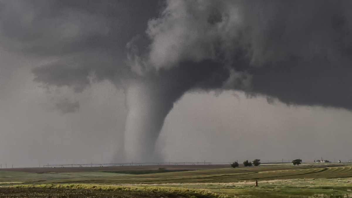
A line of strong to severe thunderstorms could produce tornadoes in south-central Pennsylvania.
The WGAL News 8 Storm Team declared Monday an Alert Day as the entire Susquehanna Valley is under an enhanced risk.

The York County Office of Emergency Management provides tips on what to do if a tornado touches down.
What to doGet off the road as soon as it’s safe.Best option: drive to a designated shelter, basement, or safe room.Next best option: take shelter in a small, windowless room or hallway on the lowest floor of a sturdy building.
What NOT to do
Do not seek refuge in a vehicle, outside or under an overpass.Do not shelter under an overpass or a tree. This increases the risk of serious injury or death from flying debris and tornado winds. Prepare your familyMake sure everyone knows the safe location in your home. Keep an emergency kit in that safe location. Identify where to go if you’re at work or school. Make a family communications plan. Prepare your petsGet pets ready at the first sign of an approaching storm. Put dogs on a leash and cats in a carrier. Move pets to the shelter well ahead of the storm. Include pet food and medications in your emergency kit.
Did you capture the storm and would like to share with News 8? Send us your photos or videos at https://www.wgal.com/upload.