
A strong cold front will approach the region from the north Sunday afternoon with a warm and more humid air mass ahead of it. Temperatures Sunday afternoon are expected to top out around 70 degrees with a warm south wind gusting over 20mph as well. As the strong cold front drops in from the north and clashes with this air mass, some thunderstorms are likely and there is a severe thunderstorm risk during the late afternoon and evening.
KEY MESSAGES:
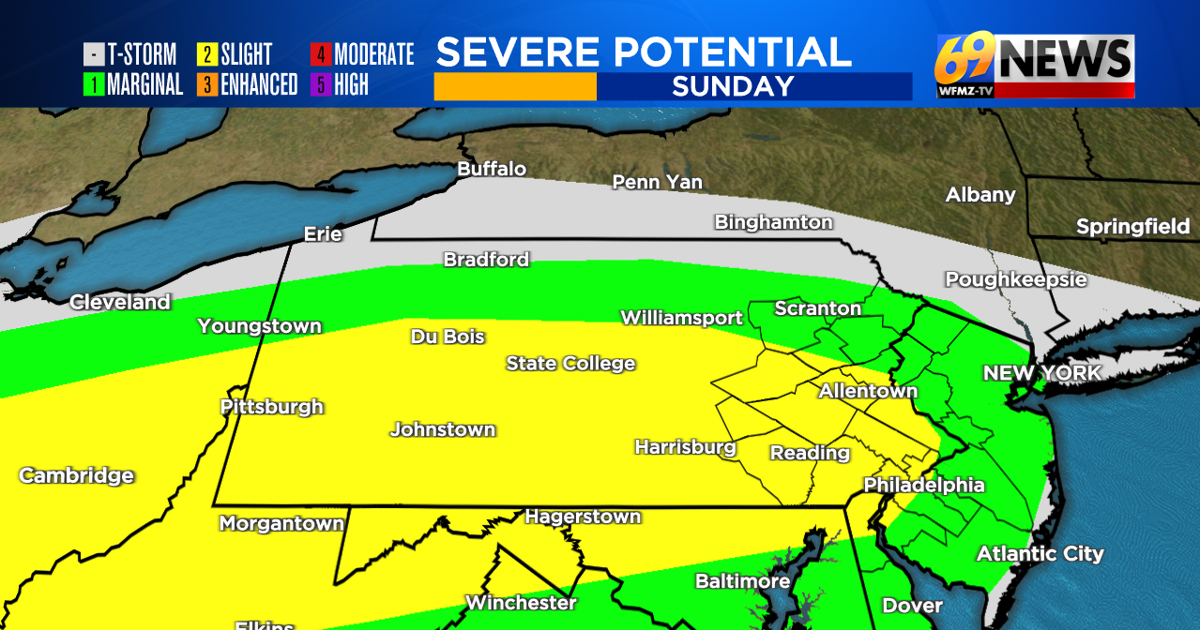
Isolated to scattered severe thunderstorms are possible late Sunday afternoon and evening, approximately from 4pm to 10pm, soonest north and latest south.
Damaging straight-line wind gusts to 60-70mph and large hail at least 1″ in diameter or greater are the primary severe weather hazards. An isolated tornado is also possible.
Showers and thunderstorms will continue through much of the nighttime, but any severe threat is likely done with after 10pm. However, some heavy downpours may remain for a while overnight Sunday and we’ll need to watch for ponding of water on roads. A general 1″ to 1.5″ of total rainfall is expected with some isolated amounts to 2″ possible.
TRACK THE WEATHER:
LINKS: HOUR BY HOUR | RADAR | TRAFFIC