
Cooler & breezy this evening; dry & cool for the weekend across south-central Pennsylvania
High pressure builds in for the weekend, allowing dry conditions both days. Temperatures are cooler in the 40s but moderate on Sunday. Unsettled pattern is on tap for next week with multiple chances for rain.
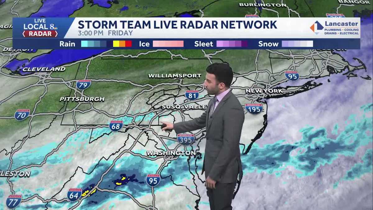
LOOKOUT FOR THE CHECKS AND TO CASH THEM WHEN THEY ARRIVE. NOW, THE WGAL NEWS EIGHT STORM TEAM FORECAST WITH METEOROLOGIST BRIAN ARGENTI LOOKING AT MOSTLY CLOUDY CONDITIONS FOR THE MAJORITY OF THE AREA. YOU CAN SEE THE WINDS, THOUGH IN THE BACKGROUND THERE A LITTLE BIT ELEVATED. YOU CAN SEE THE FLAG IS ALSO WAVING IN THE BACKGROUND THERE, BUT DEFINITELY BEEN MOSTLY CLOUDY DAY FOR THE MAJORITY OF THE DAY, BUT WE WILL START TO SEE SOME CLEARING AS WE GET INTO LATE IN THE EVENING. TEMPERATURES RIGHT AROUND THE LOWER 40S MARK WITH THAT SUSTAINED NORTHERLY BREEZE RIGHT AROUND TEN MILES PER HOUR. BUT HERE’S STORM TEAM LIVE RADAR NETWORK. WE ARE SEEING SOME RAIN RETURNS ON THE ON THE RADAR. BUT WHEN I TURN ON JUST STRICTLY LIVE LOCAL EIGHT RADAR. NOTICE HOW NOT REALLY SEEING ANYTHING EXCEPT FOR A LITTLE A LITTLE. YOU SEE THAT LITTLE LITTLE BLIP RIGHT THERE OF A RETURN IN TERMS OF THE RAIN, WE MIGHT BE SEEING SOME ISOLATED SHOWERS AT THIS TIME. CLOSER TOWARDS SOUTH MOUNTAIN. IF YOU’RE TUNING IN FROM FRANKLIN OR ADAMS COUNTY. SO JUST KEEP THAT IN MIND. WE DO HAVE THE CHANCE FOR SOME ISOLATED SHOWERS LATER ON THIS EVENING AND. BUT WE WILL EVENTUALLY, LIKE I MENTIONED, SEE SOME CLEARING SKIES OVERNIGHT TONIGHT. THEN AS WE HEAD INTO THE WEEKEND, BIT OF A CHILLY START. IT WILL BE A MILD END TO. THE WEEKEND WILL BE DRY THROUGHOUT. SO IF YOU HAVE ANY EASTER OR EARLY EASTER PLANS OR EASTER EGG HUNTS, IT SHOULD BE PRETTY DRY FOR THE WEEKEND. BUT THEN WE ARE LOOKING AT AN ACTIVE PATTERN AS WE HEAD INTO NEXT WEEK. WITH TEMPERATURES YOU’LL SEE GETTING INTO THE 70S. SO TEMPERATURES THIS EVENING GETTING INTO THE LOWER 40S WITH THE DIMINISHING BREEZE OUT OF THE NORTH, KEEPING THAT ISOLATED SHOWER CHANCE. BUT WE’LL REALLY START TO SEE SOME CLEARING SKIES AS WE GET INTO LATER IN THE EVENING. STILL HAVE THAT LIGHT BREEZE AROUND 26 TO 30 DEGREES FOR OVERNIGHT TEMPERATURES. SO PRETTY CHILLY GETTING INTO THE UPPER 20S, BUT WE’LL STILL BE PARTLY CLOUDY. AND THEN FOR TOMORROW WE’LL HAVE PLENTY OF SUNSHINE AS HIGH PRESSURE TAKES OVER. THAT’S GOING TO HELP CLEAR OUR SKIES WILL BE BLUSTERY AND CHILLY THOUGH, BUT WINDS WILL RELAX LATE IN THE DAY. YOU CAN SEE THE MAJORITY OF THE DAY WILL BE BREEZY BETWEEN 10 AND 15MPH OUT OF THE NORTHWEST. TEMPERATURES INTO THE 40S MID 40S FOR SOME AREAS STILL HAVE THAT BREEZE COMING IN FROM THE NORTH. IT’S A NOTICEABLE BREEZE ABOUT 10 TO 15MPH. I WOULD SAY AT THIS TIME. BUT YOU CAN SEE STORM TEAM LIVE RADAR NETWORK. AGAIN, MAJORITY OF THESE RETURNS THAT WE’RE SEEING, THERE’S NO PRECIPITATION ACTUALLY MAKING IT TO THE GROUND. SO ONLY ONLY REAL SHOT OF SOME PRECIPITATION AT THIS TIME IS BETWEEN FRANKLIN AND ADAMS COUNTY, WHERE YOU CAN SEE SOME OF THOSE DARKER BLUES COMING IN OVER THE VALLEY. BUT IN TERMS OF THE REST OF THIS EVENING, YOU CAN SEE PREDICTOR HIGHLIGHTING THIS. WE CAN SEE SOME CLEARING SKIES AS WE GET INTO THE OVERNIGHT PERIOD. ALSO INTO OUR SATURDAY MORNING. IT’S ALL THANKS TO HIGH PRESSURE THAT’S GOING TO BE OUR DOMINANT WEATHER PATTERN AS WE HEAD INTO THE FIRST HALF OF THE WEEKEND. SECOND HALF OF THE WEEKEND, HIGH PRESSURE STARTS TO SHIFT OFFSHORE, BUT THEN STARTS TO FILTER IN OR USHER IN, I SHOULD SAY, MILDER AIR FROM THE SOUTH. THAT’S GOING TO THAT’S GOING TO PUSH OUR TEMPERATURES UP A LITTLE BIT AS WE HEAD INTO OUR SUNDAY, KEEPING IT A LITTLE BIT MILDER. BUT LOOK AT THIS. YOU CAN SEE TEMPERATURES GETTING INTO THE INTO THE 70S FOR YOUR TUESDAY AND WEDNESDAY, CERTAINLY ABOVE AVERAGE FOR THIS TIME OF THE YEAR, BECAUSE THE AVERAGES IS RIGHT AROUND THE MID 50S. BUT YOU CAN SEE IN THE TEN DAY FORECAST, IT IS ALSO GOING TO BE AN UNSETTLED PATTERN AS WE HEAD INTO NEXT WEEK. YOU CAN SEE FOR OUR MONDAY MILD INTO THE LOWER 60S. THERE’S THOSE 70S FOR TUESDAY AND WEDNESDAY. COOLER THOUGH AS WE HEAD INTO THURSDAY. AND ANOTHER CHANCE OF SOME SHOWERS FOR FRIDAY AND SATURDAY. NOW LOOKING AHEAD TO SUNDAY EASTER SUNDAY THINGS ARE LOOKING MILD, BUT THERE IS A SLIGHT CHANCE O
Cooler & breezy this evening; dry & cool for the weekend across south-central Pennsylvania
High pressure builds in for the weekend, allowing dry conditions both days. Temperatures are cooler in the 40s but moderate on Sunday. Unsettled pattern is on tap for next week with multiple chances for rain.

Updated: 4:26 PM EDT Mar 27, 2026
In the wake of a slow-moving cold front that swept through the Valley, showers have ended and clearing skies are on tap late evening. There may be a stray or isolated chance of a shower this evening, due to some upper-level energy passing over the area. Temperatures will fall through the low 40s this evening with winds briefly diminishing to between 5-10 mph.For the weekend, high pressure brings dry weather for the last weekend in March. Look for mostly skies Saturday with cooler highs in the mid-40s. It will be breezy, which will add an extra chill to the air. The winds relax towards evening. Temperatures moderate back to the mid-50s Sunday under sunshine and late day high clouds.WARMING WITH SEVERAL RAIN CHANCESHeading into the work week, Monday is mainly dry with showers possible towards evening. Highs return to the 60s. With a warm front lifting through early, a few showers are possible early then skies are partly sunny. Highs are much warmer in the low to mid 70s. A cold front brings scattered showers and thunderstorms. It is very warm in the upper 70s.COOLER WITH MORE RAIN CHANCESCooler temperatures prevail Thursday with highs back to the 60s. The next system brings back a chance for showers in the evening, with a better chance of rain on Friday. Unsettled weather continues through next weekend with wet weather is possible each day.
In the wake of a slow-moving cold front that swept through the Valley, showers have ended and clearing skies are on tap late evening. There may be a stray or isolated chance of a shower this evening, due to some upper-level energy passing over the area. Temperatures will fall through the low 40s this evening with winds briefly diminishing to between 5-10 mph.
For the weekend, high pressure brings dry weather for the last weekend in March. Look for mostly skies Saturday with cooler highs in the mid-40s. It will be breezy, which will add an extra chill to the air. The winds relax towards evening. Temperatures moderate back to the mid-50s Sunday under sunshine and late day high clouds.
WARMING WITH SEVERAL RAIN CHANCES
Heading into the work week, Monday is mainly dry with showers possible towards evening. Highs return to the 60s. With a warm front lifting through early, a few showers are possible early then skies are partly sunny. Highs are much warmer in the low to mid 70s. A cold front brings scattered showers and thunderstorms. It is very warm in the upper 70s.
COOLER WITH MORE RAIN CHANCES
Cooler temperatures prevail Thursday with highs back to the 60s. The next system brings back a chance for showers in the evening, with a better chance of rain on Friday. Unsettled weather continues through next weekend with wet weather is possible each day.