

SHORT TERM FORECAST
TONIGHT: Becoming mostly cloudy with a spotty shower or some sprinkles overnight. Low: 46
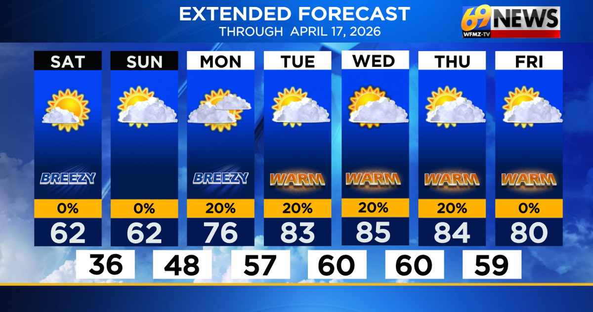
SATURDAY: Mostly sunny, breezy, and seasonable; high brush fire danger. High: 62
SATURDAY NIGHT: Mostly clear with diminishing winds. Low: 36
FORECAST SUMMARY
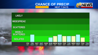
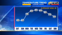
Early morning clouds gave way to the promised milder sunshine we were expecting to wrap up the week, with noticeably warmer highs around 65 to 70 degrees on our Friday afternoon. A weak cold front will slide harmlessly through overnight, and outside of some extra clouds tonight and a spotty shower or two, especially north and west of the Lehigh Valley, little impact is expected. Behind our front, a dry and pleasant weekend will follow, with abundant sunshine on Saturday and a partly sunny Sunday expected. Brisk breezes on Saturday coupled with low relative humidity will lead to a high brush fire danger day, and pollen will be very high all weekend long. But minus those caveats, expect a nice weekend for all outdoor activities, with seasonably mild highs around 60-65 degrees each afternoon. A warm front will slide through early Monday, opening the floodgates for southwest winds to deliver some summer-like and unseasonably warm temperatures for most of the week. Highs will at least be in the mid to upper 70s on Monday and Friday to start and end the week, with at least a 3-day stretch of 80-something-degree highs midweek, with mid 80s likely for one or two days between Tuesday and Thursday. While there will be a 20-30% chance of a spotty shower at any time, we’re mostly dry otherwise, and some spots may stay entirely dry through a very warm spring week.
DETAILED FORECAST
TONIGHT
We’ll go into this evening with mild and dry weather, with skies becoming mostly cloudy after dark as a weak cold front approaches. This front won’t have much moisture to work with, but will produce some light rain showers across northern Pennsylvania and upstate New York. Those showers will start to fizzle as they drop southeast in our direction, but a few light showers are possible from the Lehigh Valley north and west around midnight. Farther south and east, perhaps a few sprinkles are felt, as most places likely stay dry. Rainfall amounts are meager, with a trace to maybe one or two hundredths of an inch of rain, primarily in the Poconos and up along the I-80/I-81 corridors. Lows will be in the mid 40s overnight, with some clearing towards morning behind our front.
SATURDAY
We’ll kick off the weekend with a mostly sunny and seasonable day, with highs right around our “average” for mid-April, in the low 60s. So it will be just a touch cooler behind our front, but still dry and pleasant all weekend long. A brisk northwesterly breeze on Saturday around 15mph (with gusts to 25mph), when combined with low relatively humidity and overall dry conditions, will lead to a high risk for the rapid spread of any brush fires that start. So be sure to use caution outside while enjoying the nice weather. Winds diminish Saturday night, with seasonably chilly low in the mid to upper 30s.
SUNDAY
High pressure crests overhead early Sunday, allowing for lighter winds as compared to Saturday. A warm front will begin to lift in our direction from the southwest, allowing for some clouds to increase and mix with the sunshine. Still, a partly sunny and pleasantly mild day is expected, with highs similar to Saturday and in the low 60s once again. Skies likely trend mostly cloudy later Sunday and Sunday night as the warm front nears, which means milder overnight lows in the upper 40s Sunday night.
MONDAY
As we get into the warm sector on Monday, expect highs to shoot up into the 70s. Now Monday may end up mostly cloudy, and there could even be a spotty rain shower or two as the warmth becomes established. But most of the day is dry, with highs at least into the low to mid 70s for most, mid 70s if we can manage a little more sun, low 70s if the clouds hang tough and a shower or two pops up. Either way, it’s the start of a week-long warm spell, with much warmer weather to come over the following days.
TUESDAY THROUGH THURSDAY
Here comes an extended taste of summer, with highs into the 80s every day, with mid 80s quite doable with enough sunshine. There will be a big “Bermuda” high off the East Coast all week pumping in the warmth, and a front stalled up over upstate New York and New England for the better part of the week. That means most of the shower activity should remain closer to the front and to our north all week, but a spotty shower or two could sneak south, especially into the Poconos or North Jersey, on any given day. However, most of the time is dry, and most of the time is unseasonably warm with 80s by day, and near 60° at night. That front won’t slip south and through our area until the end of the week, and even then, it looks only modestly “cooler” by Friday into next weekend. Rainfall amounts for the entire week may only be less than a tenth of an inch in the Poconos, and little measurable rain for everyone else.
TRACK THE WEATHER:
LINKS: HOUR BY HOUR | RADAR | TRAFFIC