
(WBRE/WYOU) — High pressure will be giving us a nice end to the weekend.
The start of the new work week looks pretty good also, before this high moves off the coast and allows unsettled weather back in later on Tuesday. Above average temperatures will be with us to start the week, with below average temperatures returning Wednesday.
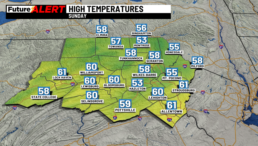
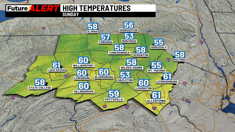
For today you can expect partly cloudy skies. It’ll be breezy with highs in the upper 50s. Tonight, will be partly cloudy. It won’t be as cold with lows in the low 40s.
Monday will see plenty of sunshine. It’ll be pleasant with highs in the upper 60s.
Tuesday will have partly sunny skies with highs in the mid 70s, however there will be some chance of scattered showers.
Wednesday and Thursday will likely see showers accompanied by mostly cloudy skies and highs in the mid and low 60s.
Friday will cool down, with highs in the upper 50s joined by a chance of a shower. Saturday will be much of the same, however temperatures will warm up slightly to the low 60s.
You can stay current on all the latest weather alerts and track the storm using the Future Alert Interactive Radar.
Copyright 2026 Nexstar Media, Inc. All rights reserved. This material may not be published, broadcast, rewritten, or redistributed.
For the latest news, weather, sports, and streaming video, head to 28/22 News.