
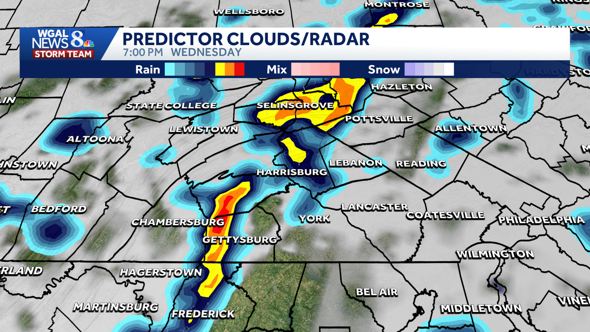
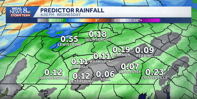
LOOKING GREAT WITH HIGHS IN THE UPPER 60S FOR WEDNESDAY. A WARM FRONT LIFTS NORTH IN THE MORNING. MOST OF THE RAIN IN THE MORNING IS TO OUR NORTH OR OUT TO THE WEST. SO I THINK WE CAN SQUEEZE BY WITH SOME DRY TIME ON WEDNESDAY MORNING. BUT NOTICE RIGHT IN THE MID PART OF THE DAY WE GET A LINE OF SHOWERS THAT COME THROUGH HERE AND THEN A COLD FRONT LATE THAT COULD BRING A FEW RUMBLES OF THUNDER LATE ON WEDNESDAY INTO WEDNESDAY NIGHT. SO WE’LL KEEP YOU UPDATED ON THOSE CHANCES AND CHANCES FOR BENEFICIAL RAINFALL. NOW NOTICE OUR RAINFALL THROUGH WEDNESDAY EVENING IS ABOUT A 10TH OF AN INCH, MOST OF THAT FALLING ON WEDNESDAY AFTERNOON INTO THE EVENING HOURS. WE COULD EVEN SEE SOME SLIGHTLY HIGHER TOTALS DEPENDING ON IF YOU GET A THUNDERSTORM LATE THURSDAY, IT’S GOING TO BE COOL DOWN TO 62 DEGREES. LOOK AT FRIDAY THOUGH. WE BOUNCE BACK TO 70. THAT’S MORE LIKE IT FOR MID MAY. SATURDAY WE’RE UP TO 76 DEGREES. A MUCH WARMER WEEKEND. SUNDAYS AT 80. AND NEXT WEEK WE CONTINUE THAT 80 DEGREE TREND ON MONDAY AND TUESDAY BEFO
Impact Wednesday: Possible thunderstorms, heavy rain in south-central Pennsylvania

Updated: 7:53 AM EDT May 11, 2026
A chance of thunderstorms and heavy rain is expected to hit south-central Pennsylvania on Wednesday, which could impact your evening plans. Impact Wednesday: What to expect Wednesday will bring several rounds of rain to the Susquehanna Valley. A few thunderstorms are possible by the evening, with brief heavy rain in some spots. High temperatures will reach the mid-60s. Timing A warm front lifting north on Wednesday morning could spark a few early showers.More scattered showers are expected to develop during the afternoon ahead of an approaching cold front. The best chance for stronger showers and a few rumbles of thunder is in the evening as the front moves through. Below: Predictor of rain chances across south-central Pa. Rain totals Most areas are expected to pick up around one-tenth of an inch of rain. The WGAL News 8 Storm Team will continue tracking Wednesday’s rain chances, thunderstorm potential and forecast timing. SOUTH-CENTRAL PA WEATHER RESOURCES: INTERACTIVE RADAR | ACTIVE WEATHER ALERTS | CURRENT CONDITIONS | HOURLY FORECAST | 10-DAY FORECAST | WEEKEND FORECAST | MAP ROOM | DOWNLOAD THE APP | WEATHER EMAILS
A chance of thunderstorms and heavy rain is expected to hit south-central Pennsylvania on Wednesday, which could impact your evening plans.
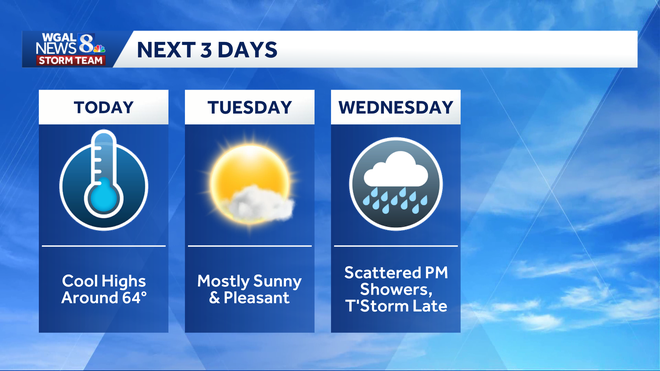
Impact Wednesday: What to expect Wednesday will bring several rounds of rain to the Susquehanna Valley. A few thunderstorms are possible by the evening, with brief heavy rain in some spots. High temperatures will reach the mid-60s.
Timing
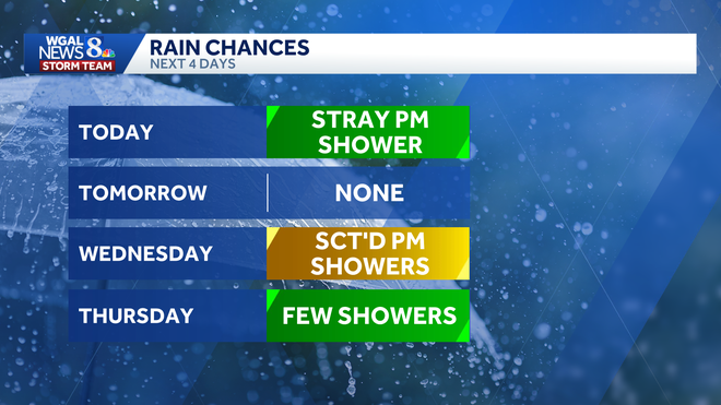
A warm front lifting north on Wednesday morning could spark a few early showers.More scattered showers are expected to develop during the afternoon ahead of an approaching cold front. The best chance for stronger showers and a few rumbles of thunder is in the evening as the front moves through.
Below: Predictor of rain chances across south-central Pa.
Rain totals Most areas are expected to pick up around one-tenth of an inch of rain.
WGAL News 8 Storm Team
Wednesday’s rain totals across south-central Pennsylvania
The WGAL News 8 Storm Team will continue tracking Wednesday’s rain chances, thunderstorm potential and forecast timing.
SOUTH-CENTRAL PA WEATHER RESOURCES: INTERACTIVE RADAR | ACTIVE WEATHER ALERTS | CURRENT CONDITIONS | HOURLY FORECAST | 10-DAY FORECAST | WEEKEND FORECAST | MAP ROOM | DOWNLOAD THE APP | WEATHER EMAILS