
Highs in the 80s return for the first time since April this weekend. A late-day shower or storm chance could interrupt our outdoor plans today. Sunshine will return to close out the weekend. The mercury continues to rise with 90 degrees likely early next week. Summer feeling returnsTemperatures are trending more summer-like starting this weekend. Highs should reach the lower 80s the next two afternoons. That is where our average highs sit in June and July.We are watching for afternoon showers and isolated storms. Activity will arrive as early as noon to 2 p.m. for areas west of Pittsburgh. Action will be limited in coverage and weaken by sundown. Clouds will linger into early Sunday morning with clearing skies by the afternoon.Sizzling start to next weekThe summer takeover doesn’t stop at the weekend. The warmest days of the year so far is likely on Monday and Tuesday as we make a run to 90 for the first time this year.More seasonal trend after mid-week showersClouds will increase late on Tuesday as a cold front approaches, meaning the highest temperatures will be most likely for Pittsburgh and locations south and east.Rain chances return on Wednesday as a cold front arrives. Depending on timing, rain could get here as early as late on Tuesday. This cold front will also bring back more seasonal temperatures in the lower 70s to close out the week. As of now, we look to be dry for the start of the Memorial Day weekend.TODAY: Sun and clouds, isolated shower or storm. High: 80°.TONIGHT: Showers and storms fizzle, staying mostly cloudy and mild. Low: 62°.SUNDAY: Morning clouds, afternoon clearing with pop-up showers. High: 83°, low: 64°.MONDAY: Sunny and hot. High: 90°, low: 70°.TUESDAY: Humid and still hot. Increasing clouds. High: 89°, low: 70°.
PITTSBURGH —
Highs in the 80s return for the first time since April this weekend. A late-day shower or storm chance could interrupt our outdoor plans today. Sunshine will return to close out the weekend. The mercury continues to rise with 90 degrees likely early next week.
Summer feeling returns
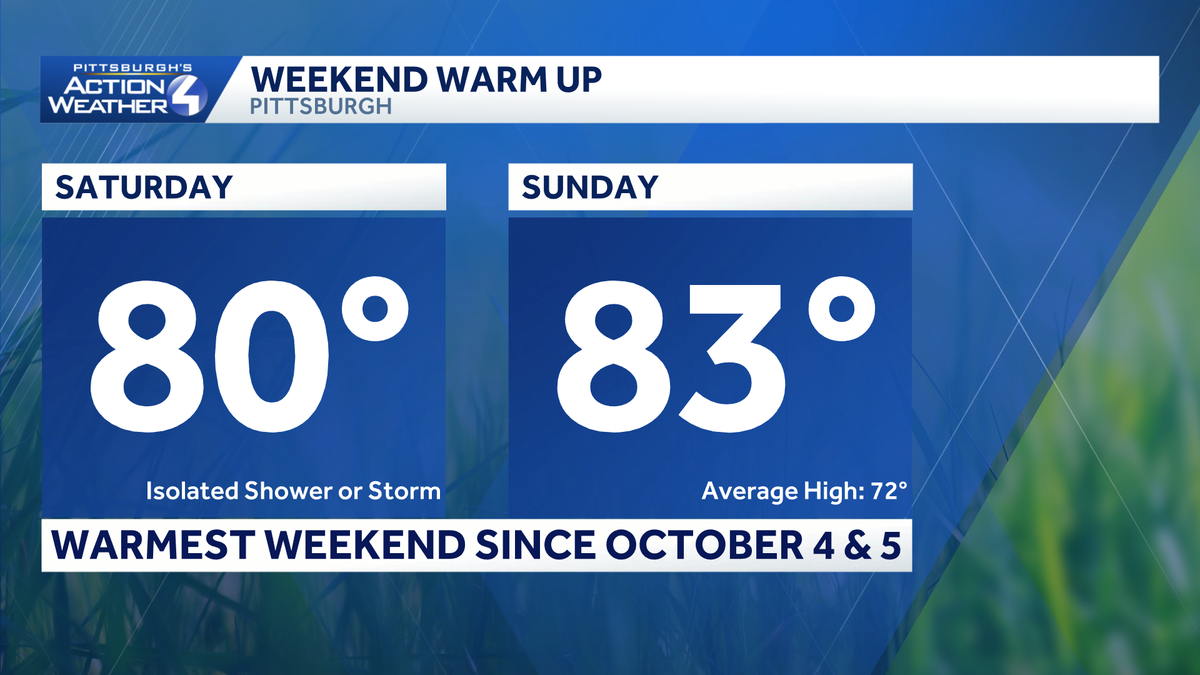
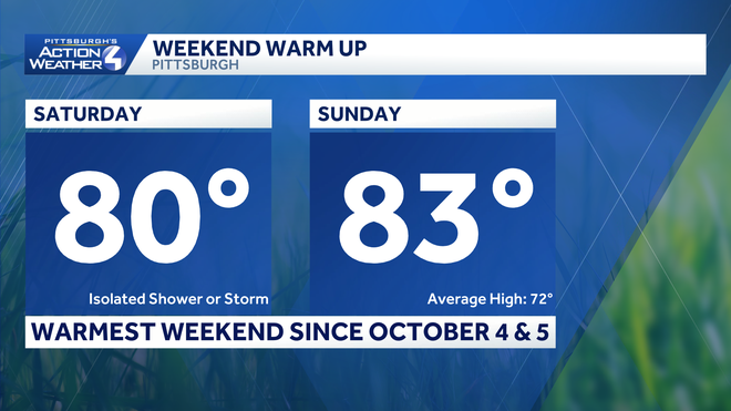
Temperatures are trending more summer-like starting this weekend. Highs should reach the lower 80s the next two afternoons. That is where our average highs sit in June and July.
Hearst OwnedHearst
A summer warm up begins this weekend for western PA.
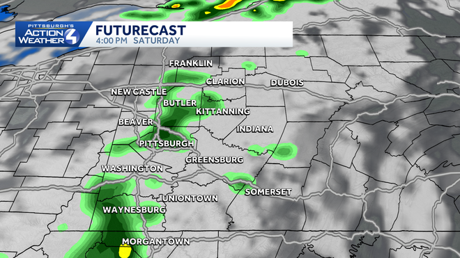
We are watching for afternoon showers and isolated storms. Activity will arrive as early as noon to 2 p.m. for areas west of Pittsburgh. Action will be limited in coverage and weaken by sundown. Clouds will linger into early Sunday morning with clearing skies by the afternoon.
Hearst OwnedHearst
Isolated showers with a storm or two arrives from the west as early as noon or 2 p.m.
Sizzling start to next week
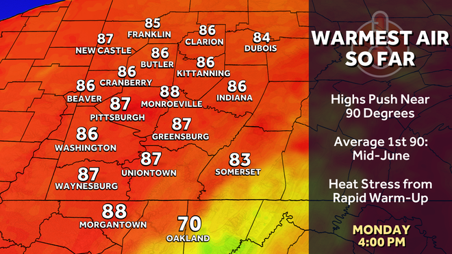
The summer takeover doesn’t stop at the weekend. The warmest days of the year so far is likely on Monday and Tuesday as we make a run to 90 for the first time this year.
Hearst OwnedHearst
Monday and Tuesday will be the hottest days of the year with highs pushing 90 degrees.
More seasonal trend after mid-week showers
Clouds will increase late on Tuesday as a cold front approaches, meaning the highest temperatures will be most likely for Pittsburgh and locations south and east.
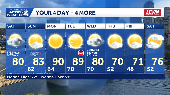
Rain chances return on Wednesday as a cold front arrives. Depending on timing, rain could get here as early as late on Tuesday. This cold front will also bring back more seasonal temperatures in the lower 70s to close out the week. As of now, we look to be dry for the start of the Memorial Day weekend.
Hearst OwnedHearst
A better rain chance follows the heat. Temperatures will trend more seasonal ahead of Memorial Day weekend.
TODAY: Sun and clouds, isolated shower or storm. High: 80°.
TONIGHT: Showers and storms fizzle, staying mostly cloudy and mild. Low: 62°.
SUNDAY: Morning clouds, afternoon clearing with pop-up showers. High: 83°, low: 64°.
MONDAY: Sunny and hot. High: 90°, low: 70°.
TUESDAY: Humid and still hot. Increasing clouds. High: 89°, low: 70°.