
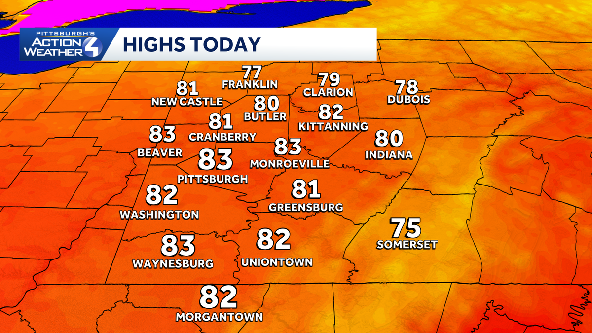
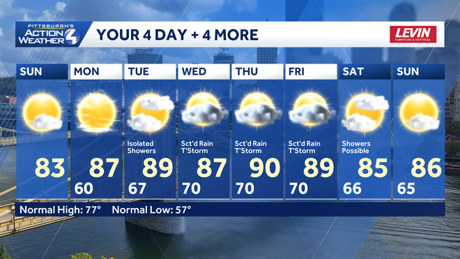
A quieter day for Western PA with sunshine increasing through the afternoon as highs reach the lower 80s. Humidity ramps up this week as daily rain chances return through the middle and end of the week.Quieter SundayAreas of fog in the morning give way to ample sunshine through the afternoon. Highs today will reach the lower 80s, which is where we have been for the last few days. Humidity will be tolerable today.Hot and Humid Week with Daily StormsHighs return to the upper 80s on Monday and will flirt with 90 Tuesday through Friday. We likely reach 90 at least once this week, with the most likely day at this point being Thursday.Daily rain chances return Tuesday as a couple of weak systems move through our area as we head through the end of the week. At this point, no one day looks to be a total washout, but showers and a few storms will be possible each afternoon. Wednesday and Friday look to be the wettest day as we likely see two cold fronts pass through the area those days.With the daily rain chances, rainfall totals this week will likely be less than an inch by Friday afternoon. However, if you see a few thunderstorms during the week, locally higher rainfall totals are possible. With the rain spread out all week, there are currently no flooding concerns. Severe weather at this point also looks unlikely.TODAY: Turning sunny. High: 83°.TONIGHT: Clear and comfortable. Low: 60°.MONDAY: Sunny and hot. High: 87°, low: 67°.TUESDAY: Partly cloudy with isolated showers. High: 89°, low: 70°.
PITTSBURGH —
A quieter day for Western PA with sunshine increasing through the afternoon as highs reach the lower 80s. Humidity ramps up this week as daily rain chances return through the middle and end of the week.
Quieter Sunday
Areas of fog in the morning give way to ample sunshine through the afternoon. Highs today will reach the lower 80s, which is where we have been for the last few days. Humidity will be tolerable today.
Hearst Owned
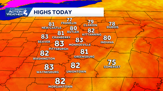
Another warm day today and, potentially, the coolest day of the week.
Hot and Humid Week with Daily Storms
Highs return to the upper 80s on Monday and will flirt with 90 Tuesday through Friday. We likely reach 90 at least once this week, with the most likely day at this point being Thursday.
Hearst Owned
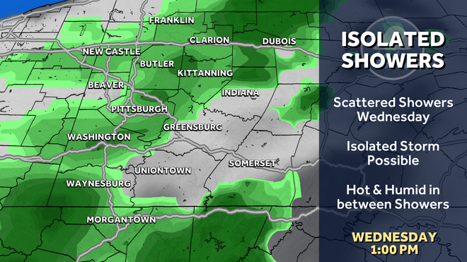
Daily rain chances are possible Tuesday through Saturday. There will be dry times each day.
Daily rain chances return Tuesday as a couple of weak systems move through our area as we head through the end of the week. At this point, no one day looks to be a total washout, but showers and a few storms will be possible each afternoon. Wednesday and Friday look to be the wettest day as we likely see two cold fronts pass through the area those days.
Hearst Owned
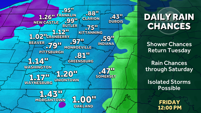
Rainfall totals through the week will generally be less than an inch, unless you see multiple thunderstorms.
With the daily rain chances, rainfall totals this week will likely be less than an inch by Friday afternoon. However, if you see a few thunderstorms during the week, locally higher rainfall totals are possible. With the rain spread out all week, there are currently no flooding concerns. Severe weather at this point also looks unlikely.
Hearst Owned
A warm and humid week ahead as highs flirt with 90. Daily rain chances also return starting Tuesday.
TODAY: Turning sunny. High: 83°.
TONIGHT: Clear and comfortable. Low: 60°.
MONDAY: Sunny and hot. High: 87°, low: 67°.
TUESDAY: Partly cloudy with isolated showers. High: 89°, low: 70°.