
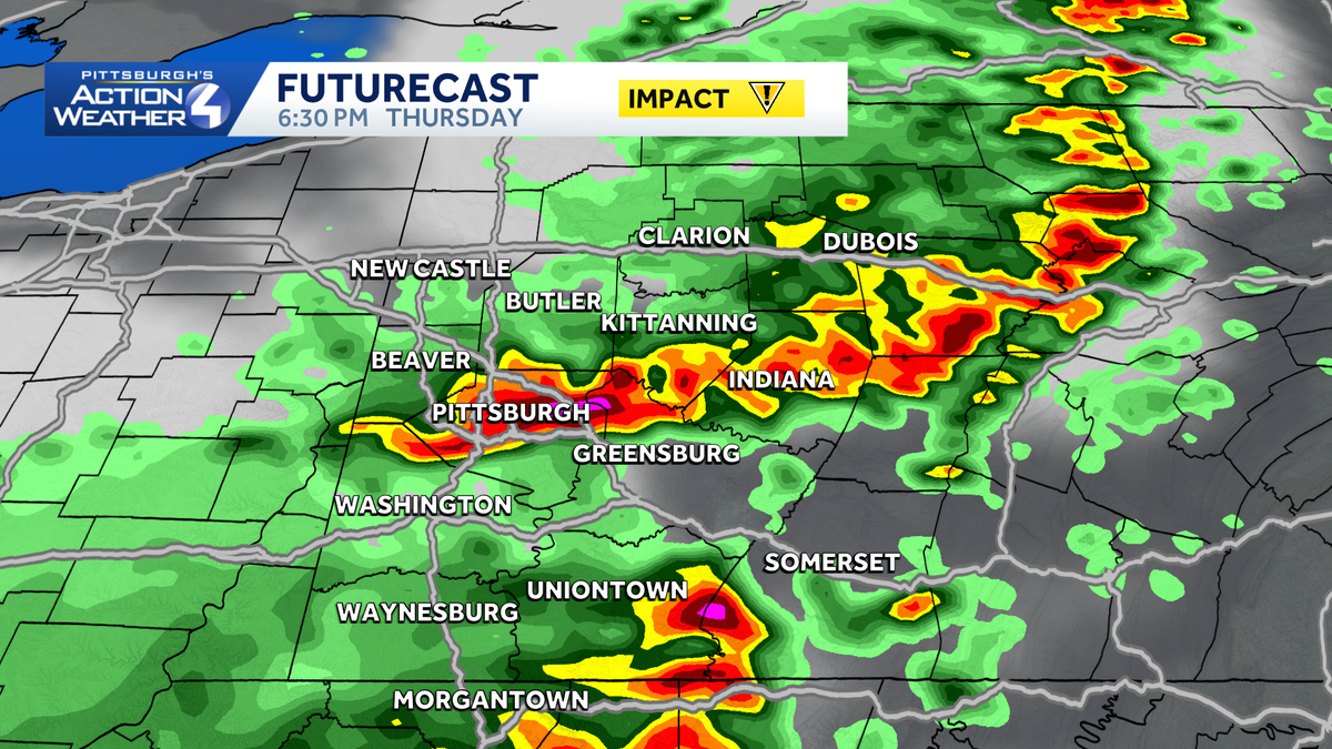
Warm and muggy conditions have arrived in western Pennsylvania and will stick around through Friday. Thursday and Friday are Impact Days with the threat of scattered showers and thunderstorms both days.Impact Days Thursday and FridayThe heat and humidity are the first part of Thursday’s Impact Day. Heat index values will top 90 degrees through the middle of the afternoon before any rain or storms develop. This will make it dangerous to be outside for extended periods doing strenuous activities.The second part of the Impact Day for Thursday is the chance for strong to severe storms. Storms look to fire as early as 2 p.m. and clear by 9 p.m. Damaging wind will be the primary concern with any storms, but heavy rain and lightning will accompany storms as well. Flooding will only be possible if heavy rainfall moves over the same location multiple times. Friday’s rain and storm chance is a bit more uncertain. What is left of a thunderstorm complex currently in the Midwest will arrive sometime on Friday. When it arrives, and how it interacts with our environment, will determine if stronger storms develop Friday afternoon. As of now, it appears to arrive earlier in the day to touch off scattered showers, and perhaps a storm, before pushing east of us in the middle of the afternoon. We will continue to watch the timing for storms on Friday. A later arrival would likely mean stronger storms in our area. Quieter, more seasonal start to the weekendThe weather will calm down over the weekend. High temperatures will be in the lower 80s, and humidity levels will be less. Expect plenty of sunshine on Saturday.Rain showers return in the second half of Sunday with a cold front crossing the region. More seasonal temperatures will follow next week with much lower humidity.THURSDAY – Impact Day: Hot and humid with afternoon and evening storms, some strong to severe. High: 87°TONIGHT: Mostly cloudy and steamy. Low: 72°.FRIDAY – Impact Day: Mostly cloudy with scattered showers and storms possible. High: 85°, low: 60°.SATURDAY: Mostly sunny and less humid. High: 83°, low: 64°.SUNDAY: Partly cloudy with afternoon showers. High: 80°, low: 56°.
PITTSBURGH —
Warm and muggy conditions have arrived in western Pennsylvania and will stick around through Friday. Thursday and Friday are Impact Days with the threat of scattered showers and thunderstorms both days.
Impact Days Thursday and Friday
The heat and humidity are the first part of Thursday’s Impact Day. Heat index values will top 90 degrees through the middle of the afternoon before any rain or storms develop. This will make it dangerous to be outside for extended periods doing strenuous activities.
Hearst Owned
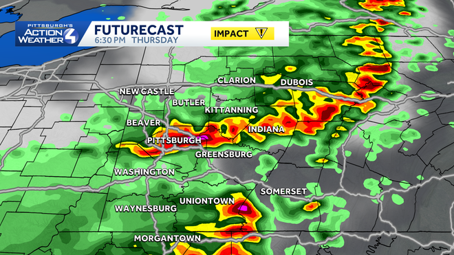
A line of storms is likely this afternoon and evening across Western PA.
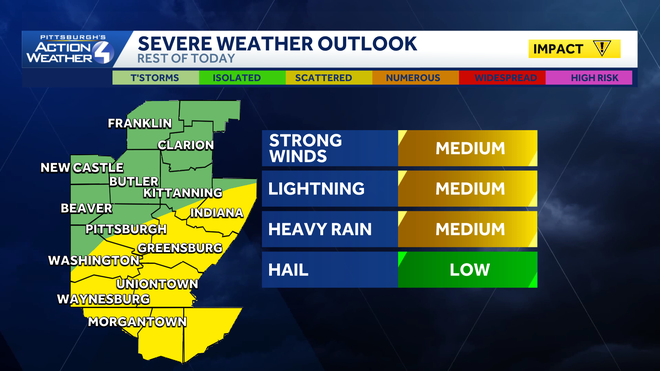
The second part of the Impact Day for Thursday is the chance for strong to severe storms. Storms look to fire as early as 2 p.m. and clear by 9 p.m. Damaging wind will be the primary concern with any storms, but heavy rain and lightning will accompany storms as well. Flooding will only be possible if heavy rainfall moves over the same location multiple times.
Hearst Owned
Strong winds are the primary concern from any storms Thursday and again on Friday.
Friday’s rain and storm chance is a bit more uncertain. What is left of a thunderstorm complex currently in the Midwest will arrive sometime on Friday. When it arrives, and how it interacts with our environment, will determine if stronger storms develop Friday afternoon. As of now, it appears to arrive earlier in the day to touch off scattered showers, and perhaps a storm, before pushing east of us in the middle of the afternoon. We will continue to watch the timing for storms on Friday. A later arrival would likely mean stronger storms in our area.
Quieter, more seasonal start to the weekend
The weather will calm down over the weekend. High temperatures will be in the lower 80s, and humidity levels will be less. Expect plenty of sunshine on Saturday.
Rain showers return in the second half of Sunday with a cold front crossing the region. More seasonal temperatures will follow next week with much lower humidity.
Hearst Owned
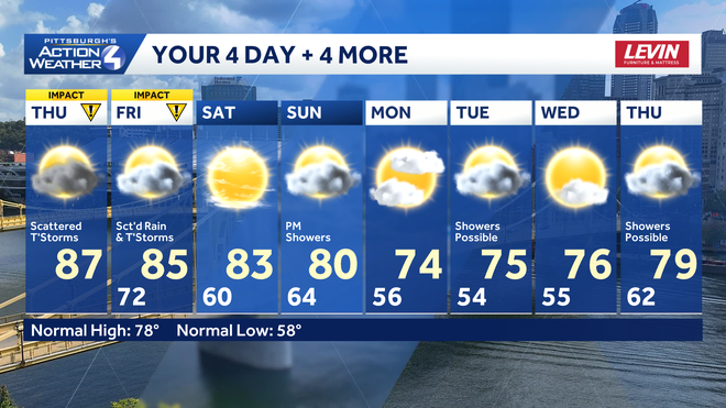
A much nicer weekend ahead and more seasonal next week.
THURSDAY – Impact Day: Hot and humid with afternoon and evening storms, some strong to severe. High: 87°
TONIGHT: Mostly cloudy and steamy. Low: 72°.
FRIDAY – Impact Day: Mostly cloudy with scattered showers and storms possible. High: 85°, low: 60°.
SATURDAY: Mostly sunny and less humid. High: 83°, low: 64°.
SUNDAY: Partly cloudy with afternoon showers. High: 80°, low: 56°.