
SHORT TERM FORECAST
TONIGHT: Shower or thunderstorm early in spots. Gradual clearing later. Low: 63
SATURDAY: Mostly sunny and warm, but more comfortable humidity. High: 88
SATURDAY NIGHT: Turning partly cloudy. Low: 63
THE BIG PICTURE
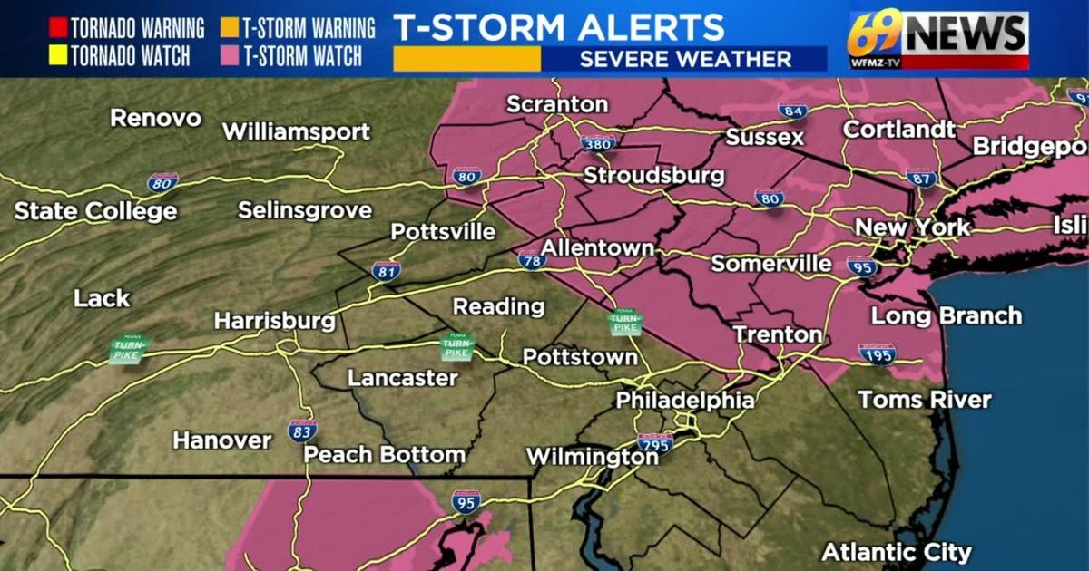
As expected, Friday was another hot and humid day with many of us reaching the low to mid 90s for high temperatures while dew points again ran around or just above 70 degrees. That combination of heat and humidity made for heat index values in the upper 90s to around 100 degrees. At the same time, we did see some mostly isolated downpours and perhaps a little bit of lightning and thunder fire up across the Lehigh Valley later in the afternoon. We may see a little more scattered shower and thunderstorm activity pop up as we work into the evening as a cold front to our west continues its journey eastward clashing with the hot and humid air. The entire region once again is highlighted under a “slight risk” for severe thunderstorms which is a level 2 out of 5. We also have a Severe Thunderstorm WATCH in effect for the Lehigh Valley, Poconos, Bucks County, and much of central and northern New Jersey until 9pm. A few strong and gusty thunderstorms are possible for the rest of the day, but many also will likely not deal with severe weather. The main thing to watch for with any stronger thunderstorm will be damaging wind gusts to 60mph. The weekend, at least Saturday, is shaping up to be fairly nice with high temperatures in the upper-80s with sunny skies on Saturday, then partly sunny skies to start on Sunday followed by scattered showers and thunderstorms arriving in the afternoon and evening. A few of those storms may once again be on the gusty side. Temperatures will run seasonable for the first half of next week along with largely dry, pleasant, and sunny conditions. A bit of rain may return later Wednesday and especially Thursday of next week along with an uptick in humidity.
FORECAST DETAILS
TONIGHT
Today’s heat and humidity has once again been high, and that has also once more created a fair amount of instability in the atmosphere which is fuel for storms. And with an approaching cold front, this will lead to hit-or-miss thunderstorm chances as we head into the evening. A couple cells may produce damaging wind gusts, large hail, and a brief downpour, although widespread thunderstorms are not expected. The greatest threat for severe weather to occur will be the further north one heads from the Lehigh Valley. Skies will eventually turn out mostly clear overnight with any thunderstorm chance ending prior to the midnight hour. Overnight low temperatures will drop back to cooler levels in the low 60s as the humidity also drops back to more pleasant levels.
THIS WEEKEND
Behind our Friday night cold front, it won’t be quite as hot or humid for the weekend, but it will still be warm. Expect skies to be mostly sunny on Saturday, with a dry day kicking off the weekend. There will also be much lower humidity, and highs will be in the upper 80s. On Sunday, we can expect partly sunny skies and once again warm afternoon high temperatures in the mid to upper 80s. The wind flow briefly comes back out of the south however on Sunday, and this will lead to a brief increase in humidity to sticky levels again. At the same time, another cold front will approach from the Great Lakes and will bring the chance of more scattered showers and thunderstorms Sunday afternoon into the evening. A few thunderstorms later Sunday may have the potential to bring strong wind gusts.
NEXT WEEK
Temperatures continue to drop as we move from the start of the work week through Wednesday, with high temperatures dropping back into the upper 70s to near 80 degrees along with much more comfortable dew points in the 50s. Skies will be partly sunny through this stretch and we shouldn’t see any rain until perhaps a weak disturbance later Wednesday brings a few light showers. A breezy Thursday will see temperatures rise to the mid-80s, with an uptick in humidity and also the next chance of thunderstorms coming later in the day, probably the best chance of rain we’ll see next week. Friday we should get behind said cold front and see highs in the mid 80s with a return to mostly sunny skies and comfortable humidity values.
TRACK THE WEATHER:
LINKS: HOUR BY HOUR | RADAR | TRAFFIC