
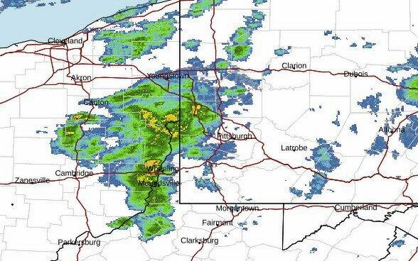
While the National Weather Service has not yet issued a storm warning, its staff is expecting strong thunderstorms to move through the region later Sunday afternoon.
Strong to severe thunderstorms that could bring high winds are anticipated to set in around 3 p.m. Sunday, according to the NWS office in Moon.
Forecasters are keeping an eye out for the conditions that can create strong winds.
“Things we look for that produce higher winds are higher levels of instability within a storm,” said NWS Meteorologist Chris Leonardi. “We also keep an eye out for fast storm movement. The wind that’s moving those storms can sometimes be transported down closer to the surface.”
Leonardi said the storm, which is also advancing alongside a cold front, will likely start northwest of Pittsburgh around 2 p.m., moving into the city sometime between 3 p.m. and 6 p.m.
Temperatures are expected to reach the mid-80s on Sunday, before dipping to a low of 56 degrees overnight.
If the storm requires weather watches or warnings as it continues to develop, they will be posted at Weather.gov/pbz.