
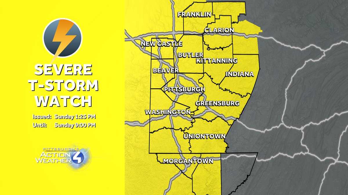
A Thunderstorm Watch has been issued across Western Pennsylvania.The line of storms tracks through between 4 p.m. and 8 p.m. with the potential for damaging winds and downpours.Thunderstorm WatchA Severe Thunderstorm Watch is in effect for all of Western Pennsylvania until 9 p.m. A line of storms is expected to bring strong winds and heavy downpours beginning at 4 p.m.More: Read current weather alerts for your countyInteractive radar: Track storms in your areaLearn how to enable automatic weather alerts on the WTAE mobile appImpact Day: Scattered afternoon stormsA break from spotty showers with some rays of sunshine comes early this afternoon. The lull will help to increase chances for strong to severe thunderstorms.The window for storms opens around 3 p.m. and continues through 8 p.m. The line of thunderstorms will work from west to east. Strong winds and downpours are expected. Some small hail and a non-zero risk for a tornado are also possible.Cooler and less humid to start the weekToday’s cold front will usher in a rather refreshing air mass to start next week. Highs will be in the 70s, lows will dip into the 50s. Clouds will gradually break Monday; Tuesday will feature all day sunshine.The next rain and storm chance ThursdayWe are watching another round of rain and storms for Thursday. The morning hours look a little busier for the Pittsburgh, potentially making it an Impact Day. Outside of the rain and storms, it will be a breezy day. Conditions will dry out on Juneteenth and stay quiet for Father’s Day weekend.TODAY – Impact Day: Morning showers, scattered PM thunderstorms. High: 80°.TONIGHT: Showers and storms end around sunset. Mostly cloudy with patchy fog. Low: 56°.MONDAY: Cooler with clouds and sun. High: 71°, low: 54°.TUESDAY: Delightful with more sunshine. High: 76°, low: 57°.WEDNESDAY: Increasing clouds with showers returning late. High: 80°, low: 64°.
A Thunderstorm Watch has been issued across Western Pennsylvania.
The line of storms tracks through between 4 p.m. and 8 p.m. with the potential for damaging winds and downpours.
Thunderstorm Watch
A Severe Thunderstorm Watch is in effect for all of Western Pennsylvania until 9 p.m. A line of storms is expected to bring strong winds and heavy downpours beginning at 4 p.m.
Impact Day: Scattered afternoon storms
A break from spotty showers with some rays of sunshine comes early this afternoon. The lull will help to increase chances for strong to severe thunderstorms.
Hearst OwnedHearst
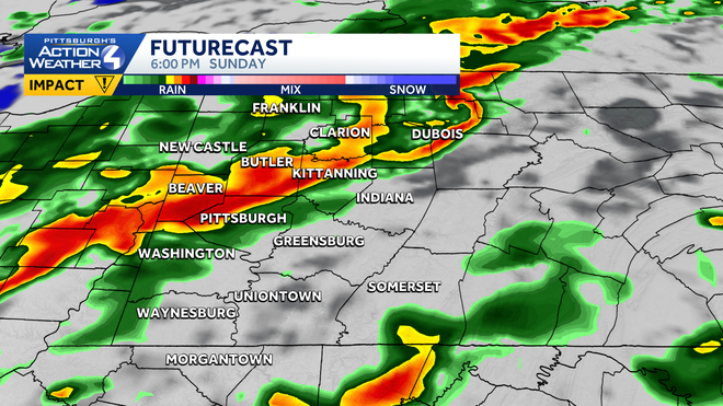
A line of thunderstorms will cut through western Pennsylvania between 3 p.m. and 8 p.m.
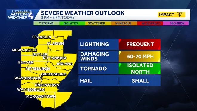
The window for storms opens around 3 p.m. and continues through 8 p.m. The line of thunderstorms will work from west to east. Strong winds and downpours are expected. Some small hail and a non-zero risk for a tornado are also possible.
Hearst OwnedHearst
Damaging winds and downpours are the leading storm risks.
Cooler and less humid to start the week
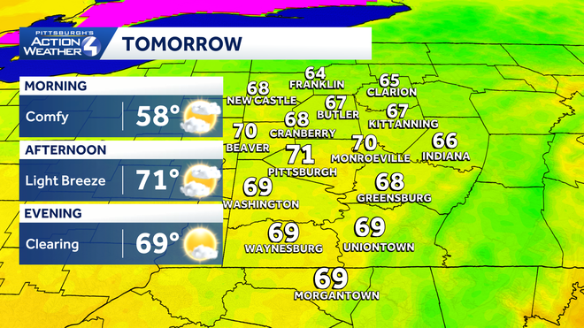
Today’s cold front will usher in a rather refreshing air mass to start next week. Highs will be in the 70s, lows will dip into the 50s. Clouds will gradually break Monday; Tuesday will feature all day sunshine.
Hearst OwnedHearst
Cooler and dry on Monday with clouds and sunshine around western PA.
The next rain and storm chance Thursday
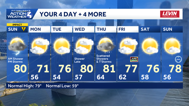
We are watching another round of rain and storms for Thursday. The morning hours look a little busier for the Pittsburgh, potentially making it an Impact Day. Outside of the rain and storms, it will be a breezy day. Conditions will dry out on Juneteenth and stay quiet for Father’s Day weekend.
Hearst OwnedHearst
More refreshing air arrives after today’s storms. Thursday will be another unsettled day for the Pittsburgh area.
TODAY – Impact Day: Morning showers, scattered PM thunderstorms. High: 80°.
TONIGHT: Showers and storms end around sunset. Mostly cloudy with patchy fog. Low: 56°.
MONDAY: Cooler with clouds and sun. High: 71°, low: 54°.
TUESDAY: Delightful with more sunshine. High: 76°, low: 57°.
WEDNESDAY: Increasing clouds with showers returning late. High: 80°, low: 64°.