
A cooler, rather refreshing air mass settles into western Pennsylvania. Rain chances will hold off until Wednesday. Thursday is now a Severe Weather Alert Day for rain and storms, especially around the morning commute.Dry and Comfortable Calm and quiet with comfortable temperatures today. Temperatures will dip close to 50° early this morning, but daytime highs will rise into the mid 70s.Rain returns, Sever Weather Alert Day ThursdayA few showers will be around Wednesday morning followed by more rain overnight. The daylight hours of Wednesday should be dry. Thursday is now a Severe Weather Alert Day. Strong to severe thunderstorms are possible, especially southeast of the city. The storms may produce damaging winds, hail, heavy rain, and a possible tornado. Even though there is the chance for storms, the bigger concern for Thursday is localized flooding from heavy rain. The excessive rainfall outlook has part of the region under an elevated risk for flash flooding, which adds to the Severe Weather Alert Day.By the time rain ends mid-morning, some locations could see upwards of an inch of rain. That much rain in a few hour span could cause flooding and ponding on roadways. Even after the rain ends, the wind picks up through the day with gusts potentially topping 40 mph through the afternoon and early evening.Drying out again by the weekendConditions will dry out on Juneteenth and stay quiet for Father’s Day weekend. Sunday is also the Summer Solstice. Temperatures won’t feel very summer-like for the start of the new season. Rain returns as we start next week.TODAY: A nice day with sunshine, clouds return late. High: 76°.TONIGHT: Mostly cloudy with a passing shower chance towards sunrise. Low: 58°.WEDNESDAY: Increasing clouds with rain late. High: 80°, low: 65°.THURSDAY – Severe Weather Alert Day: Rain and storms, especially in the morning. Potential flash flooding. Windy and humid. High: 83°, low: 58°. Wind gusts over 40 mph in the afternoon and evening.
PITTSBURGH —
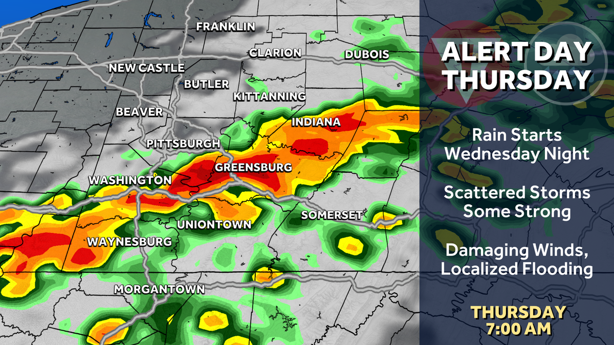
A cooler, rather refreshing air mass settles into western Pennsylvania. Rain chances will hold off until Wednesday. Thursday is now a Severe Weather Alert Day for rain and storms, especially around the morning commute.
Dry and Comfortable
Calm and quiet with comfortable temperatures today. Temperatures will dip close to 50° early this morning, but daytime highs will rise into the mid 70s.
Rain returns, Sever Weather Alert Day Thursday
A few showers will be around Wednesday morning followed by more rain overnight. The daylight hours of Wednesday should be dry.
Thursday is now a Severe Weather Alert Day. Strong to severe thunderstorms are possible, especially southeast of the city. The storms may produce damaging winds, hail, heavy rain, and a possible tornado.
Hearst Owned
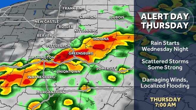
Rain and storms will move through Western PA during the morning commute Thursday.
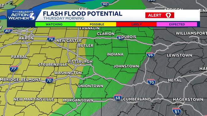
Even though there is the chance for storms, the bigger concern for Thursday is localized flooding from heavy rain. The excessive rainfall outlook has part of the region under an elevated risk for flash flooding, which adds to the Severe Weather Alert Day.
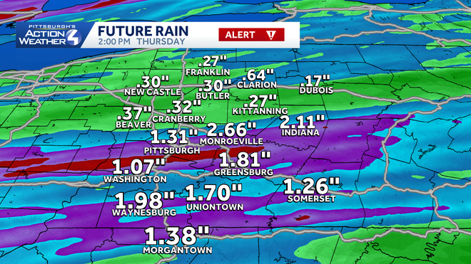
By the time rain ends mid-morning, some locations could see upwards of an inch of rain. That much rain in a few hour span could cause flooding and ponding on roadways. Even after the rain ends, the wind picks up through the day with gusts potentially topping 40 mph through the afternoon and early evening.
Hearst Owned
Some locations could see over an inch of rain Thursday morning, leading to a localized flooding threat.
Drying out again by the weekend
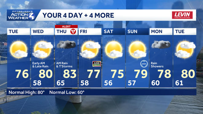
Conditions will dry out on Juneteenth and stay quiet for Father’s Day weekend. Sunday is also the Summer Solstice. Temperatures won’t feel very summer-like for the start of the new season. Rain returns as we start next week.
Hearst Owned
After Thursday’s rain and storms, the weekend is nice and pleasant before more rain to start next week.
TODAY: A nice day with sunshine, clouds return late. High: 76°.
TONIGHT: Mostly cloudy with a passing shower chance towards sunrise. Low: 58°.
WEDNESDAY: Increasing clouds with rain late. High: 80°, low: 65°.
THURSDAY – Severe Weather Alert Day: Rain and storms, especially in the morning. Potential flash flooding. Windy and humid. High: 83°, low: 58°. Wind gusts over 40 mph in the afternoon and evening.