
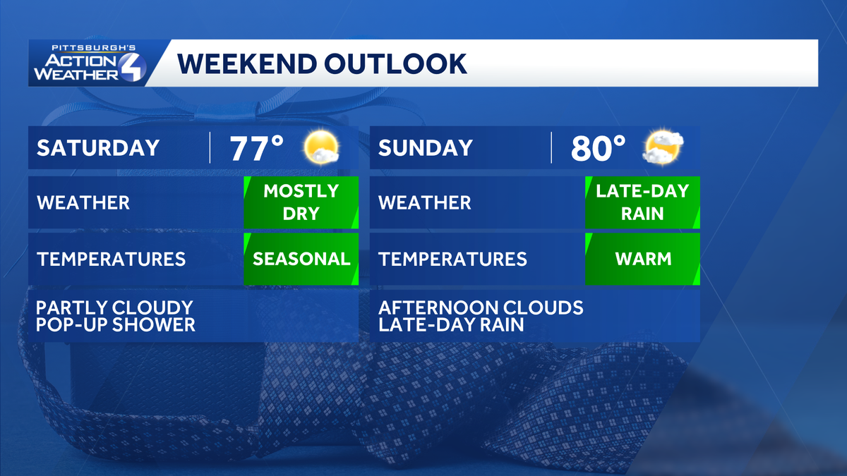
Strong wind gusts remain an issue on the backside of this morning’s cold front. A Wind Advisory is in effect until 6 p.m. for higher elevations of Fayette and Westmoreland counties along with parts of northern West Virginia. Alert Day: Strong wind gusts for western PAPittsburgh could clock gusts up to 40 mph; the wind will be even stronger through the ridges. This could cause additional problems with trees potentially toppling over due to saturated soils from the rain in the morning. Light weight outdoor objects should remain secured and keep two hands on the steering wheel and your car door.A Wind Advisory for the higher elevations of Fayette and Westmoreland counties along with parts of northern West Virginia and Garrett County is in effect through 6 p.m. Wind gusts up to 50 mph are possible for these areas. The rest of the region will deal with gusty conditions, including gusts to 30 to 40 mph. Isolated to scattered power outages are possible.Drying out, and staying dry through the weekendMore sunshine will break through the clouds during the second half of the day. Conditions will be dry on Friday/Juneteenth with sunshine and high temperatures in the upper 70s. Staying comfortable and quiet through most of Father’s Day weekend. Impact Day Monday for rain and stormsThere is a chance of rain returning as early as Sunday night, coming in with our next system that arrives on Monday bringing rain. Monday is an Impact Day for the rain chance. A few thunderstorms may also be possible as the rain moves through the area. After the rain, we remain seasonal through next week with highs in the upper 70s to 80.TONIGHT: Wind dies down with fair skies. Low: 57°.FRIDAY: Mostly sunny and pleasant. High: 77°, low: 57°.SATURDAY: Another nice day with sun and clouds. Pop-up afternoon showers are possible. High: 77°, low: 59°.SUNDAY: Increasing clouds with evening rain possible. High: 80°, low: 62°.MONDAY – Impact Day: Rain and storms, especially heavy during the morning commute. High: 76°, low: 57°.
PITTSBURGH —
Strong wind gusts remain an issue on the backside of this morning’s cold front. A Wind Advisory is in effect until 6 p.m. for higher elevations of Fayette and Westmoreland counties along with parts of northern West Virginia.
Alert Day: Strong wind gusts for western PA
Pittsburgh could clock gusts up to 40 mph; the wind will be even stronger through the ridges. This could cause additional problems with trees potentially toppling over due to saturated soils from the rain in the morning. Light weight outdoor objects should remain secured and keep two hands on the steering wheel and your car door.
Hearst OwnedHearst
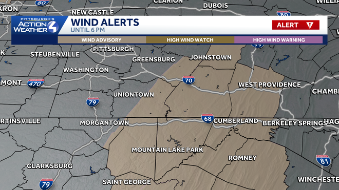
The Wind Advisory continues through 6 p.m. for the higher terrain to the southeast of Pittsburgh.
A Wind Advisory for the higher elevations of Fayette and Westmoreland counties along with parts of northern West Virginia and Garrett County is in effect through 6 p.m. Wind gusts up to 50 mph are possible for these areas. The rest of the region will deal with gusty conditions, including gusts to 30 to 40 mph. Isolated to scattered power outages are possible.
Drying out, and staying dry through the weekend
More sunshine will break through the clouds during the second half of the day. Conditions will be dry on Friday/Juneteenth with sunshine and high temperatures in the upper 70s. Staying comfortable and quiet through most of Father’s Day weekend.
Hearst Owned
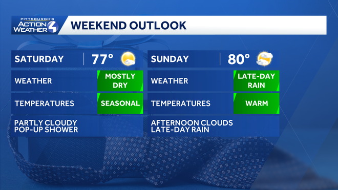
Seasonal temperatures for the weekend. Most of the rain will hold off until late-day on Father’s Day. Tee times, pool time and cookouts with dad look fine for now.
Impact Day Monday for rain and storms
There is a chance of rain returning as early as Sunday night, coming in with our next system that arrives on Monday bringing rain. Monday is an Impact Day for the rain chance. A few thunderstorms may also be possible as the rain moves through the area.
After the rain, we remain seasonal through next week with highs in the upper 70s to 80.
Hearst Owned
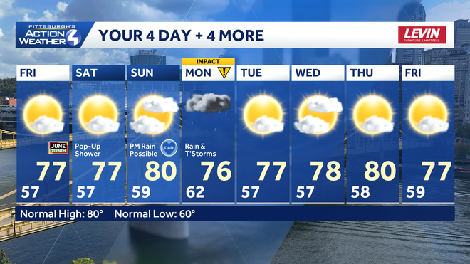
Rain holds off for most of your Father’s Day plans. Monday is more unsettled, prompting the Impact Day.
TONIGHT: Wind dies down with fair skies. Low: 57°.
FRIDAY: Mostly sunny and pleasant. High: 77°, low: 57°.
SATURDAY: Another nice day with sun and clouds. Pop-up afternoon showers are possible. High: 77°, low: 59°.
SUNDAY: Increasing clouds with evening rain possible. High: 80°, low: 62°.
MONDAY – Impact Day: Rain and storms, especially heavy during the morning commute. High: 76°, low: 57°.