
A warm and muggy night ahead, as skies gradually clear. Lows around 70.
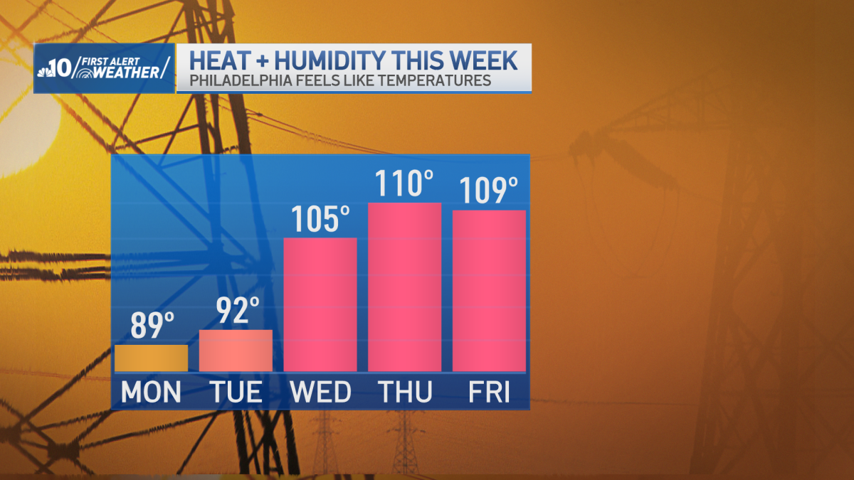
Still somewhat comfortable on Monday as highs reach the upper 80’s. A few spots may hit 90, with a slightly muggy feel to the air, and mostly sunny skies.
The heatwave officially starts for Tuesday, highs in the lower 90’s, with mostly sunny skies.
On Wednesday skies are sunny, and the afternoon high is close to 100 degrees. With the humidity factored in, it feels more like 105 degrees. This is when the very dangerous heat gets underway.
Thursday is even hotter. Highs around 102, with a feels-like temperature of 110. Remember, feels like temperature is a measure of how well sweat cools your body. With high humidity, that sweat cannot evaporate and cool you.
Friday is sunny as well, highs around 100, feels like numbers around 108.
The Fourth of July is very hot. Sunshine to start, with highs in the upper 90’s. There may be a passing thunderstorm later in the day as a cold front finally arrives, and relieves the worst of the heat.
Next Sunday starts with a shower or storm, then becomes sunny, with coolers highs around 90.
Get the latest weather updates by downloading the NBC10 app and following the NBC10 First Alert Weather team.