
It was a scorcher outside Thursday with our third day in a row of temperatures at or above 90 degrees, meaning we can now officially say we are in a heat wave, which has to be at least three consecutive days at or above 90 degrees. Temperatures Thursday didn’t just stop at 90 degrees, with multiple locations in the Lehigh Valley achieving a feat that has rarely happened in the last century: reaching a high of at least 100 degrees. The heat wave is expected to last through the end of this weekend, giving us a real taste of summer for the Fourth of July.
In Allentown, temperatures topped out at 101° — just one degree shy of the record set back in 2018. It also marks the 27th 100-degree day for the city in the last 100 years. Where we did break a record was Reading, where Thursday’s high reached 103°. The previous record stood at 102°, and was set all the way back in 1966. Additionally, as of 6 p.m., Trenton tied its 1901 record of 100° and both Mount Pocono and Philadelphia were within one degree of their respective records.
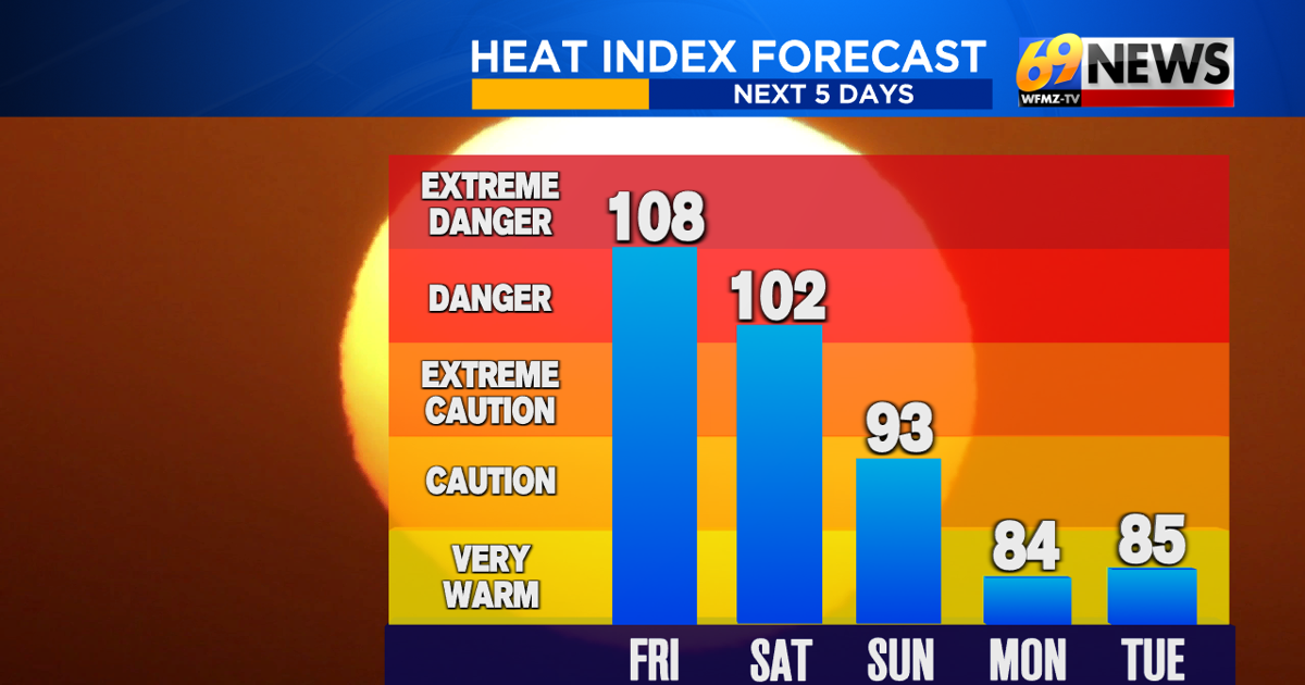
It wasn’t just the air temperatures that were hot, either. “Feels like” temperatures, which factor in both the air temperature and dewpoint temperature, also soared Thursday with some areas reaching as high as 110°. Similar conditions to those felt Thursday are expected for Friday, with temperatures nearing or topping the 100-degree mark across the Lehigh Valley, and heat index temperatures up to 110° possible yet again. The hot weather will persist into the weekend, though highs will only be in the upper 90s for Fourth of July Saturday, and into the low 90s by Sunday. An extreme heat warning continues to be in effect through 8 PM on Saturday, so continue to exercise caution when going outside; remember to drink plenty of fluids, wear light-colored clothes, stay in an air-conditioned space as much as possible, keep an eye out for those around you, and look before you lock.
Shower and storm chances return for Friday evening (20% chance), with isolated thunderstorms expected across the Valley. The rain will clear out to enable early-day holiday festivities to go on as planned before returning late in the day on Saturday (40% chance). Although some showers may delay the starting of firework displays, the incoming rain will be very beneficial to our current drought conditions. While the drought monitor did not change much over the past week, the lack of rain and increased heat we’ve been experiencing is expected to have some impact on next week’s update. More widespread rain looks to return late Sunday or Sunday night (50% chance) and persist through much of Monday.
The rain increasing over the weekend also means a cooling down of temperatures and the official end of the heatwave come Monday as temperature dip back down into the high 80s. Overnight lows will also return to more seasonable levels, with temperatures dipping back down into the mid-to-low 60s.
TRACK THE WEATHER:
LINKS: HOUR BY HOUR | RADAR | TRAFFIC