
It’s yet another oppressively hot and humid day for our July 4th, with highs into the mid- to upper 90s for much of the area, and the heat index above 100 degrees at times. And for the second straight evening, the heat and humidity could fuel another round of gusty storms.
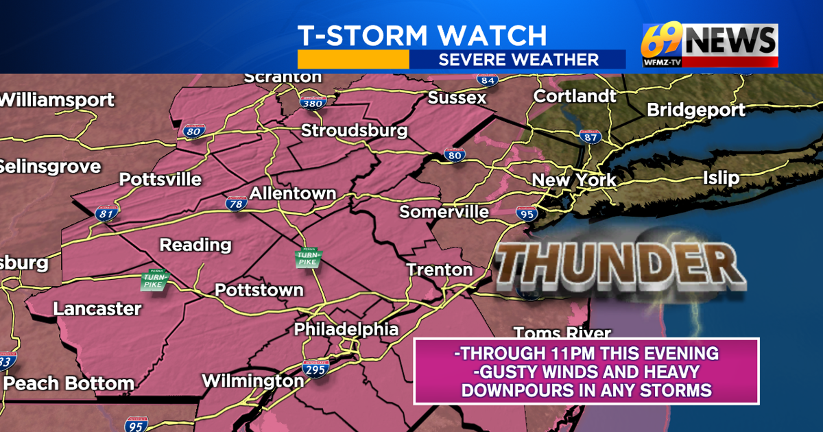
A severe thunderstorm watch has been issued for the entire area through 11 p.m. this evening, which means there is the “potential” for gusty storms. Any thunderstorm, severe or not, can contain frequent lightning and heavy downpours. Severe storms would be capable of some damaging wind gusts, much like parts of the area saw Friday evening. Hail and tornado concerns are much lower, and the focus will be on damaging winds.
Of course, with so many firework displays forecast for this evening, any storms, severe or not, and really any rain would be a complicating factor. While some showers and storms are likely, it’s not a guarantee that the entire area will get rain or severe weather. But given the heat and humidity, the ingredients are certainly there.
Right now, odds favor most of our area staying dry through the mid- to late afternoon, and perhaps even early evening. So through at least 7 p.m. to around 8 p.m., most places look to stay dry. But a few thunderstorms are possible along and north of Interstate 80 through the Poconos, Northeast PA, and far North Jersey late this afternoon ahead of any widespread activity thereafter.
For fireworks fans, be sure to download the 69News Storm Center App and follow along with any warnings, the latest radar, and the updated forecast. If thunderstorms threaten your location or severe thunderstorm warnings are issued, be sure to seek shelter from any approaching storm. Lightning and strong winds can be dangerous if proper action isn’t taken.
For the Poconos and areas north of I-80, T-storms are possible anytime from late afternoon into the evening. For the rest of the area, the best chances for showers and storms will be closer to and after sunset, say from after 7–8 p.m. and before 10–11 p.m.
These storms will provide some brief cooling, and ultimately break our heat wave. The humidity lingers Sunday and Monday, and showers and storms become even more widespread. As a result, highs will only be in the 80s on Sunday, and perhaps 70s on Monday.
You can also tune into WFMZ-TV for our evening newscasts at 6 p.m. and 10 p.m. on this July 4th for the latest on the severe threat, as well as the 69News Weather Channel, which is always on!
Be sure to stay cool and hydrated while the intense heat hangs on for just a little longer. And also be sure to stay weather aware for any storms possible later.
TRACK THE WEATHER:
LINKS: HOUR BY HOUR | RADAR | TRAFFIC