
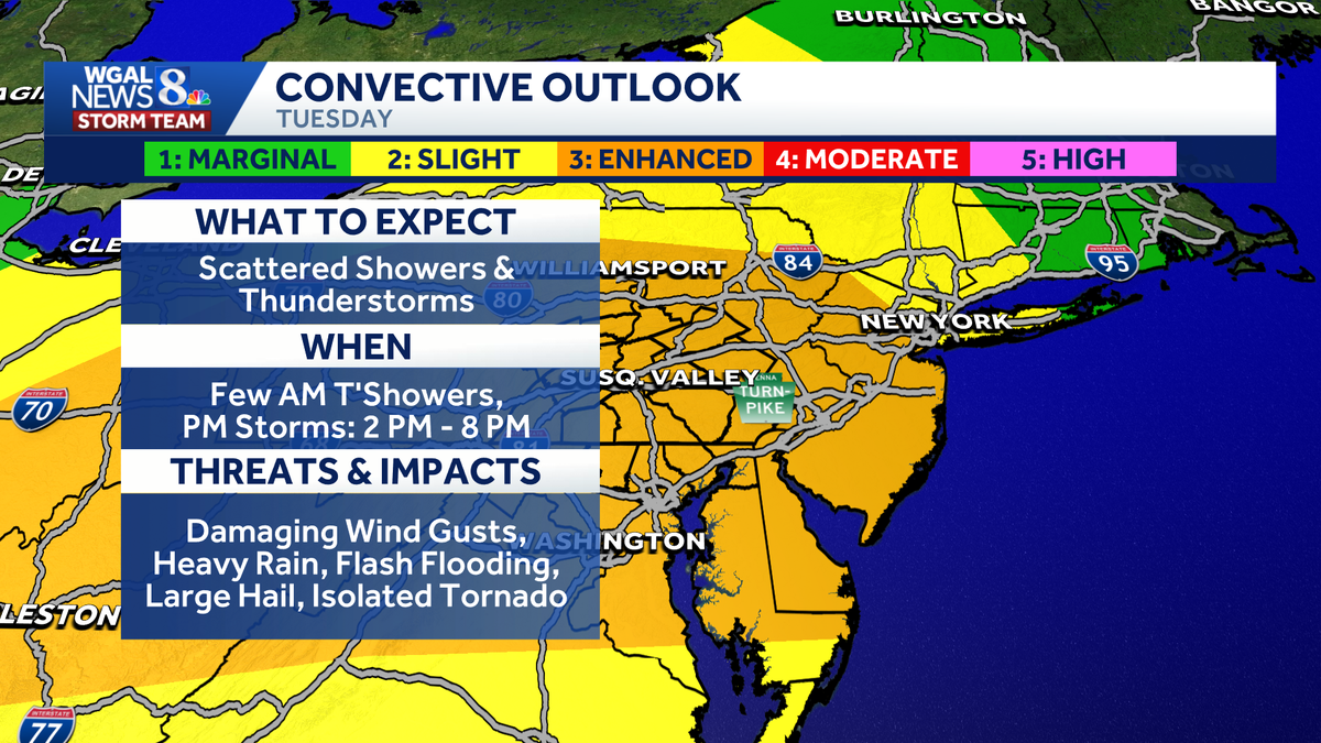
Strong to severe storms are expected in south-central Pennsylvania on Tuesday, bringing a risk of damaging winds, heavy rain, hail and an isolated tornado. The WGAL News 8 Storm Team has upgraded Tuesday to an Alert Day, meaning the threat of extreme, severe, and possibly life-threatening weather is possible. TimingMorning | A few showers and isolated thunderstorms are possible as a warm front moves in. Some areas may get a quick downpour. 2 p.m. to 8 p.m. | The highest chance for severe weather, especially around dinnertime. Sunset through midnight | Severe storms will diminish. There may be a few trailing showers and thunderstorms. Below: Swipe through the predicted radar for Tuesday’s storms. Enhanced riskThe Storm Prediction Center has placed the entire Susquehanna Valley under an Enhanced Risk (level 3/5) for severe weather. Main threatsSome thunderstorms could produce: Heavy rainDamaging windsFlash floodingLarge hailTornadoThe primary concern is damaging wind gusts that could reach 60 to 70 mph, as well as heavy rain that could lead to localized flash flooding, especially in creeks and streams as well as low-lying and poor-drainage areas.While tornadoes and hail are considered lower threats than wind and flooding, they are still possible in the strongest storms. ConditionsHighs are expected to reach around 84 degrees on Tuesday. Humid conditions are expected throughout the day.Temperatures will fall to about 70 degrees overnight.Patchy fog could develop later tonight under partly cloudy skies. Looking aheadWednesday will start off sticky, with the chance for a stray midday shower or thunderstorm before humidity gradually drops by evening. More refreshing air arrives Thursday and Friday, bringing mostly sunny skies, crisp mornings and highs in the low 80s. This weekend looks partly sunny with highs in the mid-80s and a slight chance for thunderstorms by Sunday. To receive alerts from the National Weather Service, enable weather notifications in the WGAL News 8 app. DOWNLOAD THE WGAL NEWS 8 APP HERE! Did you capture the weather and would like to share with News 8? Send us your photos or videos at https://www.wgal.com/upload.
Strong to severe storms are expected in south-central Pennsylvania on Tuesday, bringing a risk of damaging winds, heavy rain, hail and an isolated tornado.
The WGAL News 8 Storm Team has upgraded Tuesday to an Alert Day, meaning the threat of extreme, severe, and possibly life-threatening weather is possible.
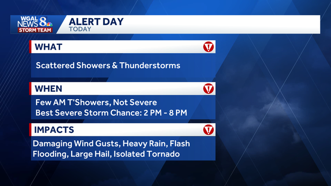
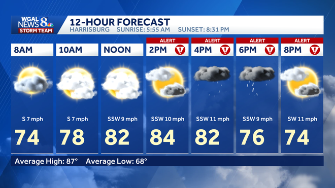
TimingMorning | A few showers and isolated thunderstorms are possible as a warm front moves in. Some areas may get a quick downpour. 2 p.m. to 8 p.m. | The highest chance for severe weather, especially around dinnertime. Sunset through midnight | Severe storms will diminish. There may be a few trailing showers and thunderstorms.
Below: Swipe through the predicted radar for Tuesday’s storms.
Enhanced risk
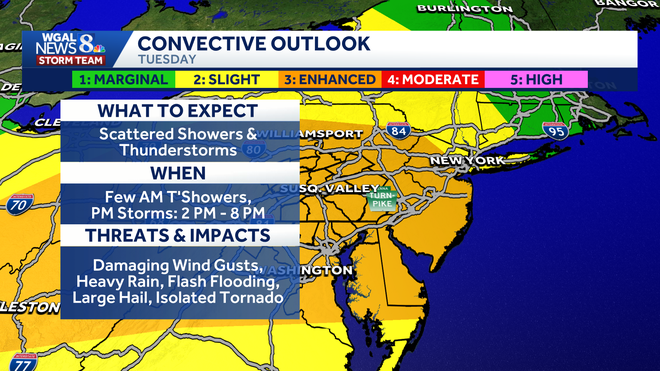
The Storm Prediction Center has placed the entire Susquehanna Valley under an Enhanced Risk (level 3/5) for severe weather.
Main threats
Some thunderstorms could produce:
Heavy rainDamaging windsFlash floodingLarge hailTornado
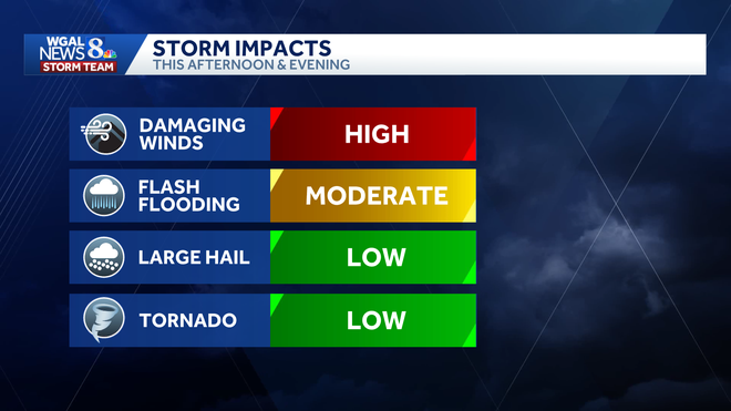
The primary concern is damaging wind gusts that could reach 60 to 70 mph, as well as heavy rain that could lead to localized flash flooding, especially in creeks and streams as well as low-lying and poor-drainage areas.
While tornadoes and hail are considered lower threats than wind and flooding, they are still possible in the strongest storms.
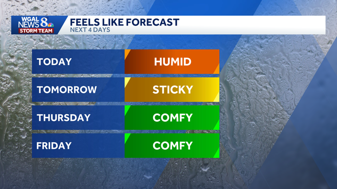
ConditionsHighs are expected to reach around 84 degrees on Tuesday. Humid conditions are expected throughout the day.Temperatures will fall to about 70 degrees overnight.Patchy fog could develop later tonight under partly cloudy skies.
Looking ahead
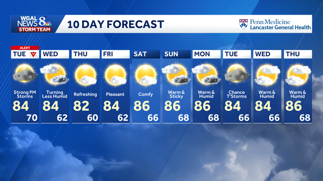
Wednesday will start off sticky, with the chance for a stray midday shower or thunderstorm before humidity gradually drops by evening.
More refreshing air arrives Thursday and Friday, bringing mostly sunny skies, crisp mornings and highs in the low 80s.
This weekend looks partly sunny with highs in the mid-80s and a slight chance for thunderstorms by Sunday.
To receive alerts from the National Weather Service, enable weather notifications in the WGAL News 8 app.
DOWNLOAD THE WGAL NEWS 8 APP HERE!
Did you capture the weather and would like to share with News 8? Send us your photos or videos at https://www.wgal.com/upload.