
(WBRE/WYOU) — Today will contain a mix of clouds and sun. A shower or storm is possible in the early to mid-afternoon as a cold front makes its way through our region.
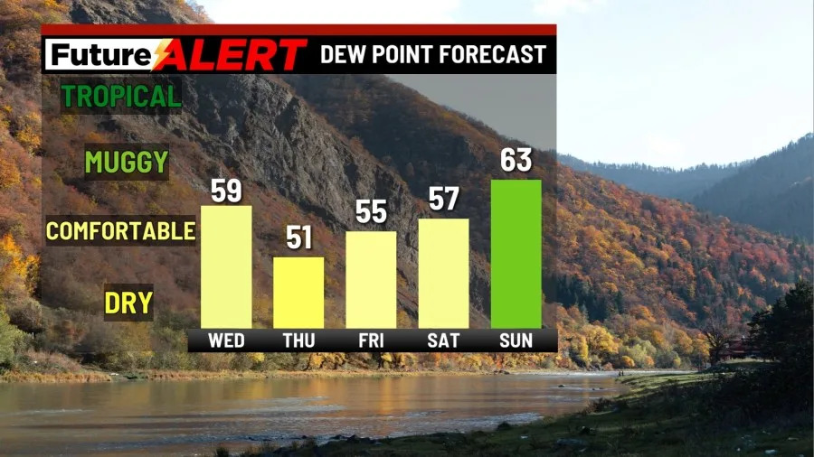
The late afternoon and evening will become noticeably less humid. Highs will be around 80. Tonight, the skies will be mainly clear, and it will become much cooler. It might be a good night to turn your AC off! Sleeping weather looks great. Lows will be in the low 50s.
Tomorrow will be the start of a pleasant few days ahead. High pressure will build into the region, creating mostly sunny skies and pleasant conditions overall. Highs will be in the upper 70s. Your Friday will be more of the same: mostly sunny skies with highs in the low 80s. For Saturday, a bit more clouds will be introduced, but overall weather will continue to be enjoyable with highs in the lower 80s as well.
Sunday will be the start of some unsettled weather. Low pressure will be re-introduced, creating a small chance for a shower or storm. Skies will be partly sunny, and highs will be in the low-to-mid 80s. Your Monday and Tuesday are also partly sunny. There are chances for showers and storms on both days as well. Monday is our hottest day in the forecast with highs in the mid-to-upper 80s, while Tuesday remains in the low-to-mid 80s.
You can stay current on all the latest weather alerts and track the storm using the Future Alert Interactive Radar.
Copyright 2026 Nexstar Media, Inc. All rights reserved. This material may not be published, broadcast, rewritten, or redistributed.
For the latest news, weather, sports, and streaming video, head to 28/22 News.