
Pittsburgh: Feeling like September to end the week
Seasonably cool temperatures and low humidity go along with sunshine.
 PITTSBURGH —
The National Weather Survey completed damage surveys and confirmed three brief, EF-0 tornadoes in Butler and Lawrence counties. The forecast for western Pennsylvania will be much quieter and more comfortable through late week.
Clear, calm and cool night
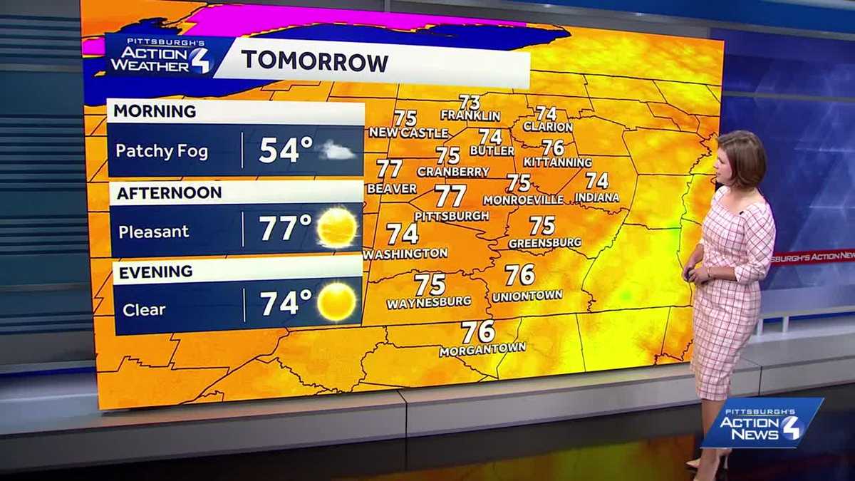
The lingering late-day clouds will dwindle this evening and tonight. The calm and dry conditions will send temperatures into the low and mid 50s. You can sleep with the windows open thanks to the fresh air and no issues from wildfire smoke. Patchy fog will form ahead of sunrise, especially in our river valleys.
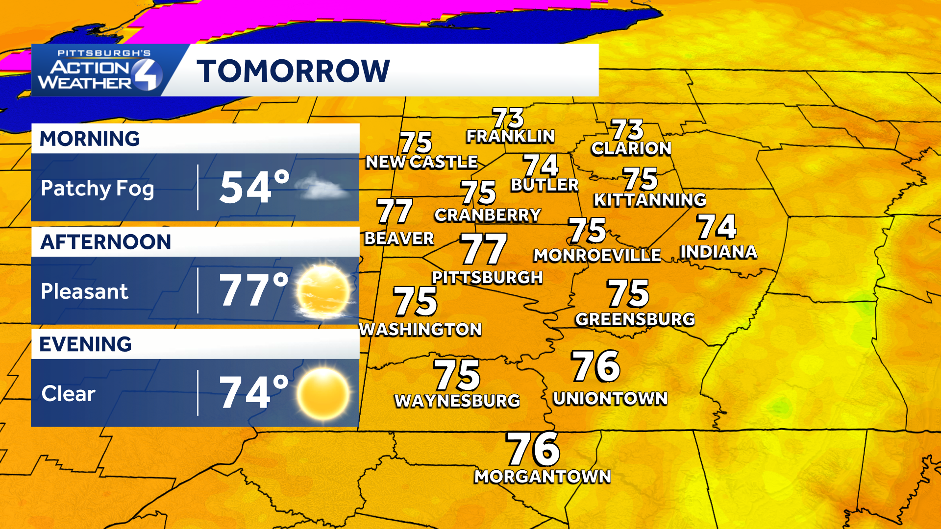
From patchy fog to sunshine tomorrow with low humidity and very comfortable temperatures.
September-like feeling
We are taking a break from the high heat and humidity along with unsettled conditions for a few days. Sunshine will rule our skies with temperatures taking a trip back to the 70s. This is more typical for September around western PA, especially with the very comfortable humidity levels.
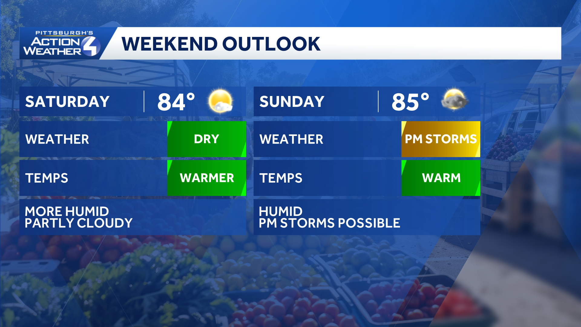
The summer feeling returns this weekend. We will monitor for storms Sunday afternoon or evening.
Rain Chances Possible Sunday
Our next rain chance comes Sunday late afternoon and evening. A few more storms are possible on Monday. Activity will ramp back up on Tuesday. Temperatures are trending more summer-like next week too.
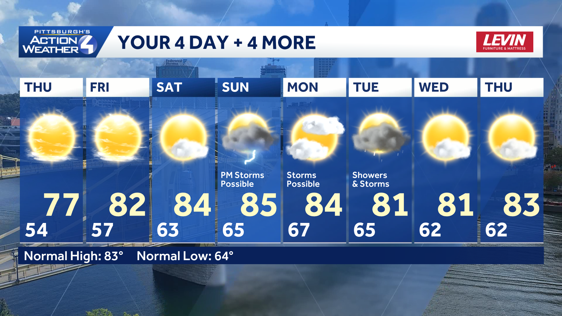
Storm chances will span Sunday to Tuesday. Monday looks to be the quietest day of the stretch.
TONIGHT: Cool with clearing skies and patchy valley fog. Low 54°.
THURSDAY: Refreshing start, pleasant finish with more sunshine. High: 77°, low: 57°.
FRIDAY: Mostly sunny to partly cloudy and warmer. High: 82°, low: 63°.
SATURDAY: Turning more humid with partly cloudy skies. High: 84°, low: 65°.