
ALTOONA, Pa. (WTAJ) — The Saturday slate is much calmer compared to how things played out last week. A few showers and heavier pockets of precip were able to develop mainly along I-80.
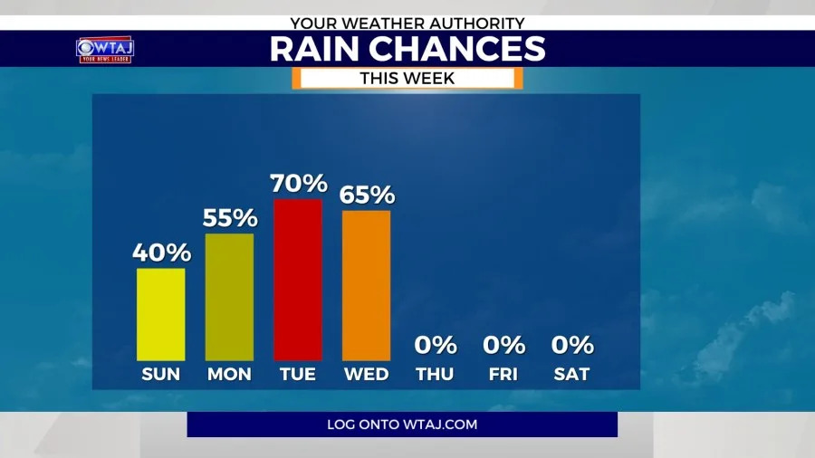
The conditions are expected to turn unsettled as we head into the end of the weekend and furthermore into next week.

Any of the areas that experienced precip on Saturday will likely be dealing with fog. Factor that into your Sunday morning commute.
Sunshine will be around for the first half of our Sunday.
Scattered showers will be present during the second half of the day. Some storms are possible, but coverage will remain widely scattered for Sunday.

Temperatures over the next few days will return back into upper 70s and mid to low 80s.
It is hard to pinpoint a sky coverage icon for the next few days, solely because of the storm setup.

Scattered showers and storms will be present over the next few days. Tuesday will be something to watch for our next widespread swath of severe weather.
7-Day Forecast
Meteorologist Zach Petey
Copyright 2026 Nexstar Media, Inc. All rights reserved. This material may not be published, broadcast, rewritten, or redistributed.
For the latest news, weather, sports, and streaming video, head to WTAJ | Your News Leader.