
Opinion
Impact Day Sunday with off and on downpours for western PA
Rainfall totals could exceed an inch in spots by Monday.
 PITTSBURGH —
This weekend won’t be a washout but we are tracking periods of rain that will start tonight and continue Sunday. Tomorrow is an Impact Day for heavy rain that could lead to localized flooding issues.
Impact Day: Heavy rain timeline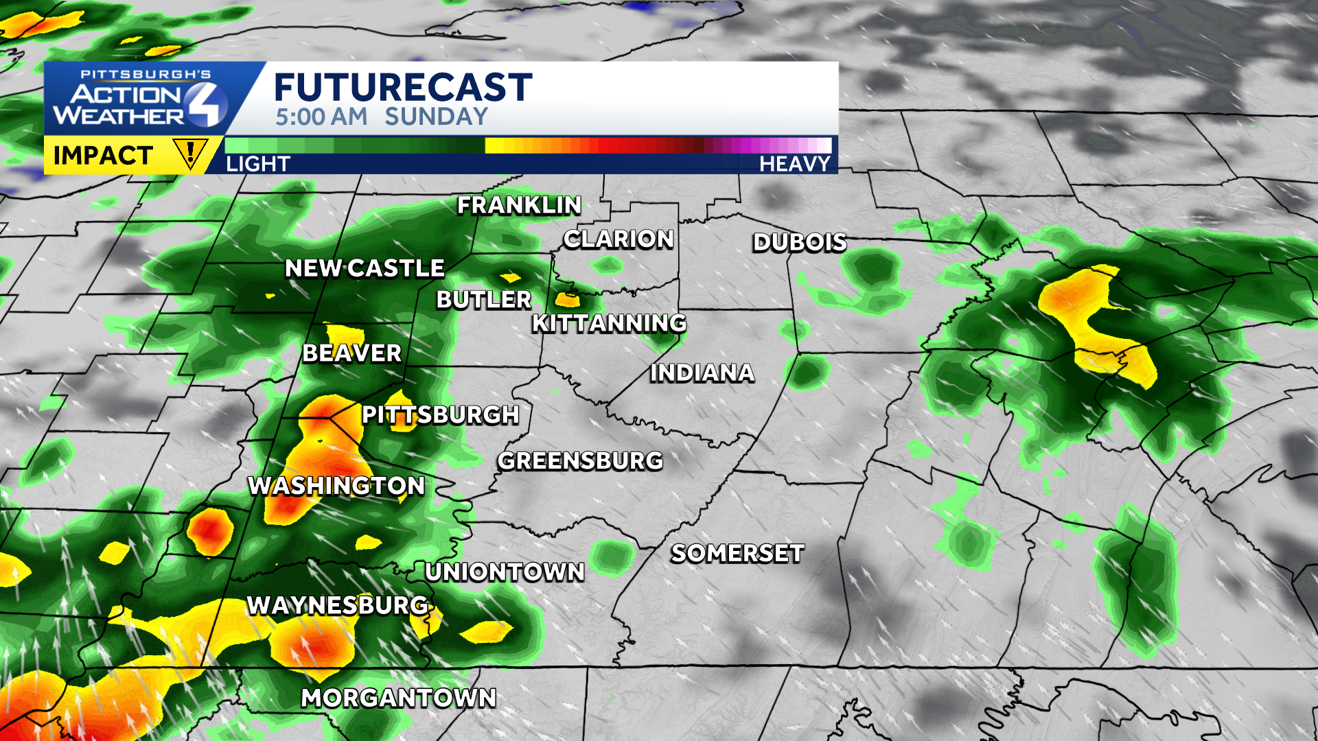
Pockets of heavy rain moves into western Pennsylvania early Sunday morning.
Most of the Pittsburgh area will wake up to some rain Sunday morning. (It may be a little earlier than you’d like.) The main concern for our Impact Day is the heavy rain potential. Repeated downpours through the morning hours could lead to localized flooding concerns.
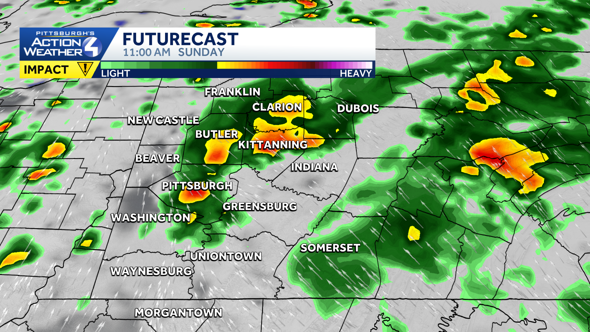
The heavy rain could briefly ease around mid-day Sunday.
We won’t have a lot of fuel for storms to form, but a few embedded thunderstorms are possible Sunday afternoon. If we see a break in the rain for the middle of the day and sunshine, that could set the stage for a few stronger storms in the late afternoon and evening.
Rain and storm impacts
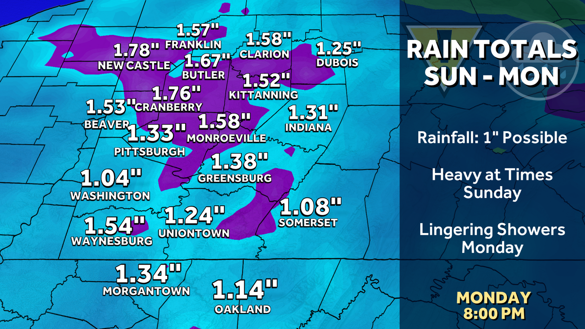
Rainfall totals currently look to be about an inch, but locations that see multiple rounds of heavy rain will have the potential to see over an inch of rain.
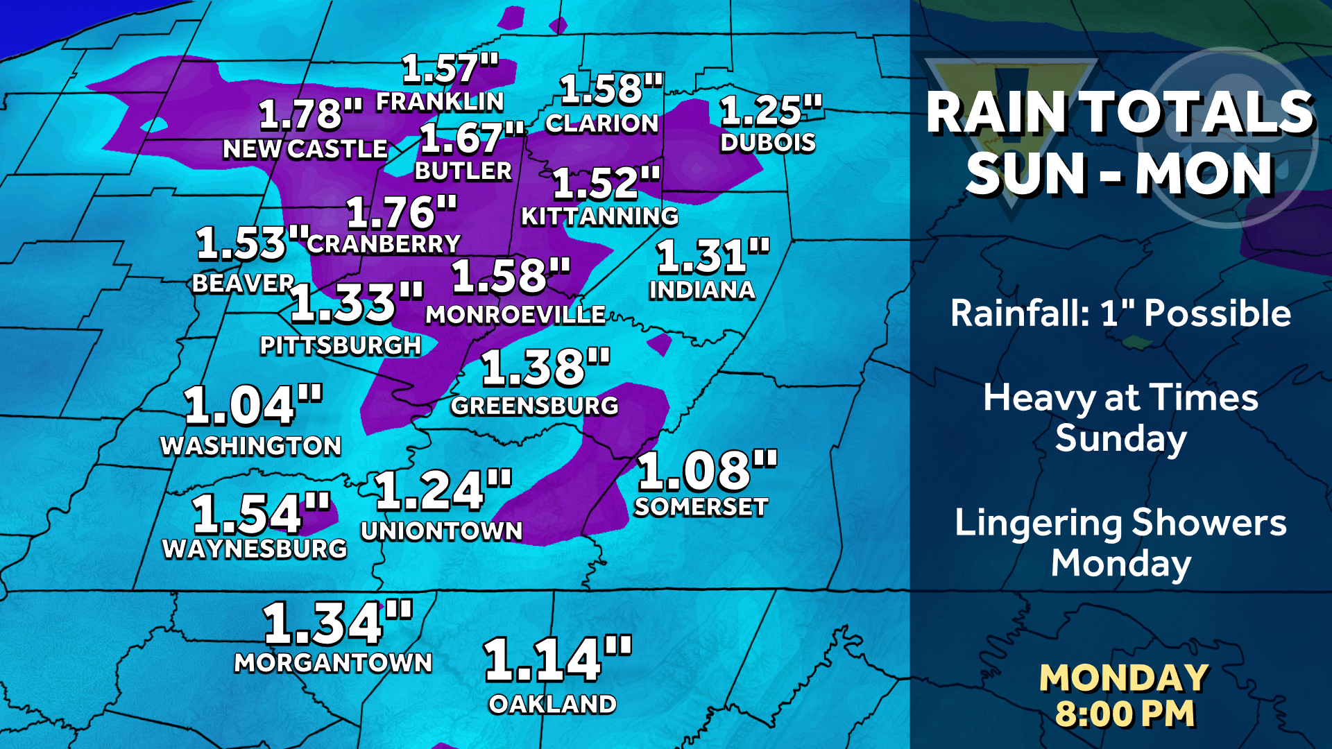
Rain totals could exceed an inch after rounds of heavy rain.
If strong thunderstorms develop, damaging winds could go along with the heavy rain Sunday afternoon.
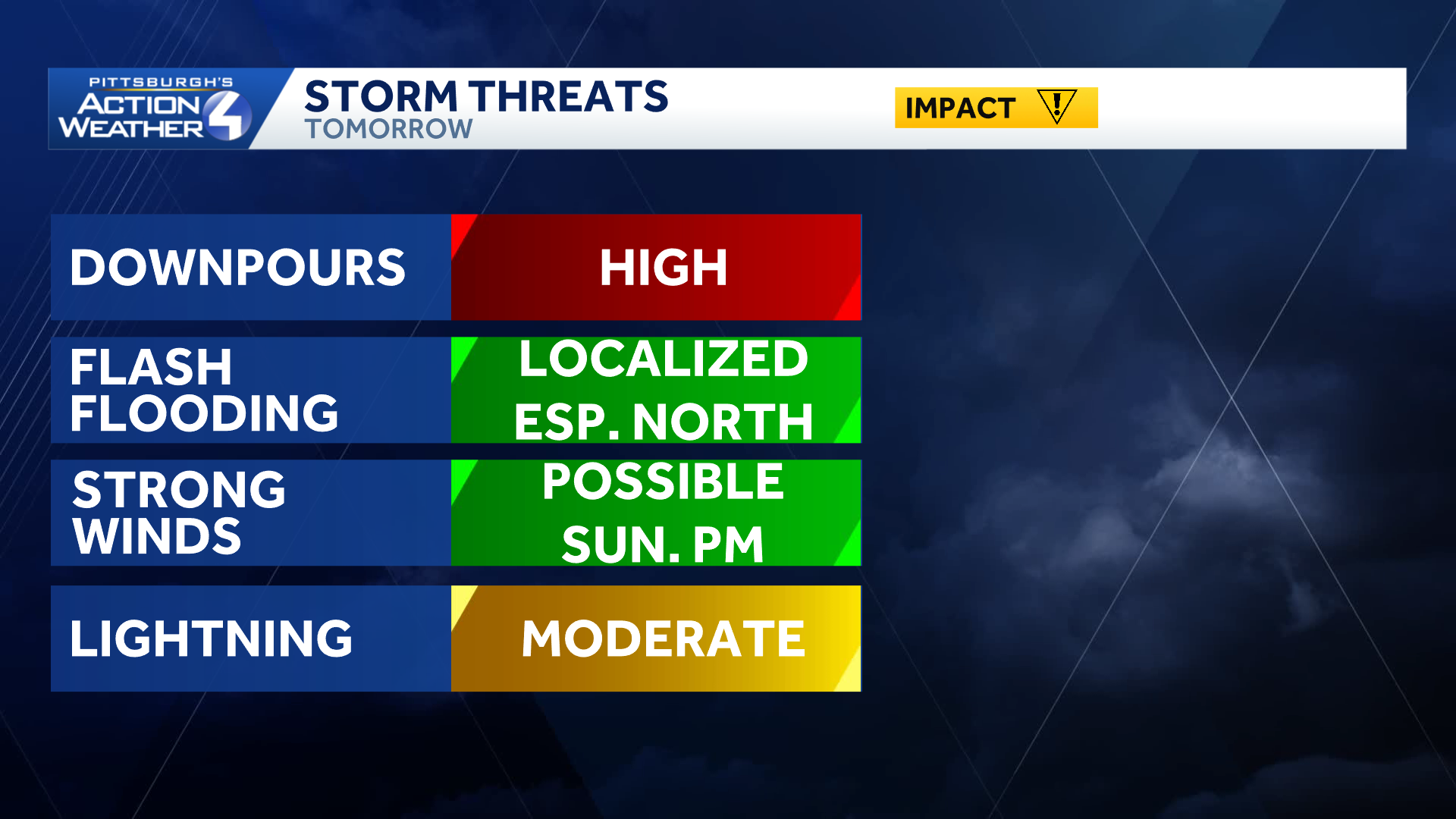
Heavy rain and potential flooding issues lead Sunday’s storm impacts.
TODAY: Mostly cloudy with rain showers late. High: 84°.
TONIGHT: Rain at times, which could be heavy. Low: 69°.
SUNDAY – Impact Day: Cloudy with periods of rain and embedded thunderstorms. High: 78°, low: 66°.
MONDAY: Clouds and scattered showers. High: 82°, low: 66°.
TUESDAY: Mostly cloudy with afternoon shower or storm. High: 84°, low: 67°.