
The Pittsburgh area saw multiple tornado and severe thunderstorm warnings issued on Sunday afternoon as severe weather slammed the region.
At least three tornado warnings were issued, but the National Weather Service has not confirmed any tornado touchdowns as of 6 p.m. Sunday. A flash flood warning remains in effect until 7:15 p.m. for northern Washington County.
As the storms rolled eastward, power outages also increased throughout the area.
West Penn Power’s outage map showed several thousand customers without power as of 6 p.m.
Westmoreland County: 14,657Fayette County: 4,300Washington County: 1,918Allegheny County: 1,650Greene County: 991Beaver County: 345Butler County: 230
Duquesne Light’s outage map showed at leasr 5,600 customers without power as of 6 p.m.
Sunday’s original forecast is below.
Sunday is a KDKA First Alert Weather Day with several rounds of heavy rain throughout the day.
Daily average High: 82° | Low: 62°
Sunrise: 6:32 a.m.; Sunset: 8:17 p.m.
FIRST ALERT: Today, Sunday, Aug. 16.
AWARE: Cooler weather ahead.
A flood watch goes through 8 a.m. Monday. Areas north of Pittsburgh, besides Beaver County, are not included in that.

KDKA-TV Weather Center
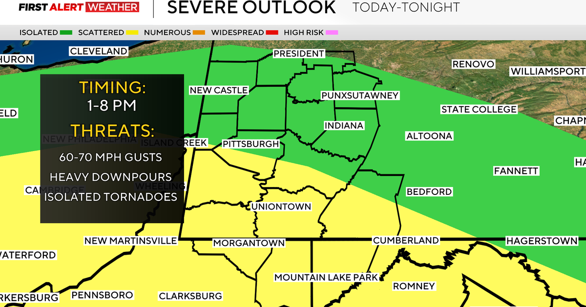
Areas south of Pittsburgh are under a slight risk for severe weather (2 out of 5), meaning a higher confidence for some storms to become severe with damaging winds and an isolated tornado after 1 p.m.
KDKA-TV Weather Center
We catch a little break in the late morning before our next round moves in, and it lasts until about 8 p.m.
On Monday, we will have a few stray showers, but then we dry out and cool down on Tuesday, with temperatures in the upper 70s and low 80s for much of the week. Humidity will also be low.
Wednesday evening, we have a chance of showers and thunderstorms.

KDKA-TV Weather Center
More from CBS News