
(WBRE/WYOU) — It was a beautiful start to the weekend, but unsettled weather will return by the end of the weekend.
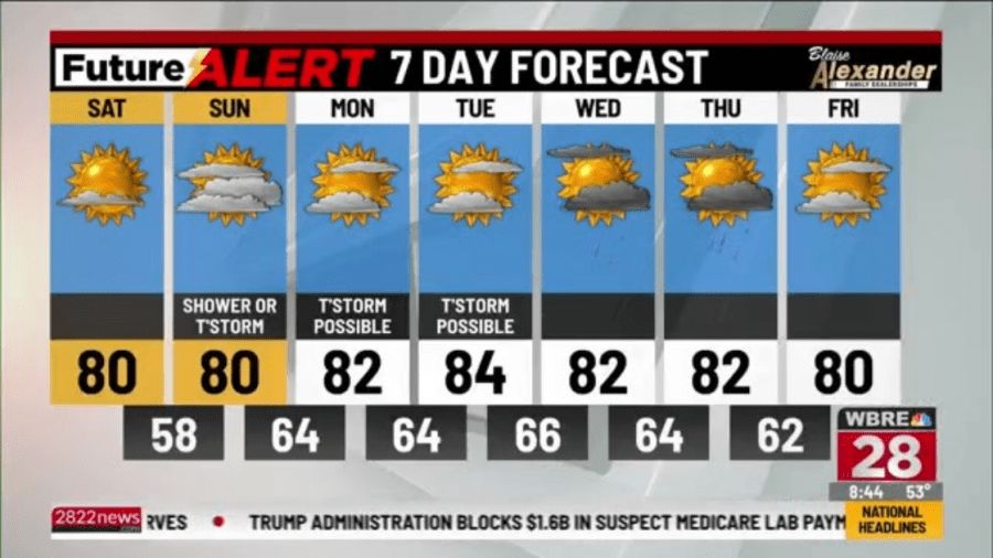
Saturday night, we’ll see increasing clouds, but it remains comfortable. Lows drop into the upper 50s.
Things will change on Sunday. In addition to more humidity, clouds as well as the chance of a shower or thunderstorm will return.
It will not rain all day. Temperatures will top off a few degrees either side of 80°.
Check out the Regional Weather Forecasts
A frontal boundary will drop into Pennsylvania later Sunday and likely stick around through the middle of next week. As it stands now, we’ll be on the warmer and more humid side of it.
Temperatures will range from the low to mid 80s. Pieces of energy will move along this boundary each day.
If they track close enough to us, they will trigger a couple of showers and thunderstorms.
This boundary will try to push far enough south by next Friday, which could set the stage for a drier end to the week and start of the weekend.
You can stay current on all the latest weather alerts and track the storm using the Future Alert Interactive Radar.
Copyright 2026 Nexstar Media, Inc. All rights reserved. This material may not be published, broadcast, rewritten, or redistributed.For the latest news, weather, sports, and streaming video, head to 28/22 News.