
Western Pennsylvania heat and humidity set stage for severe storms with damaging winds and large hail
 PITTSBURGH —
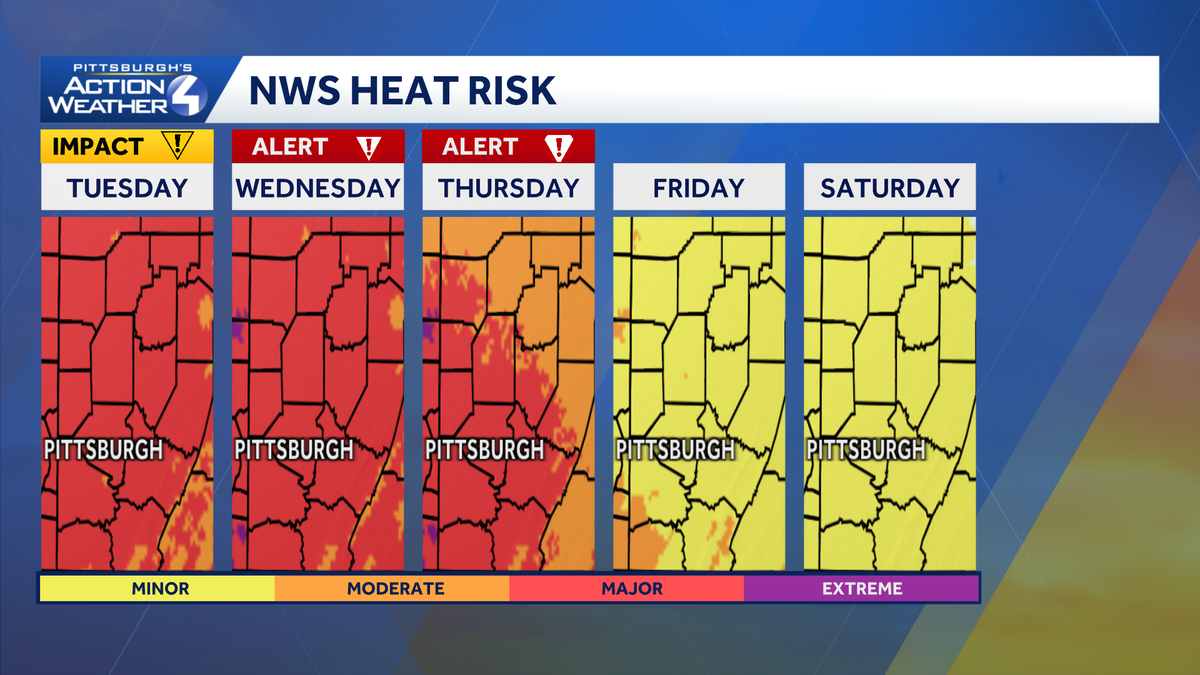
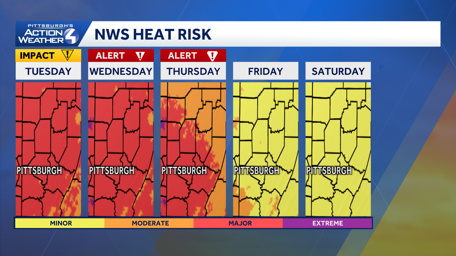
An active pattern is developing for the early days of September with rising heat and humidity, plus daily chances for showers or storms. Today is an Impact Day with the heat and humidity on the rise. Wednesday & Thursday are Severe Weather Alert Day for scattered storms.
Impact Day for heat & humidity – Tuesday
The air gets hotter and heavier through mid-week. The combination of highs near 90 degrees and very humid air will make it feel like the mid 90s, Tuesday. It is an Impact Day. It will feel very similar before thunderstorms fire Wednesday afternoon.
 Alert Days – Wednesday & Thursday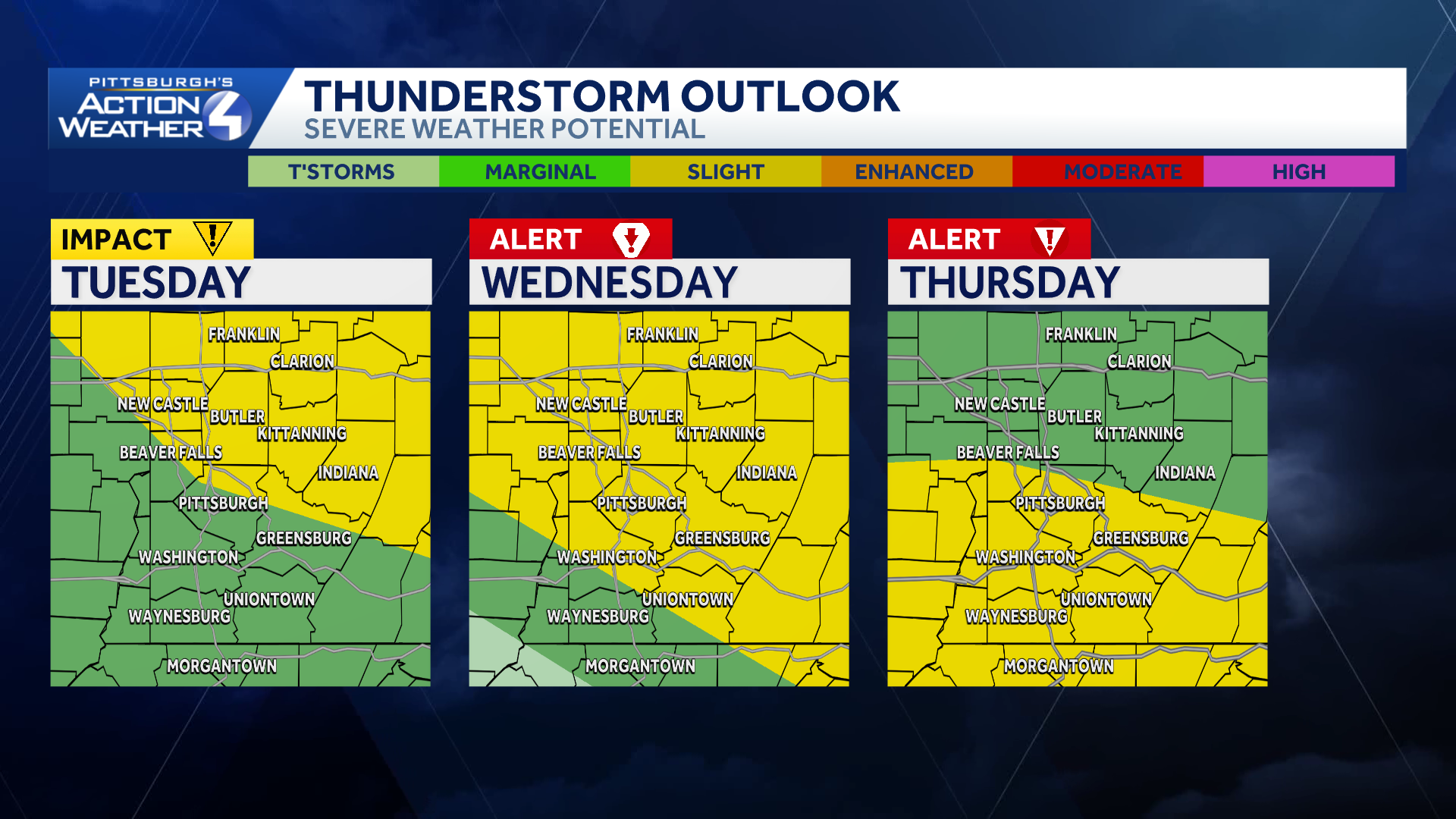
The coverage of showers and thunderstorms will expand by mid-week. The best chance will stretch between late Wednesday and Thursday. We can’t rule out some storms Wednesday morning but when we add in the daytime heating and humidity the afternoon will be prime for severe thunderstorms. Thursday will also have scattered strong to severe thunderstorms making it a Severe Weather Alert day. Severe weather is possible with damaging winds and large hail threats.
Dry, Comfortable Labor Day Weekend
Showers and storms will likely hang around Friday, especially south of Pittsburgh. Quieter weather arrives just in time for Labor Day weekend. Our area will enjoy dry and more comfortable conditions.
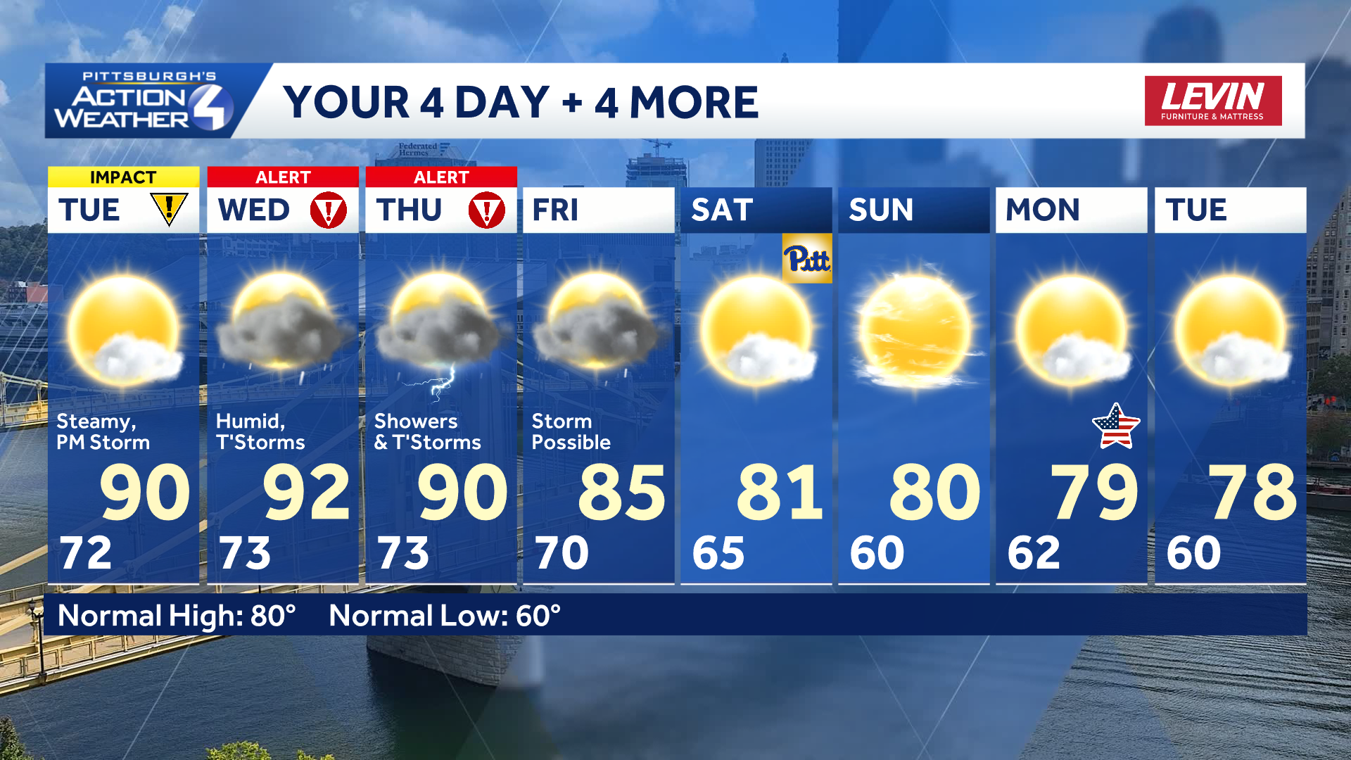
TODAY – Impact Day: Hot and very humid, feeling like the mid to upper 90s. Isolated PM storm. High: 90°
TONIGHT: Isolated storms early, warm, muggy. Low 73°
WEDNESDAY – Severe Weather Alert Day: Hotter and steamy, feels like temperatures in the mid/upper 90s. Partly cloudy with strong storms possible. High: 92°, low: 73°.
THURSDAY – Severe Weather Alert Day: Sct’d rain and storms. High: 90°, low: 68°.