
It’s looking like we are going to see a full week with the chance for snow on most days, starting on Sunday night and extending at least through next weekend. Let’s start with Sunday…
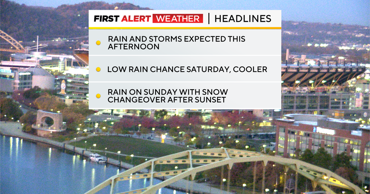
Most of Sunday will see a rain chance, with snow chances only arriving after sunsetSunday will see several hours of winter weather starting at sundown, including rain, sleet, graupel, and snow.There is a difference in what falls (maybe more than a half inch of snow) and what sticks (little to nothing). No one will need to shovel on Sunday into Monday morning.The biggest issue will be slick spots on roads starting on Monday
WEATHER LINKS:
Current Conditions | School Closings & Delays | Submit Your Weather Photos

Precipitation chances over the next six days
KDKA Weather Center
While we are still a couple of days from the potential snow showers, there are a couple of things that just aren’t going to change. Temperatures leading up to the late-day Sunday snow will be too warm for us to see any significant accumulation through Monday morning.
No one will be shoveling snow as snow rates won’t be higher than melt rates. I don’t think anything sticks for more than five minutes. Heading into Monday afternoon with windy conditions and temperatures remaining in the low 30s. We may see some minor accumulations in places north of Pittsburgh late Monday into Tuesday as snow and lake effect snow showers continue.
For the rest of the week, things are a little bit more murky when it comes to when and where snow showers will move through. Right now, model data really jumps on a mid-level low working its way through our area on Tuesday night into Wednesday morning.
Then another chance for snow may move through a week from Sunday. To me, the most important takeaway for next week is that temperatures will be cool enough for a couple of rounds of snow, and please be aware that slick spots will be possible.
Circling back to today, a cold front sliding in from the west will bring both rain and storm chances our way this afternoon. In Pittsburgh, the best chance for rain will occur from 2 p.m. to 7 p.m. Winds will be strong this afternoon, with gusts up to 30mph. I have high temperatures today, hitting the low 60s, and we bottomed out in the mid-30s.

Conditions in Pittsburgh on November 7, 2025
KDKA Weather Center
I can’t rule out a shower or two for high school football tonight. Temperatures for the playoff games will be in the mid-50s, and it’ll be breezy.

Chances for rain on Friday, November 7, 2025
KDKA Weather Center
Saturday’s high temperatures will be in the upper 50s with morning lows around 5 degrees warmer than this morning’s low. Sunday will also see highs in the 50s before temperatures plummet overnight.
Highs on Monday and Tuesday will only hit the mid to upper 30s for highs.

7-day forecast; November 7, 2025
KDKA Weather Center
Stay up to date with the KDKA Mobile App – which you can download here!