
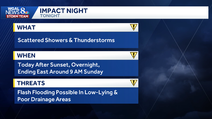
Impact night: Showers and storms expected overnight in South-Central Pennsylvania
 SUSQUEHANNA VALLEY, Pa. —
Rain chances rise this evening and especially overnight, with showers and thunderstorms likely across South-Central Pennsylvania.
Some rain may be moderate at times, and the Susquehanna Valley is under a slight risk for excessive rainfall, so localized flash flooding is possible in poor drainage and low-lying areas.
The WGAL News 8 Storm Team has designated Saturday night as an Impact Night, meaning the weather could disrupt your normal schedule and routines.
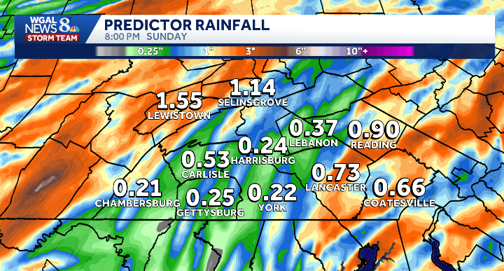
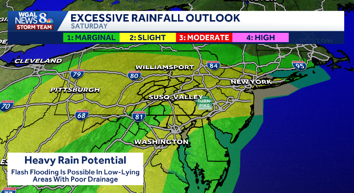 Timing of the rainEvening: Rain chances begin to increaseOvernight: Showers and thunderstorms become more likelyBy 9 a.m. Sunday: Showers taper off in the eastern countiesLater Sunday: Skies clearRainfall and impactsExpected rainfall: 0.25 to 0.75 inchesIsolated higher amounts are possibleWatch for flash flooding in vulnerable spots
 Sunday outlookMore humidWarmer temperaturesHighs in the low to mid 80s
SOUTH-CENTRAL PA WEATHER RESOURCES: INTERACTIVE RADAR | ACTIVE WEATHER ALERTS | CURRENT CONDITIONS | HOURLY FORECAST | 10-DAY FORECAST | WEEKEND FORECAST | MAP ROOM | DOWNLOAD THE APP | WEATHER EMAILS
Check live conditions on our Sky Cams
This content is imported from infogram. You may be able to find the same content in another format, or you may be able to find more information, at their web site.
This content is imported from infogram. You may be able to find the same content in another format, or you may be able to find more information, at their web site.
This content is imported from infogram. You may be able to find the same content in another format, or you may be able to find more information, at their web site.
This content is imported from infogram. You may be able to find the same content in another format, or you may be able to find more information, at their web site.