
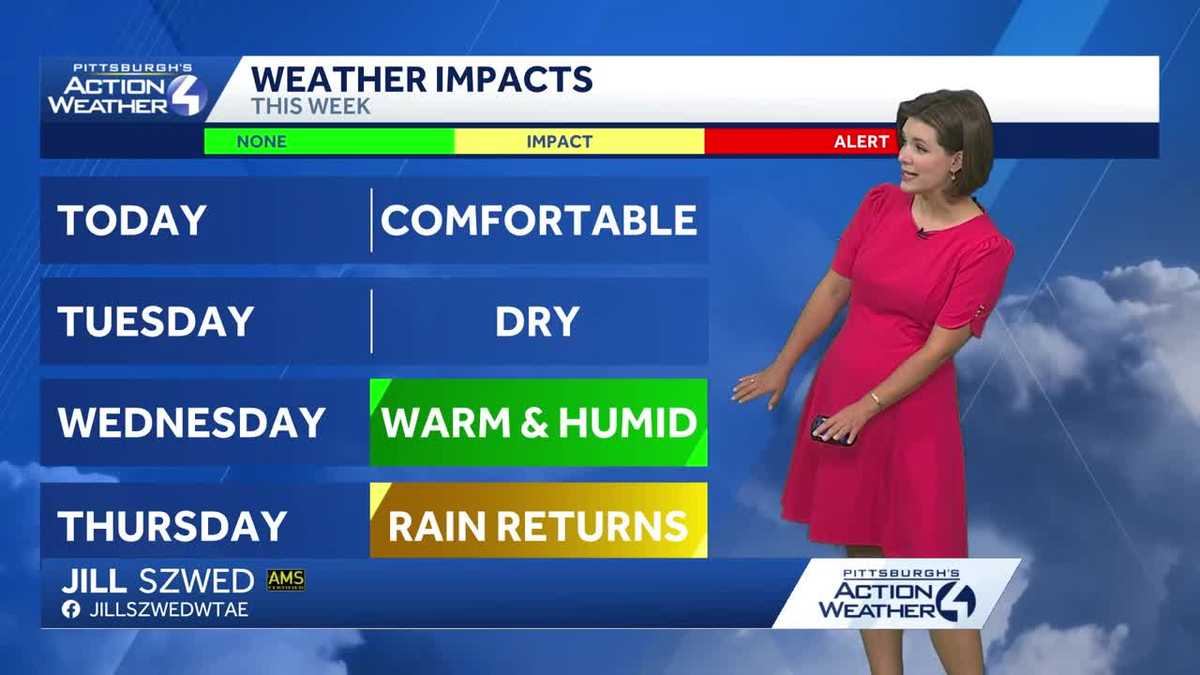
Western PA: Comfortable and bright to kick off the week
More warmth and humidity arrive by mid-week.
 PITTSBURGH —
Soak up the sunshine and comfortable air today. Temperatures and humidity levels tick higher through mid-week. Thursday is now an Impact Day with more rain and storms on tap.
Comfortable with sunshine today
Western Pennsylvania will enjoy a glimpse of fall over the next 24 hours. You may want reach for a light layer heading out this morning. Temperatures will be in the 60s for most of the day under a lot of sunshine.

Hearst OwnedHearst
Fall is in the air for the next 24 hours.
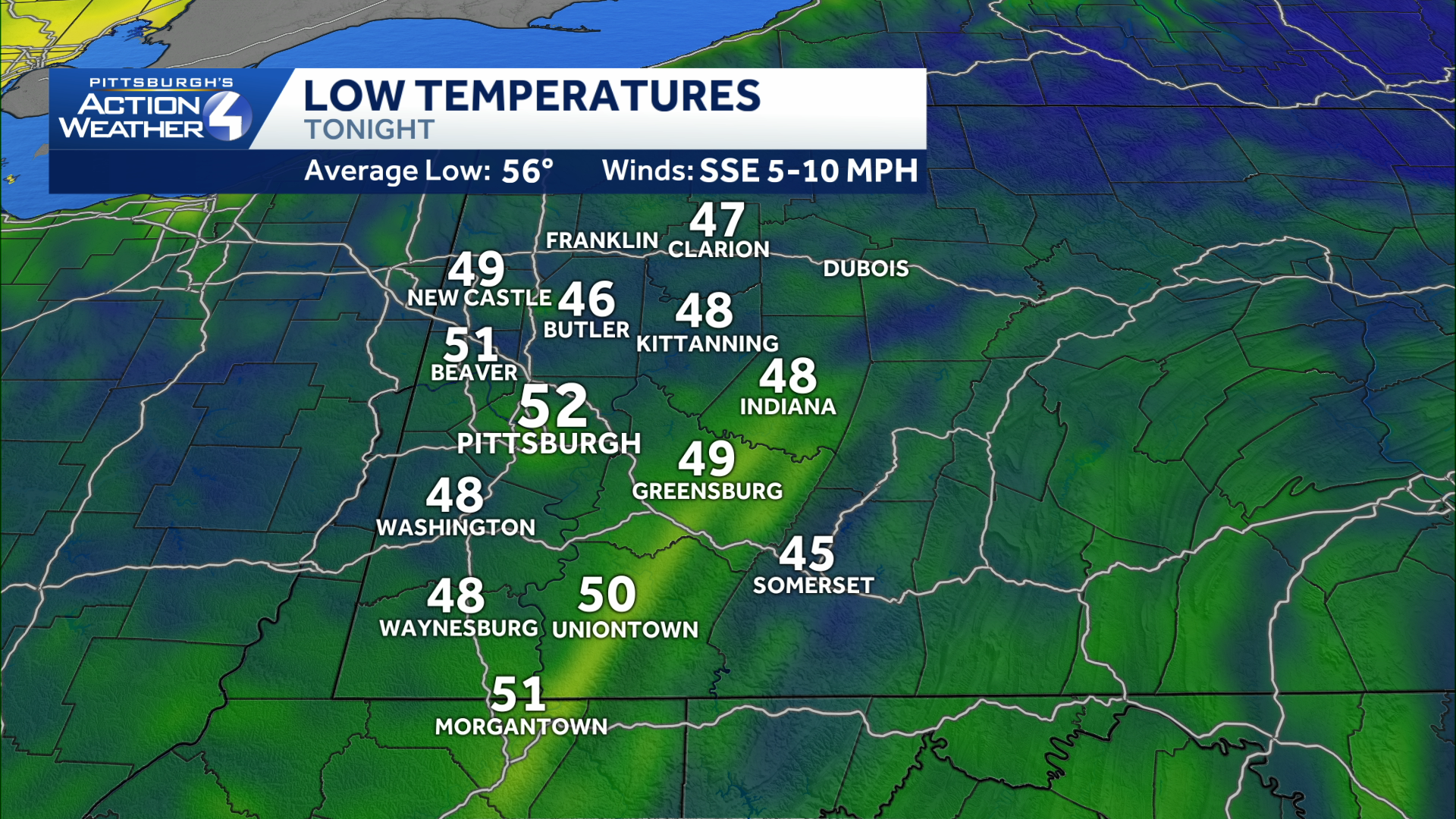
There will be a crisp feel to the air tomorrow morning with the lower 50s for Pittsburgh, the 40s for outlying spots. The break from the rain will extend through Wednesday. At the same time, temperatures and humidity levels will rise.
Hearst OwnedHearst
You’ll want to grab a hoodie before heading out tomorrow morning.
Impact Day Thursday: Rain and storms possible
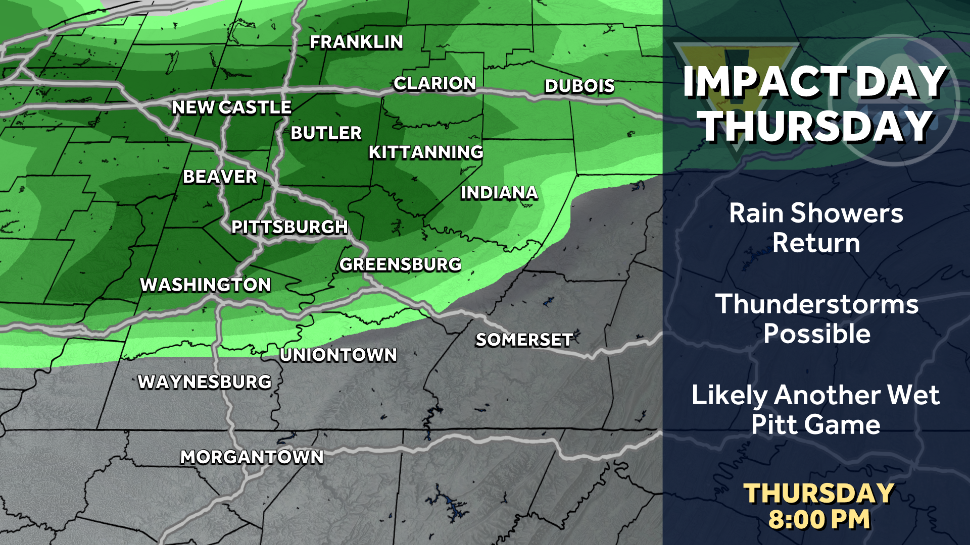
All of the late season heat and humidity will catch up with us by Thursday. Rain and storm chances return making it an Impact Day. The unsettled weather is set to arrive during the afternoon and will likely lead to another wet Pitt game.
Hearst OwnedHearst
Thursday is now an Impact Day for more rain and storms.
The final days of summer
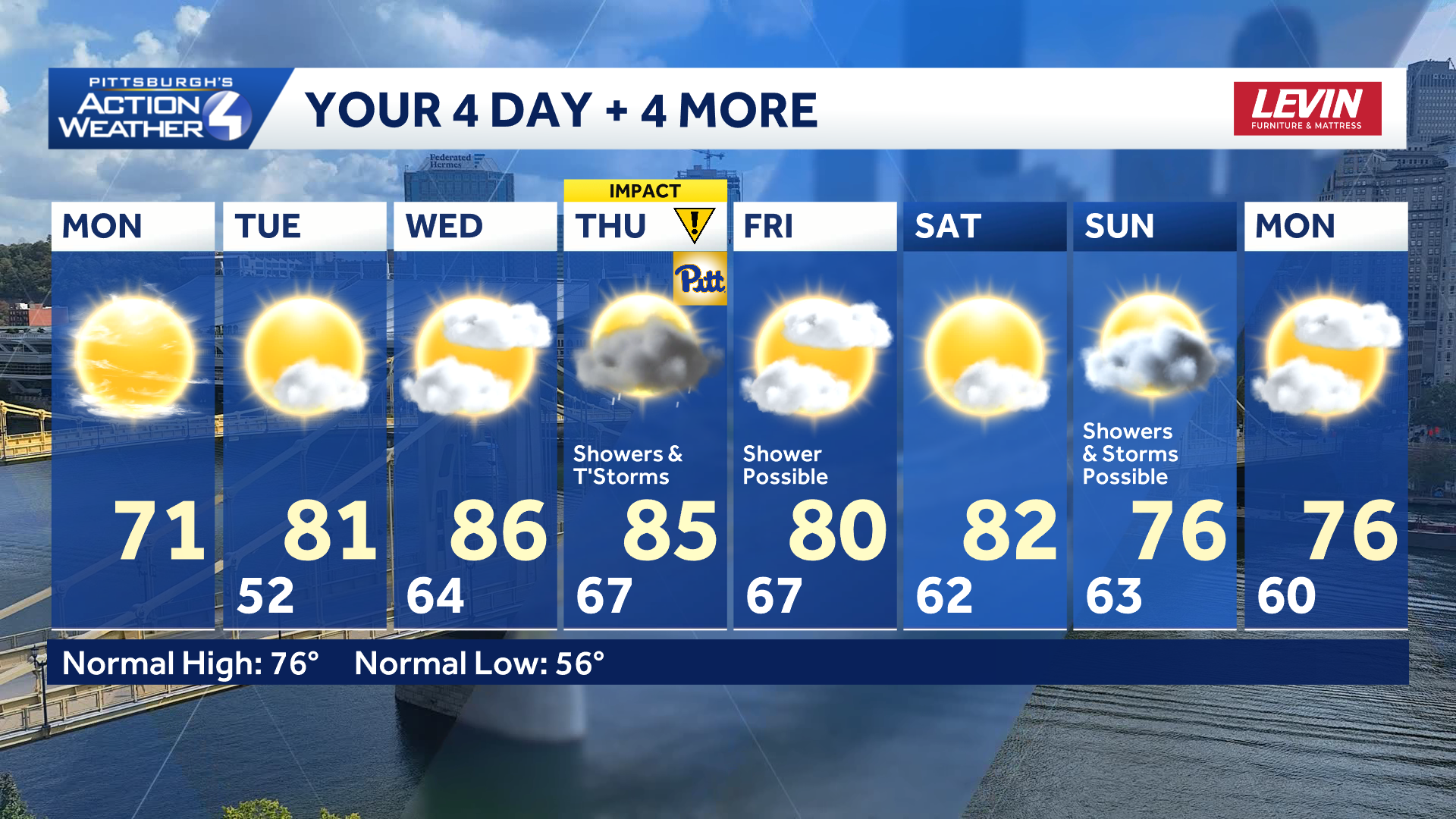
The Autumnal Equinox is next Tuesday, September 22nd. The forecast is still deciding if it wants to be summer or fall. Seasonal to slightly above-average temperatures will linger through the upcoming weekend.
Hearst OwnedHearst
Toning down the heat by the weekend.
TODAY: Comfortable with mostly sunny skies. High: 71°.
TONIGHT: Crisp night with skies becoming partly cloudy. Low: 52°.
TUESDAY: Warmer with sun and clouds. High: 80°, low: 64°.
WEDNESDAY: Warm and humid with increasing clouds. High: 86°, low: 67°.
THURSDAY – Impact Day: PM rain and thunderstorms. High: 85°, low: 67°.