
IMPACT: Scattered thunderstorms could bring heavy rain to south-central Pennsylvania

 SUSQUEHANNA VALLEY, Pa. —
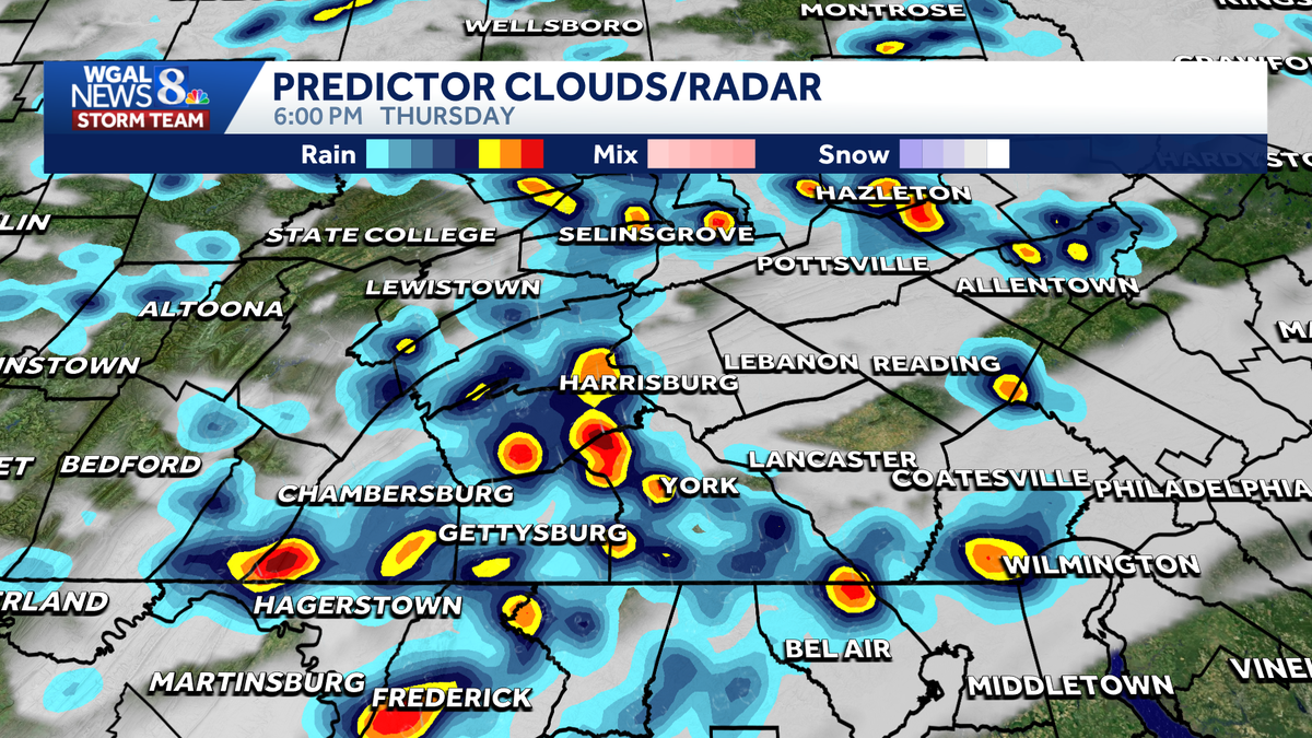
Scattered showers and thunderstorms are possible on Thursday, potentially bringing heavy downpours to south-central Pennsylvania.
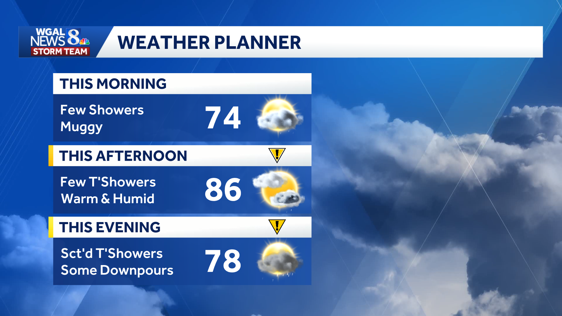
The WGAL News 8 Storm Team has declared Thursday as a low-level Impact Day, meaning the weather may disrupt your normal daily schedule or routine.
 Timing
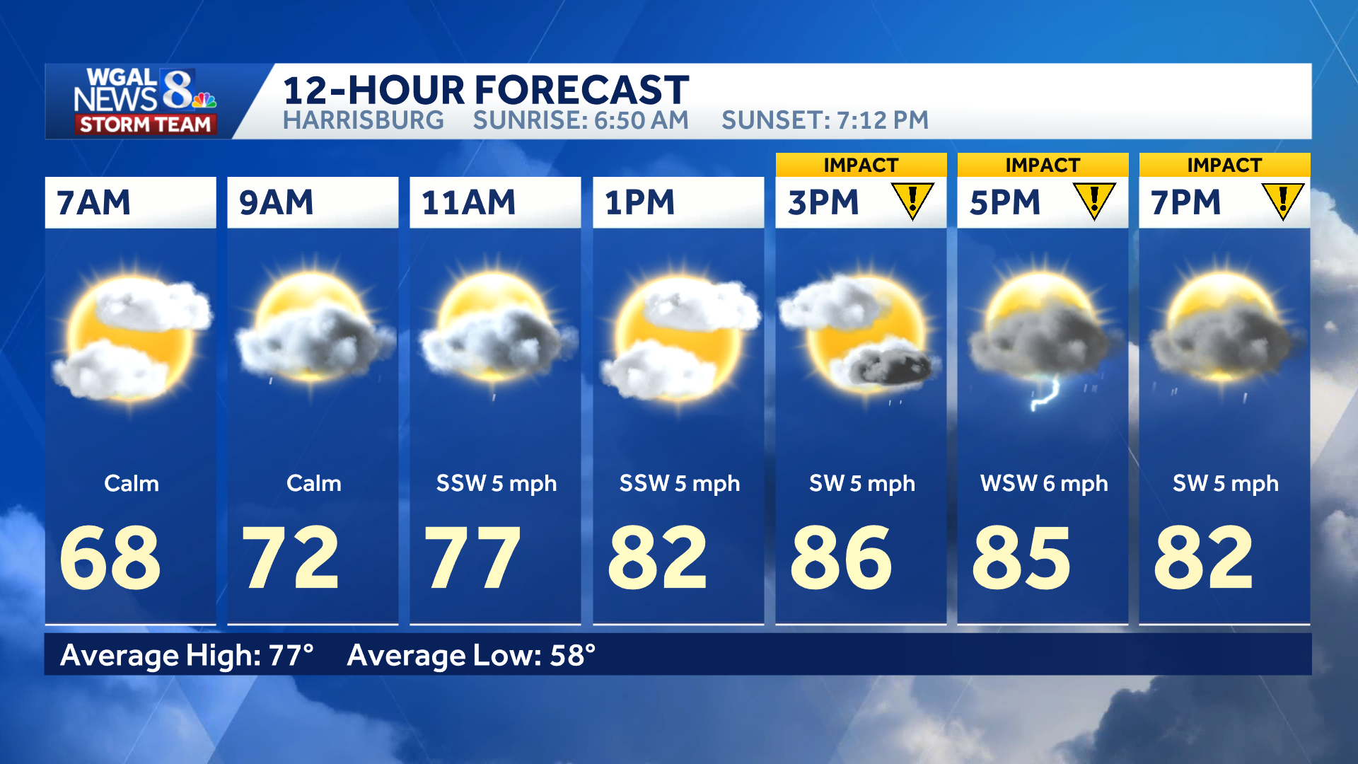
Thursday will begin partly cloudy and muggy, with temperatures in the mid- to upper 60s. Scattered morning showers and downpours are possible, especially north of the PA Turnpike.
The main window for potential storms is between 3 p.m. and 9 p.m.
Below: Swipe through the predicted radar.
This content is imported from infogram. You may be able to find the same content in another format, or you may be able to find more information, at their web site.
Excessive rainfall risk
The Susquehanna Valley is not currently outlooked for severe weather, but most of the region is under a marginal risk (level 1/4) for excessive rainfall.
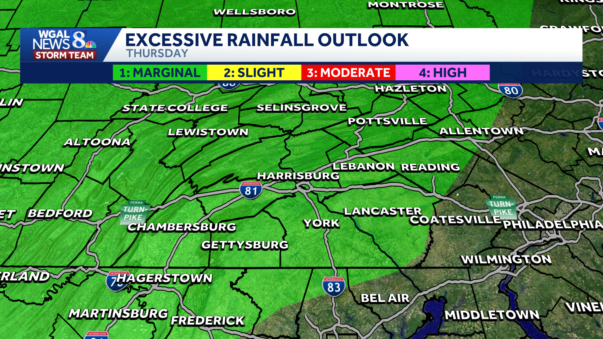
High humidity could help storms produce brief downpours, potentially causing ponding on the roads and isolated flooding in low-lying areas and spots with poor drainage.
 Weekend forecast
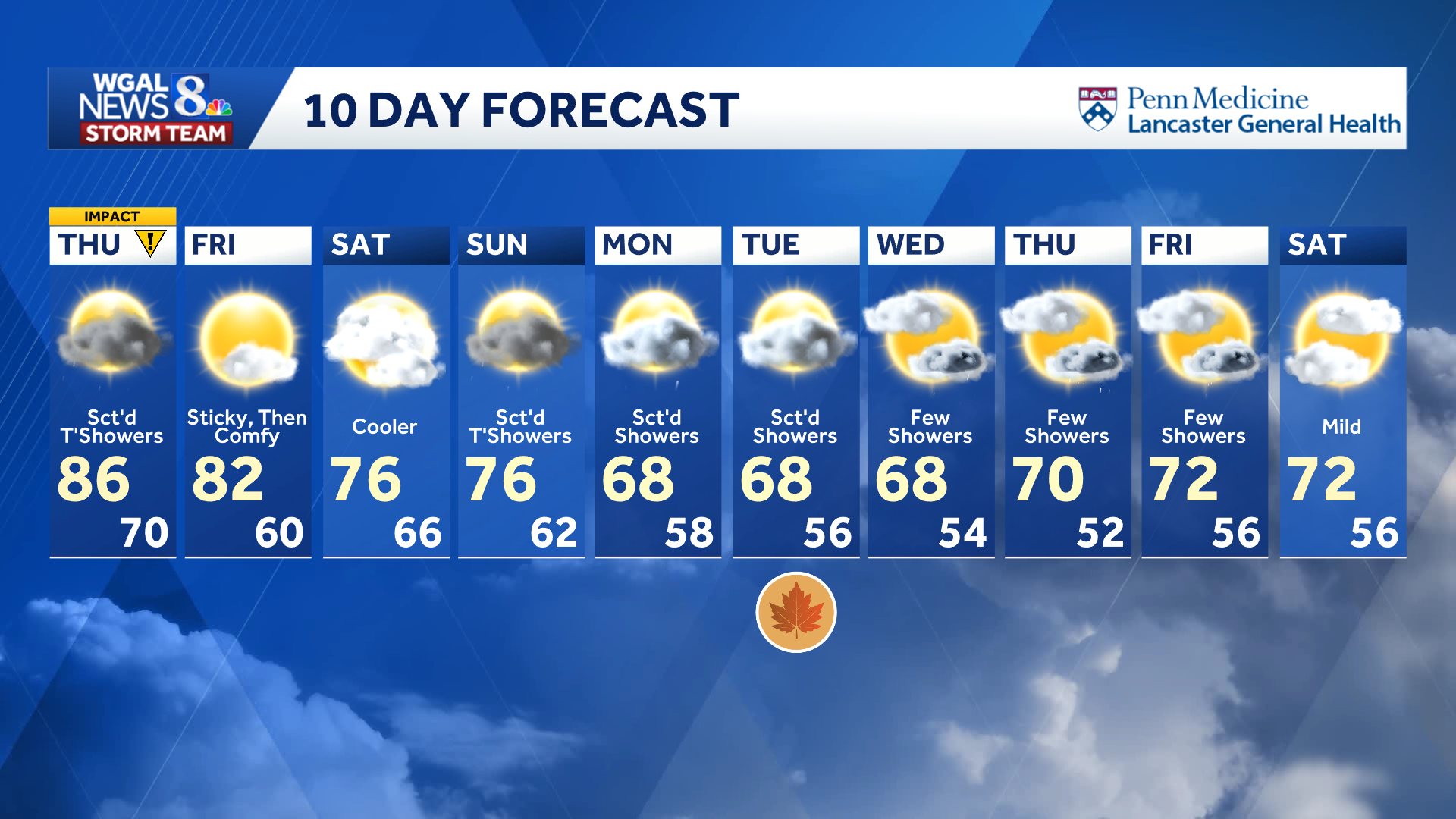
Friday will start sticky before turning more comfortable, with mostly sunny skies, highs in the low 80s and pleasant conditions for evening football.
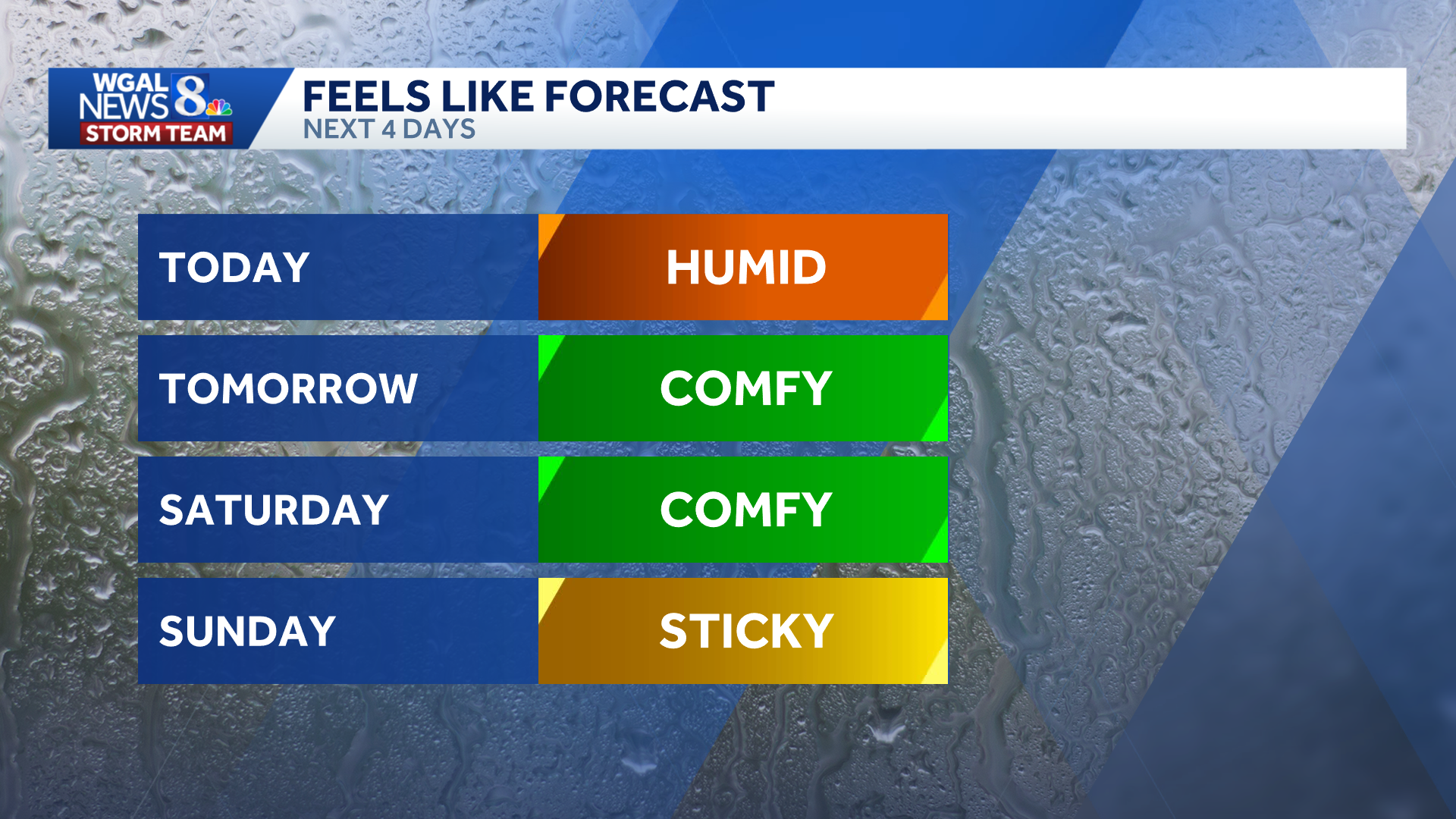
Saturday will be dry and cooler with mostly cloudy skies, comfortable humidity and highs in the mid-70s.
Scattered showers and thunderstorms return Sunday as humidity rises and temperatures reach the mid- to upper 70s.
Do you have photos or videos of the weather and would like to share them with News 8? Send them to https://www.wgal.com/upload.