
IMPACT DAY: Steady, widespread rain could cause ponding on roads in south-central Pennsylvania

 SUSQUEHANNA VALLEY, Pa. —
Widespread rain will continue across south-central Pennsylvania on Tuesday, bringing a soggy start to fall and potential for ponding on the roads.
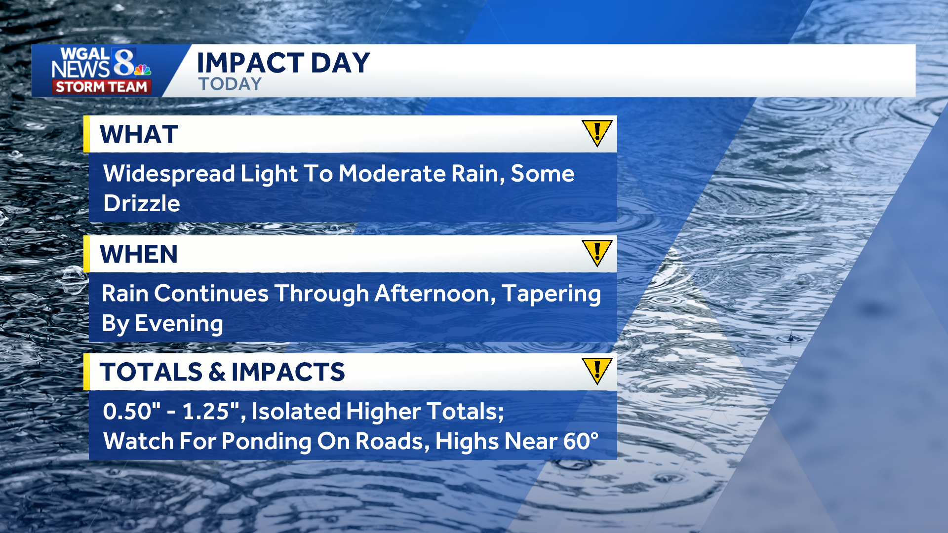
The heaviest and steadiest rain is currently falling. The WGAL News 8 Storm Team has declared Tuesday an Impact Day, meaning the weather will likely disrupt your normal daily schedule or routine.
 Timing
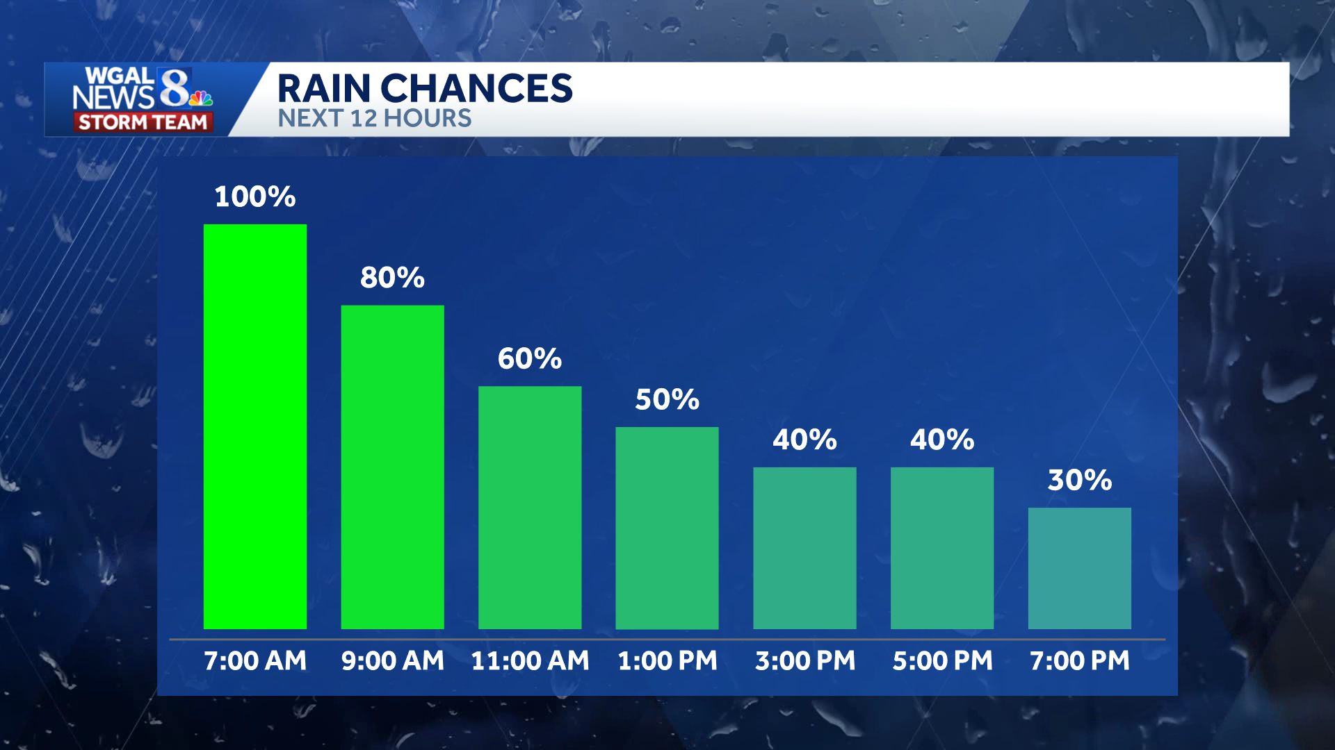
Rain will be most widespread during the morning before gradually becoming more scattered from north to south.
Morning: Light to moderate rain expected during the commute. Afternoon: Rain tapers to showers north of the Pennsylvania Turnpike. Showers remain more persistent along and south of the turnpike. Evening: Scattered showers and drizzle continue in southern areas before drier air moves in. Night: Showers end, though patchy fog may develop under mostly cloudy skies.
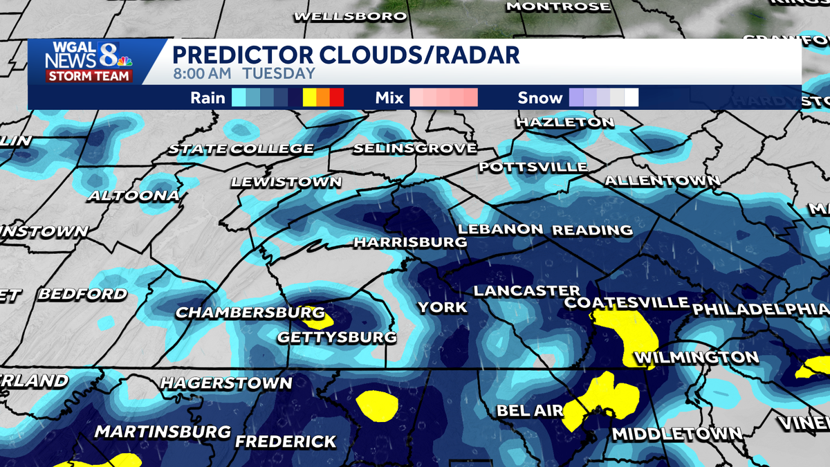
Below: Swipe through the predicted radar for Tuesday.
This content is imported from infogram. You may be able to find the same content in another format, or you may be able to find more information, at their web site.
Impacts
Although severe weather is not expected, persistent rain could affect travel throughout Tuesday.
Showers may cause ponding on the roads. Drivers are advised to use caution on wet roadways, especially during the morning commute.
 Totals
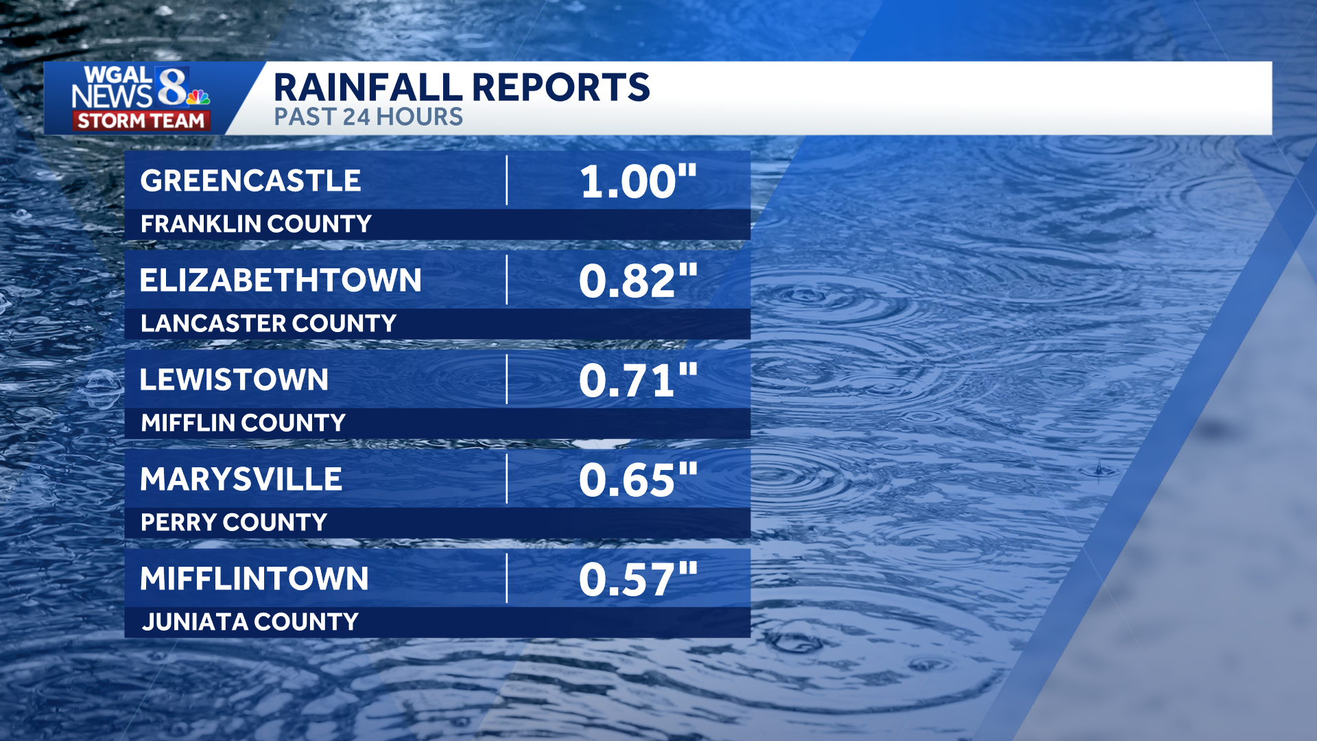
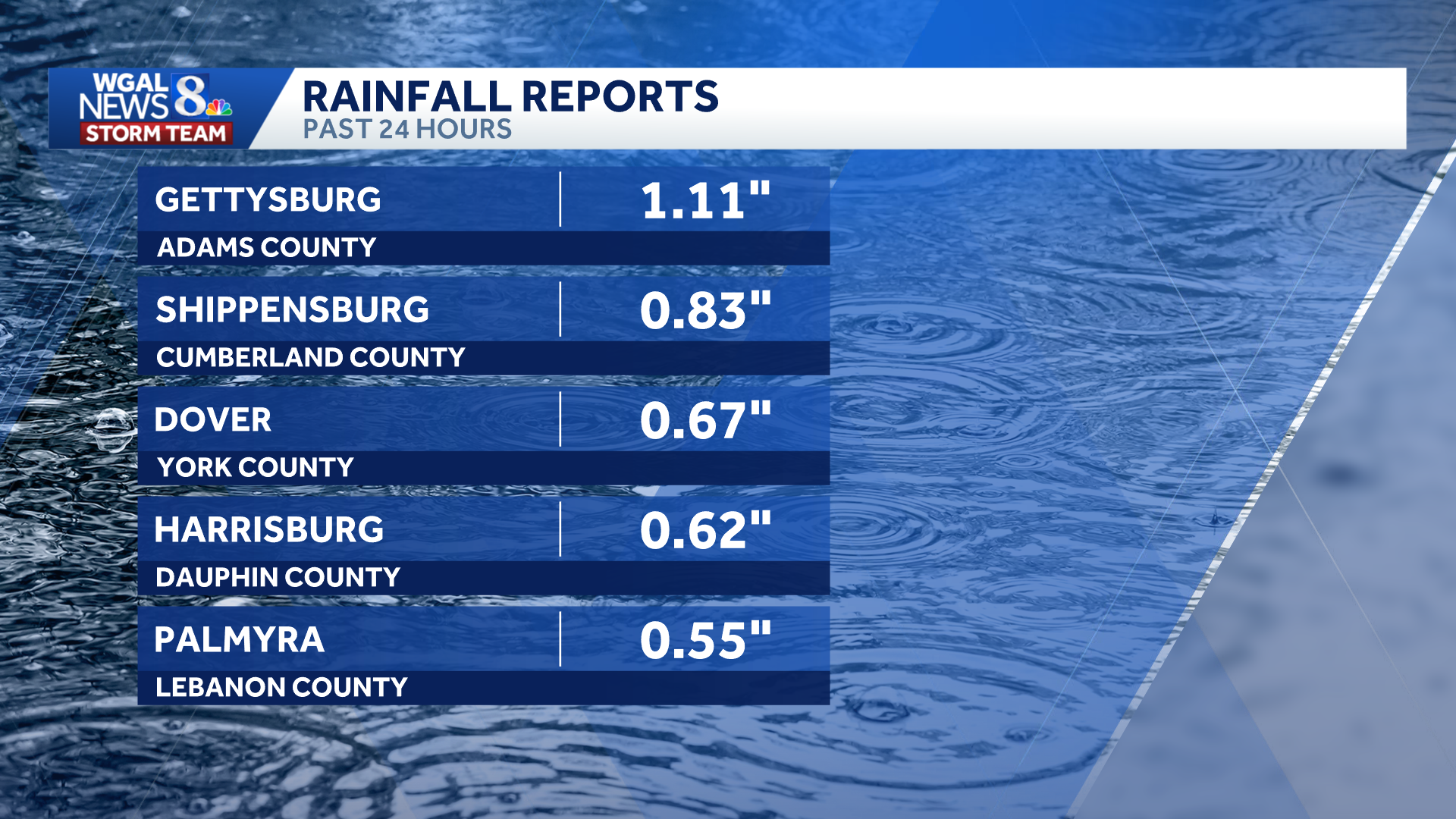
Most of the Susquehanna Valley will get between 0.50 and 1 inch of rain from this system.
Isolated higher totals are possible south of the Pennsylvania Turnpike, where steadier bands of rain persist.
Below: Rain totals as of 6 a.m. Tuesday.
 Below-average temperatures
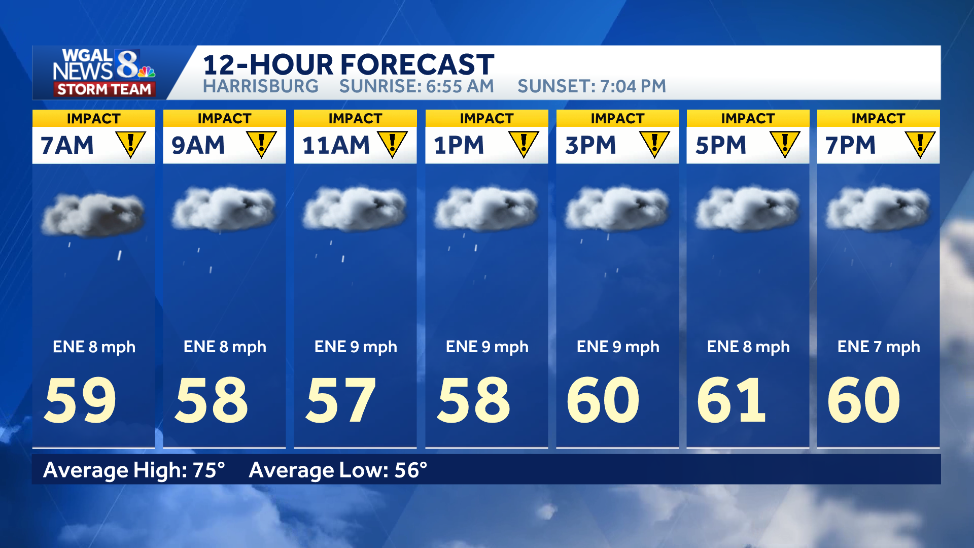
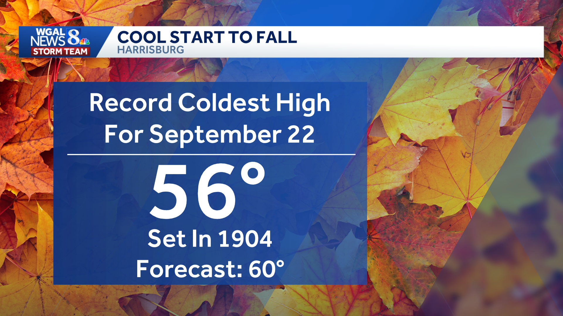
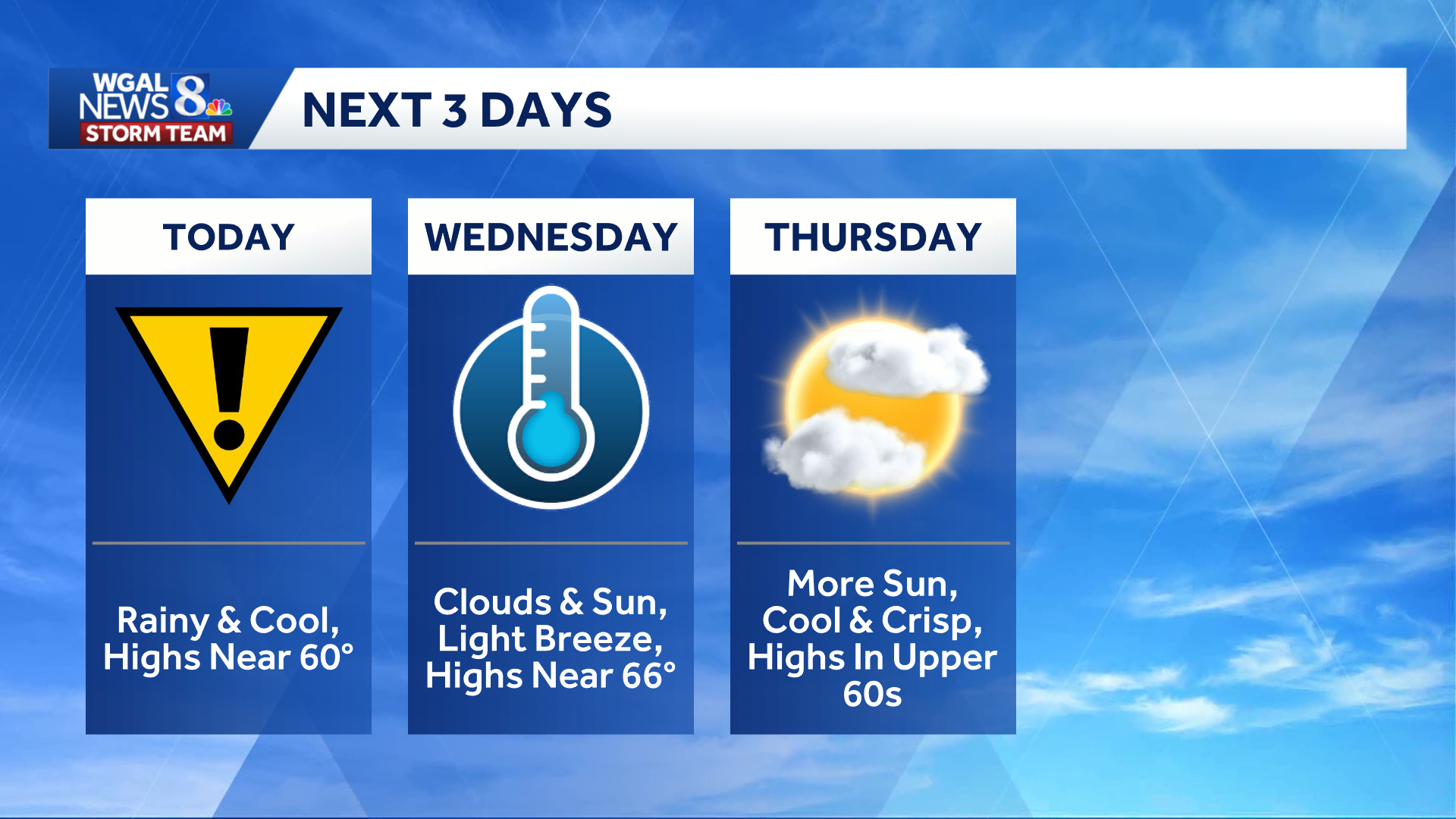
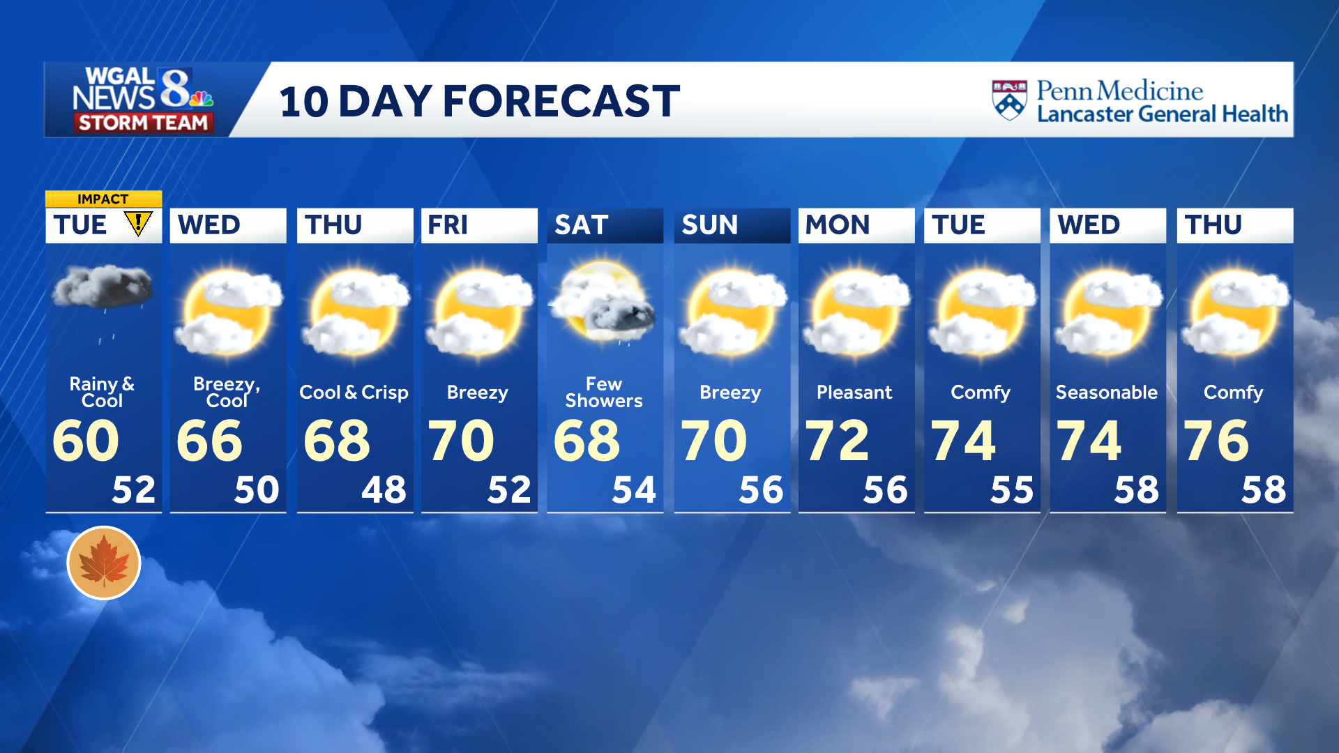
Tuesday’s high is forecast to reach only 60 degrees in Harrisburg, about 15 degrees below the average high of 75.
Despite the chill, the forecast remains above the record for the lowest high temperature on Sept. 22. That record of 56 degrees was set in 1904.
 Drier weather ahead
Drier air will move into the region Tuesday night as high pressure builds across the Northeast. Lows will fall into the lower 50s as showers end.
Wednesday will bring a mixture of clouds and sunshine, a light breeze and a high near 66 degrees. Thursday is expected to be partly sunny, cool and crisp, with highs in the upper 60s.
Temperatures should reach about 70 degrees Friday. The Storm Team is also monitoring a nor’easter, or coastal storm, that is expected to remain offshore but could bring a few showers and breezy conditions Saturday.
See news happening? Send us your photos or videos if it’s safe to do so at https://www.wgal.com/upload.