
IMPACT SUNDAY: Nor’easter to bring rain, strong winds to south-central Pennsylvania

 SUSQUEHANNA VALLEY, Pa. —
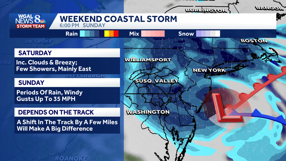
A nor’easter along the East Coast is expected to bring rounds of rain and strong winds to south-central Pennsylvania on Sunday.
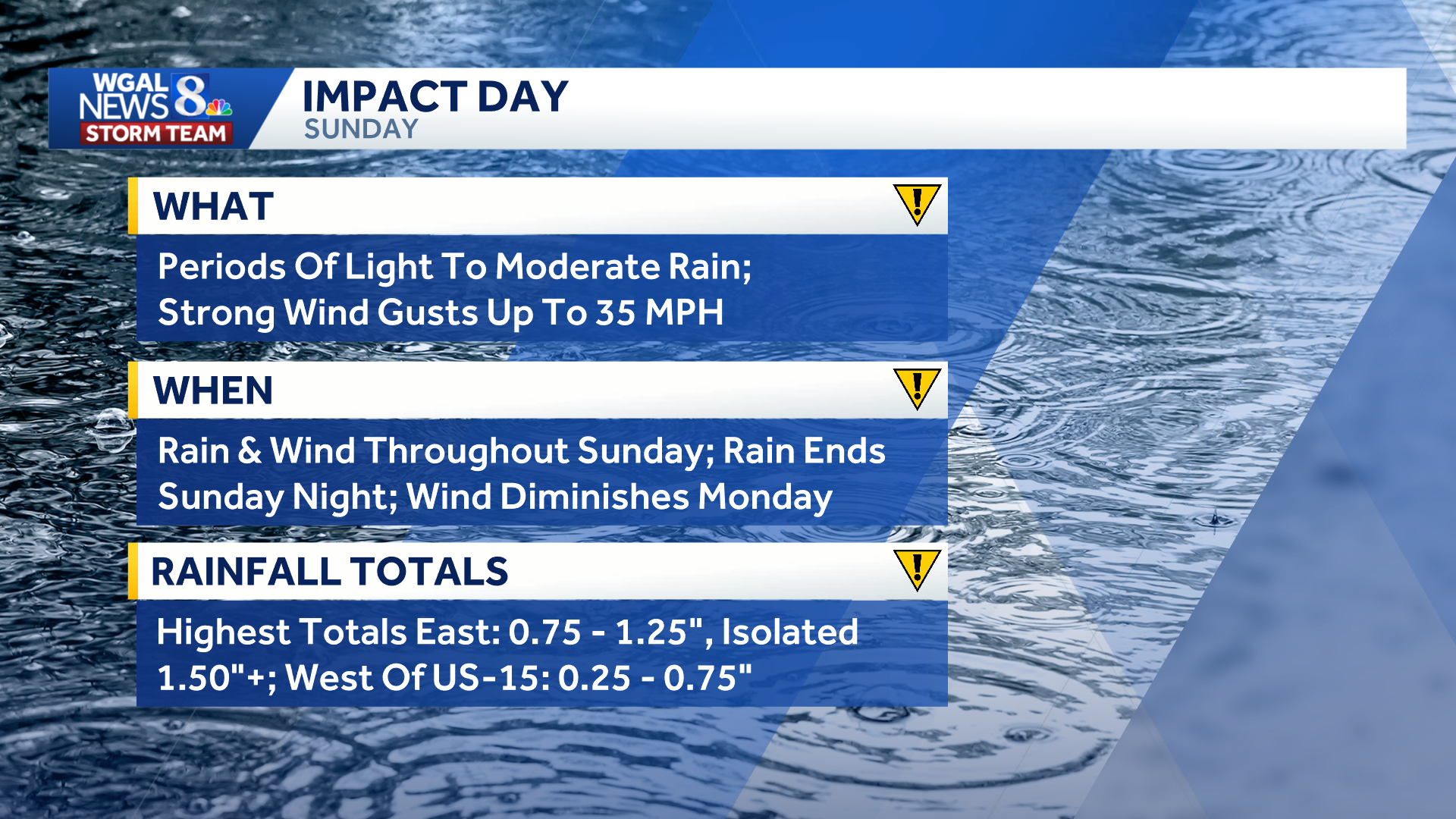
The WGAL News 8 Storm Team has declared Sunday an Impact Day, meaning the weather will likely disrupt your normal daily schedule or routine.
 Rounds of rain
The coastal storm is forecasted to produce periods of light to moderate rain throughout the day, with heavier downpours possible, especially east of the Susquehanna River.
Some breaks in the rain could develop during the afternoon as drier air moves into the region.
Showers are expected to return during the evening before tapering off overnight and moving out by Monday morning.
 Rain totals
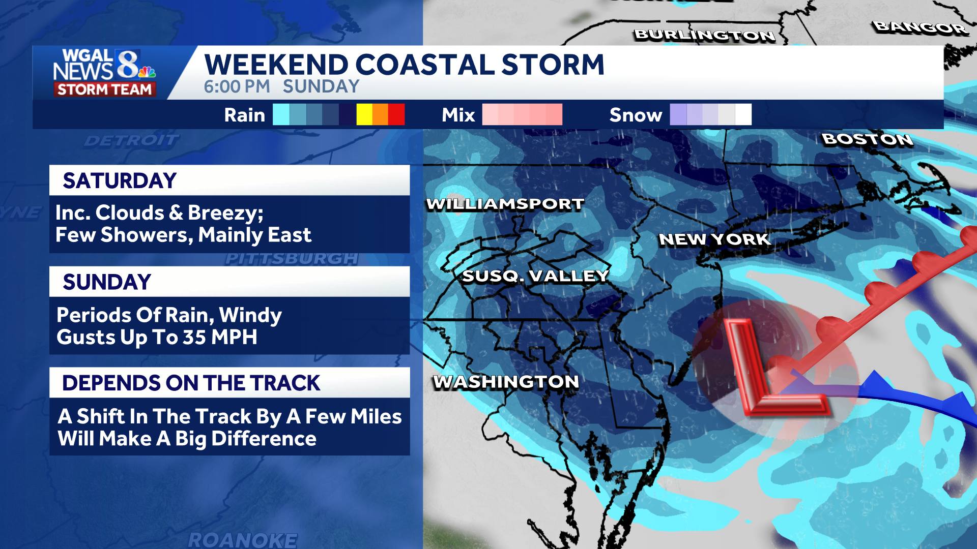
The heaviest rainfall is expected in the eastern parts of the Susquehanna Valley.
East of the Susquehanna River: 0.75 to 1.25 inches possible Isolated eastern locations: More than 1.5 inches possible West of Route 15: 0.25 to 0.75 inches possible
A shift in just a few miles of the storm’s track could significantly change rainfall and wind projections across the region.
Wind gusts could approach 40 mph
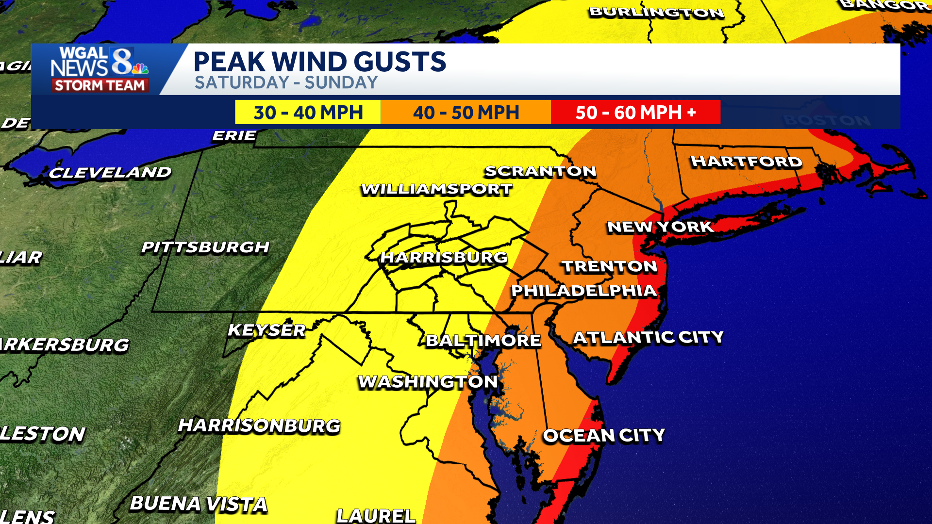
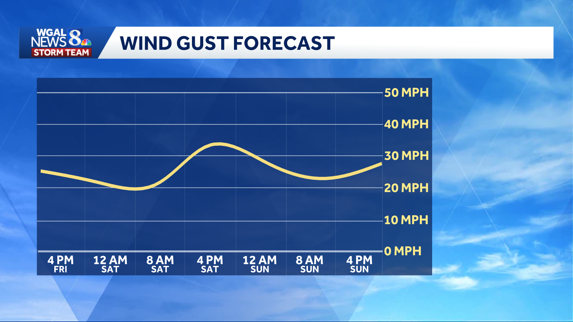
Wind gusts of up to 35 mph are expected throughout Sunday.
Areas of Lancaster and Lebanon counties could experience gusts near 40 mph if the center of low pressure moves onshore in New Jersey.
Strong winds are expected to continue Sunday night before gradually diminishing Monday.
 Dangerous surf along the coast
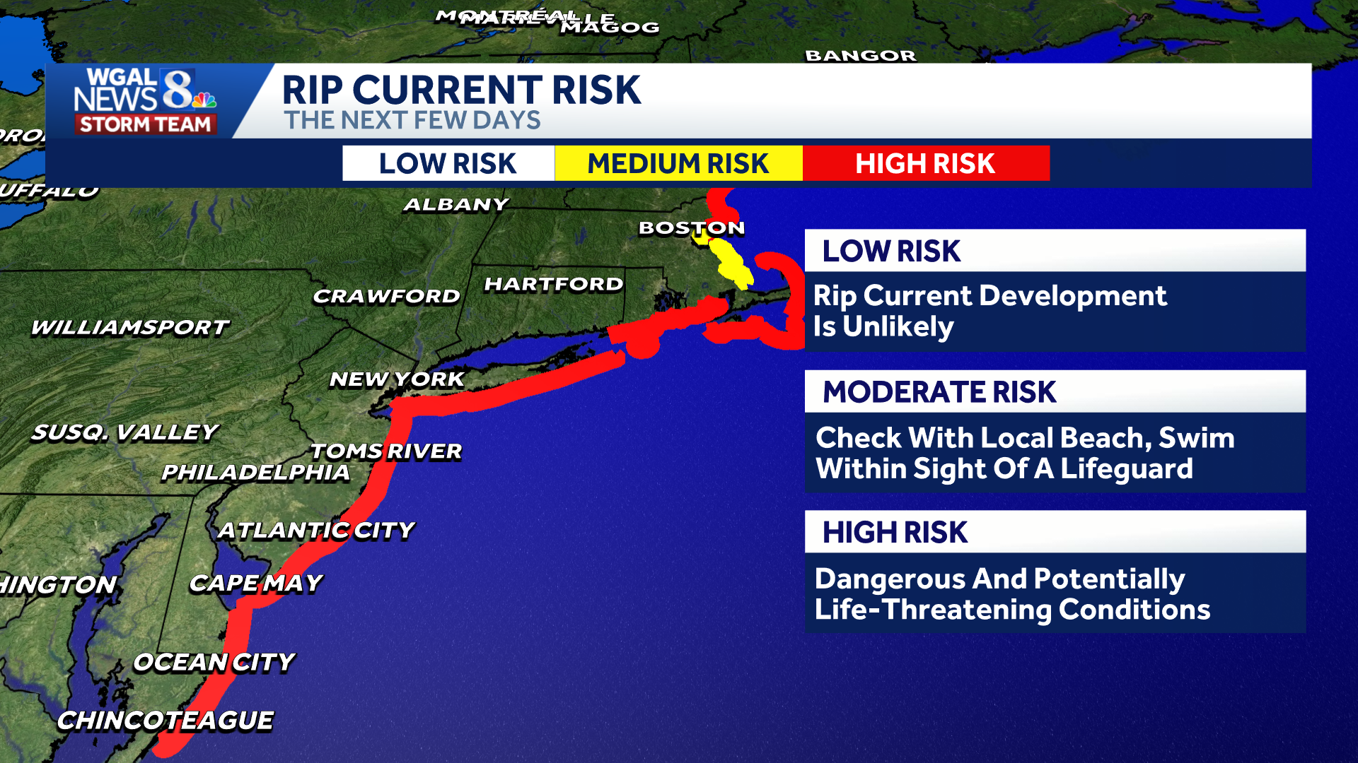
The storm is also expected to produce rough surf and an elevated risk of dangerous rip currents along portions of the Mid-Atlantic and Northeast coastlines.
A high rip-current risk indicates dangerous and potentially life-threatening conditions. Beach visitors should check local conditions before entering the water.
 Tropical Storm Gonzalo forms in eastern Atlantic
Meanwhile, Tropical Storm Gonzalo has formed in the eastern Atlantic Ocean near the Cabo Verde Islands.
The storm was about 140 miles east-southeast of the southernmost Cabo Verde islands, with sustained winds of 45 mph. Gonzalo was moving north-northwest at 9 mph and had a central pressure of 1,004 millibars.
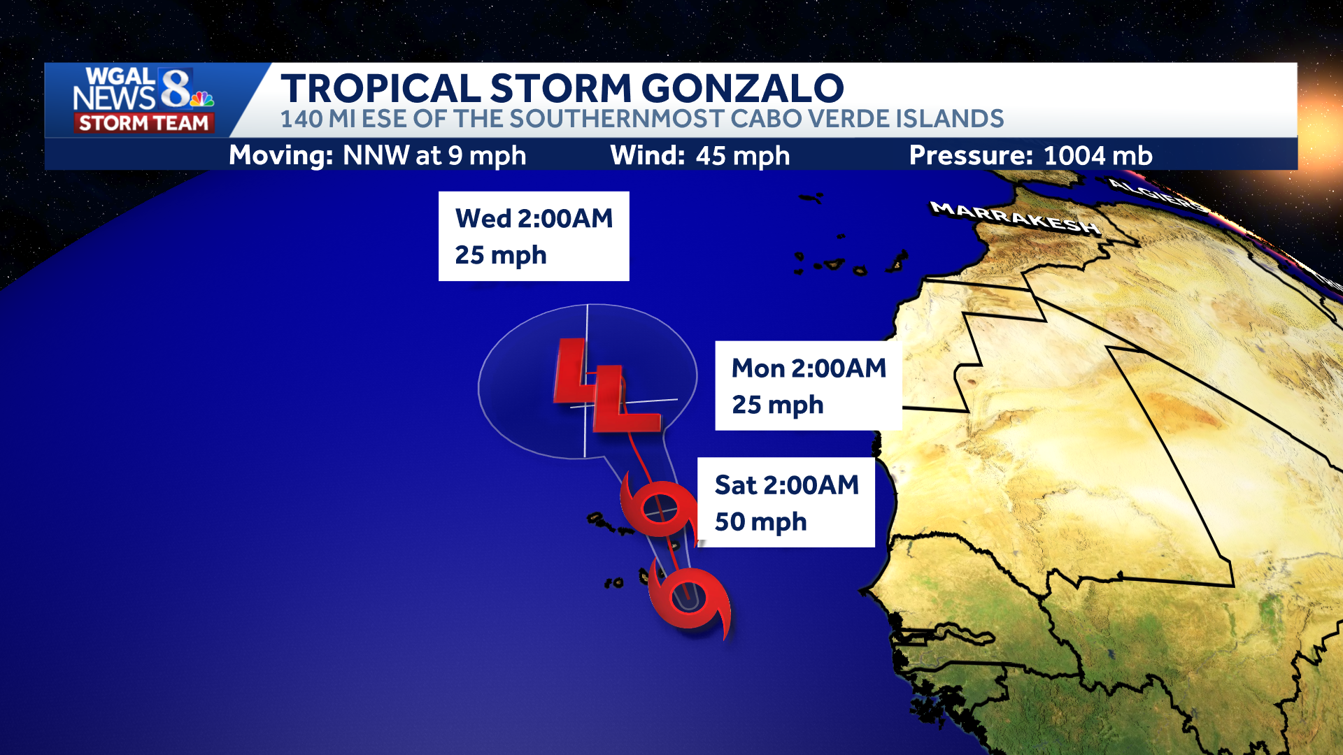
The storm is forecast to strengthen briefly, with winds reaching 50 mph early Saturday, before weakening into an area of low pressure by Monday.
Gonzalo is not expected to affect the Susquehanna Valley.
Calmer weather returns Monday
After the weekend nor’easter, calmer weather returns to the Susquehanna Valley on Monday with mostly cloudy skies, highs near 70 degrees and winds gradually diminishing.
Tuesday will be pleasant and seasonable before temperatures climb into the upper 70s Wednesday and Thursday, with shower chances returning late in the week.

Do you have photos or videos of the weather and would like to share them with News 8? Send them to https://www.wgal.com/upload.