
Warming Up Before Rain Returns Friday

Areas of patchy dense fog this morning otherwise partly cloudy skies through the day. Highs reach the 80s on Thursday before rain returns Friday.
Impact Day Friday
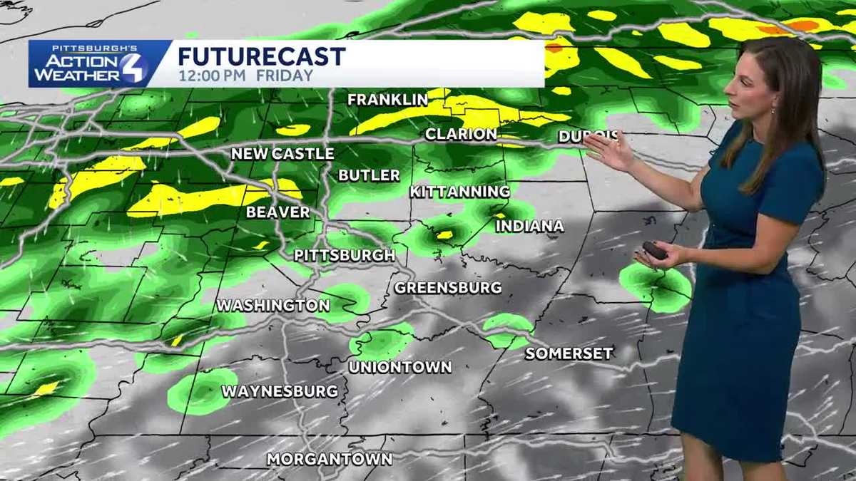
A cold front will move north to south across the region on Friday. Scattered showers through the day with the best chance of steadier rain in the afternoon hours. Rain will be exiting by the time we get to kickoff for high school football, with some showers still possible south of Pittsburgh and dry conditions north of Pittsburgh.
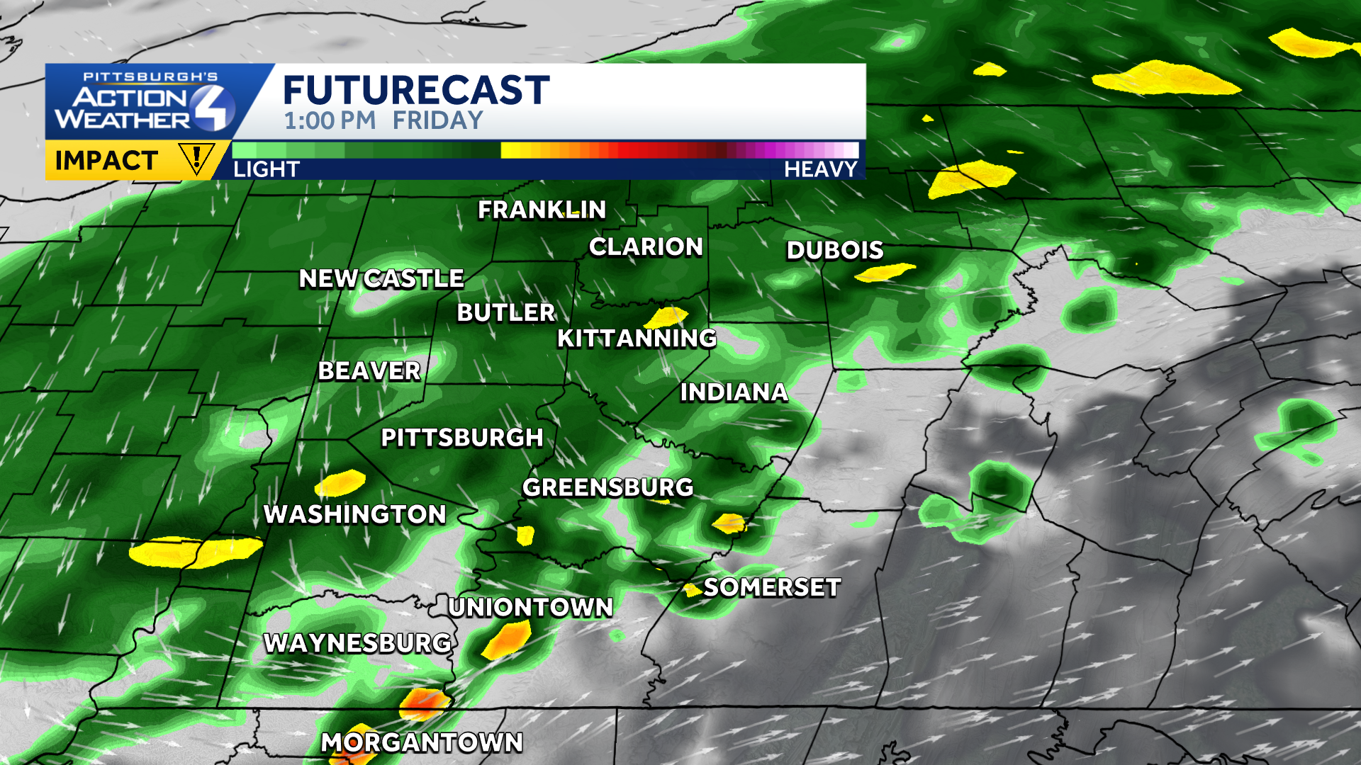
The cold front will still be near Morgantown on Saturday morning. The front looks to stay south of us on Saturday but has the potential to nudge a little further north on Sunday, meaning areas south and east of Pittsburgh could get some showers Sunday morning. The weekend is still fluid and changes are still possible.
Fall Temperatures Next Week
After rain clears Sunday, temperatures will bottom out as we head into the first full week of October. Highs on Tuesday may not get out of the 50s for most of us with low temperatures in the 30s. We could see frost and freeze concerns for the middle of next week.
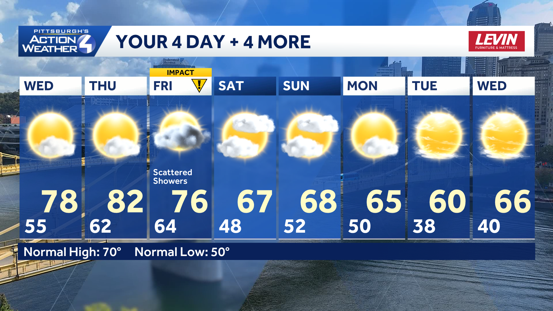
TODAY: Dense AM Fog, warmer with sun and clouds. High: 78°.
TONIGHT: Isolated showers north of 422. Mostly cloudy. Low 62°.
THURSDAY: Partly cloudy. High: 82°, low: 64°.
FRIDAY: Impact Day: Cloudy with rain showers. High: 76°, low: 48°.