

 SUSQUEHANNA VALLEY, Pa. —
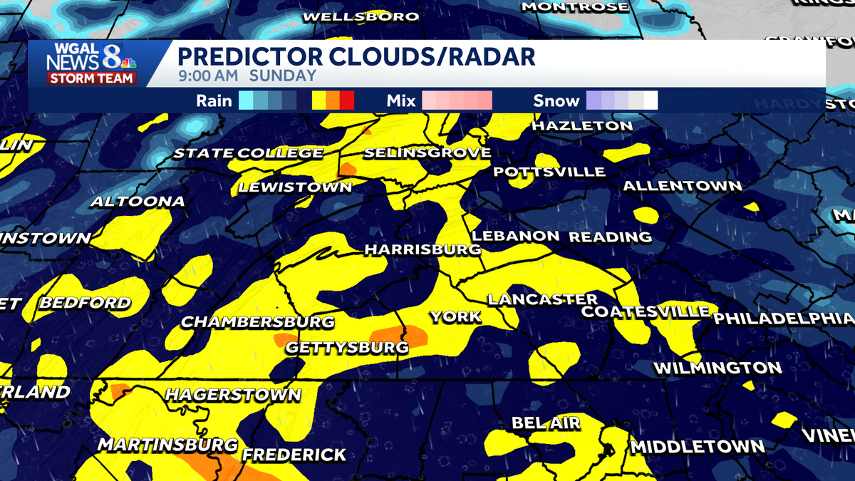
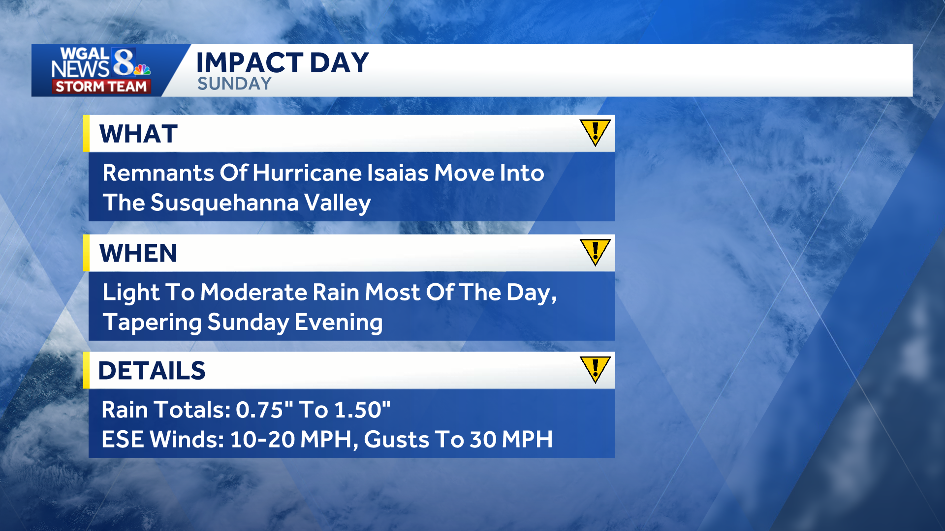
The remnants of Hurricane Isaias are expected to bring rain and gusty winds to the Susquehanna Valley on Sunday, making it an Impact Day.
 Where is Isaias now?
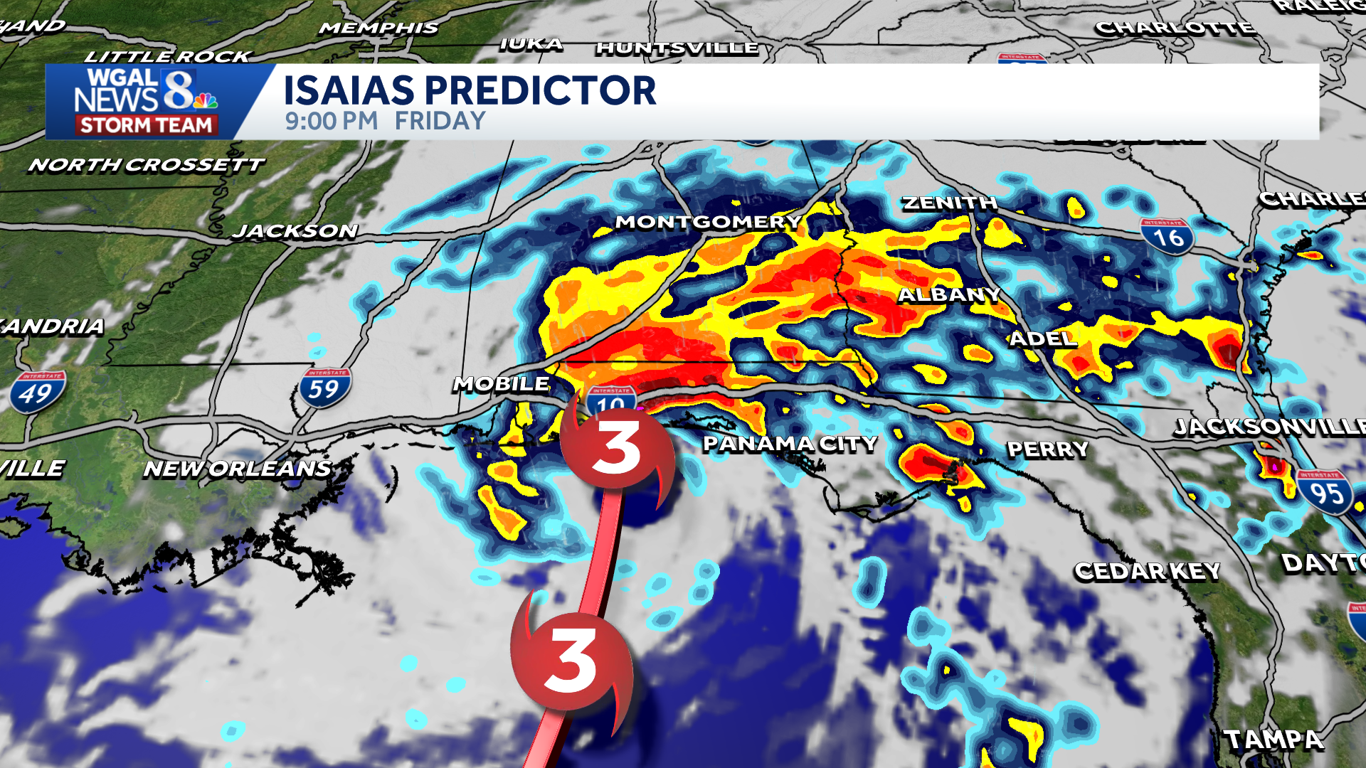
Isaias strengthened into a Category 3 hurricane Friday morning as it moved toward the U.S. Gulf Coast, according to the National Hurricane Center. The major hurricane had maximum sustained winds of 120 mph and was expected to strengthen further before making landfall late Friday near the Alabama-Florida state line.
Isaias is forecast to weaken rapidly after landfall, becoming a tropical storm by Saturday afternoon as it moves north and inland. Its remnants will then track toward the Tennessee Valley and eventually Pennsylvania.
 Timing for south-central PA
Saturday will remain dry, but clouds will increase and thicken toward the evening as the system approaches. Rain will develop late Saturday night and become widespread Sunday morning through Sunday afternoon.
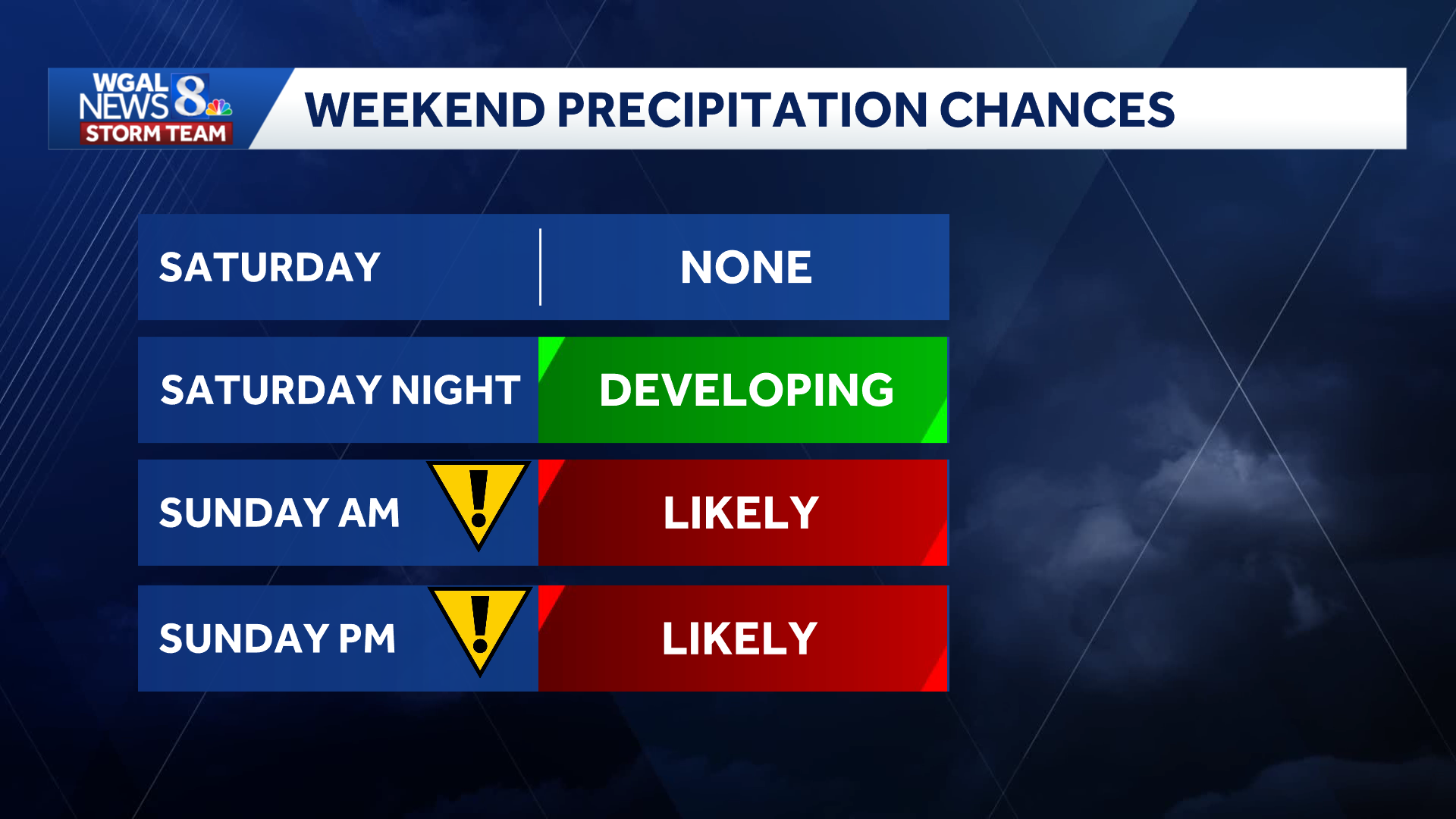 Sunday timeline: Before sunrise: Light rain develops. Late morning through the afternoon: Periods of moderate rain are likely. Evening: Rain tapers to scattered showers. Monday morning: A few showers could linger as the system moves east.
Below: Swipe through the predicted radar.
This content is imported from infogram. You may be able to find the same content in another format, or you may be able to find more information, at their web site.
Impacts and totals
Wet roads and reduced visibility could affect travel Sunday during periods of moderate rain.
East-southeast winds of 10 to 20 mph are expected, with gusts approaching 30 mph.
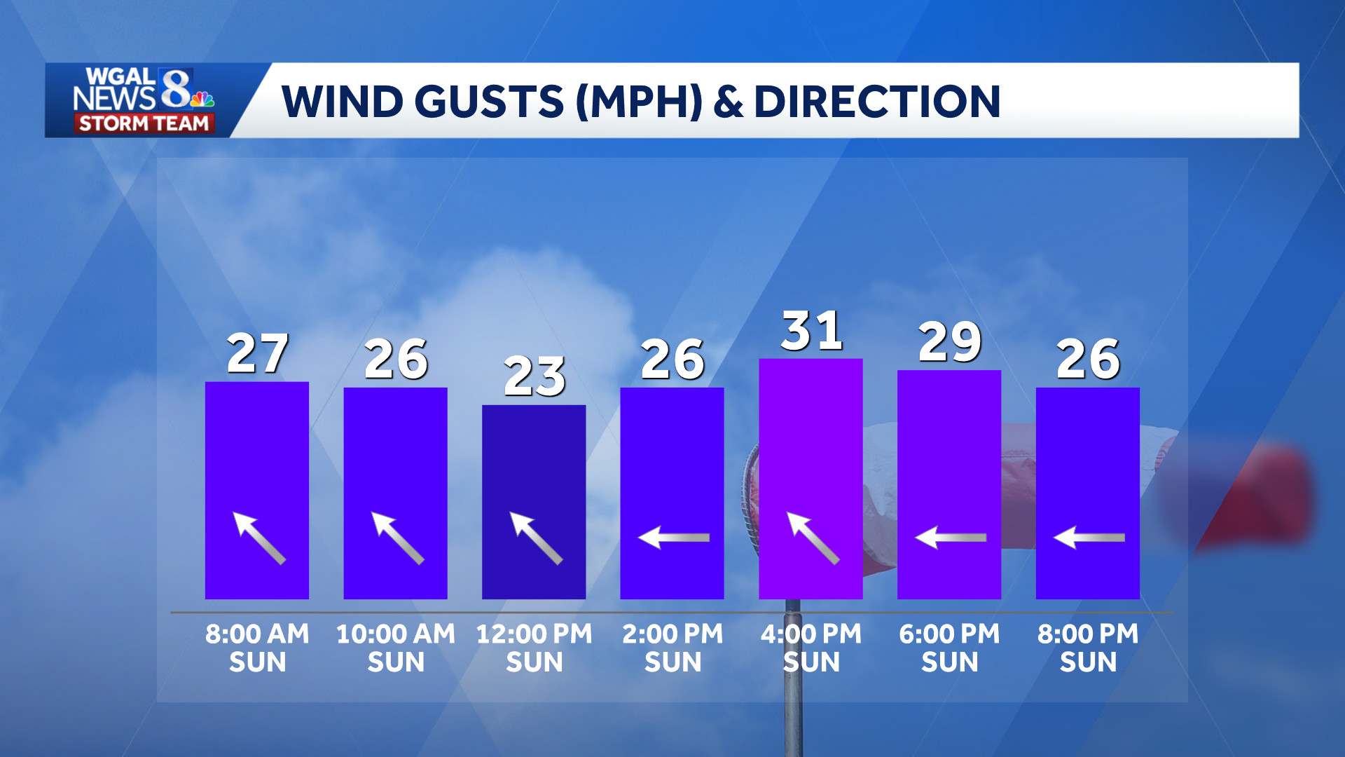
Widespread flooding is not expected, but ponding may develop on roads and in areas with poor drainage.
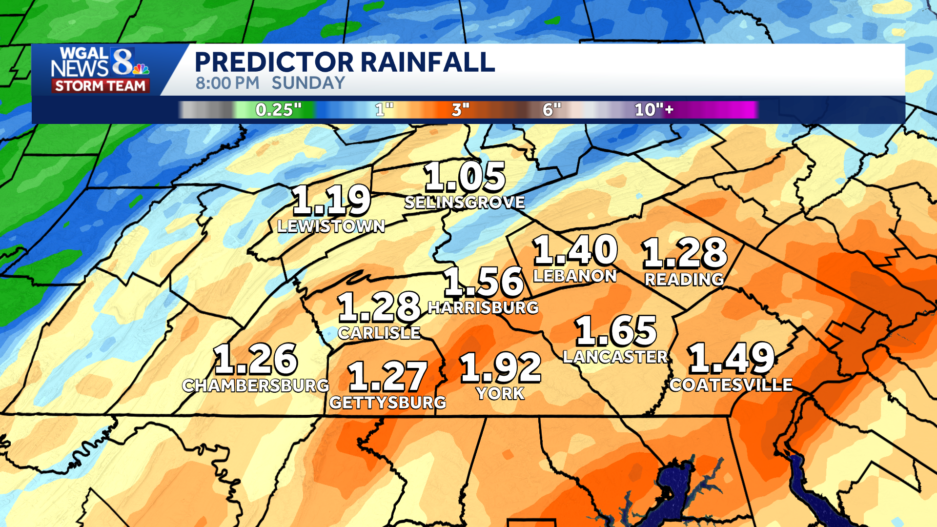
Most communities are expected to receive between 0.75 and 1.50 inches of rain, although higher amounts are possible in some areas.
 Looking ahead
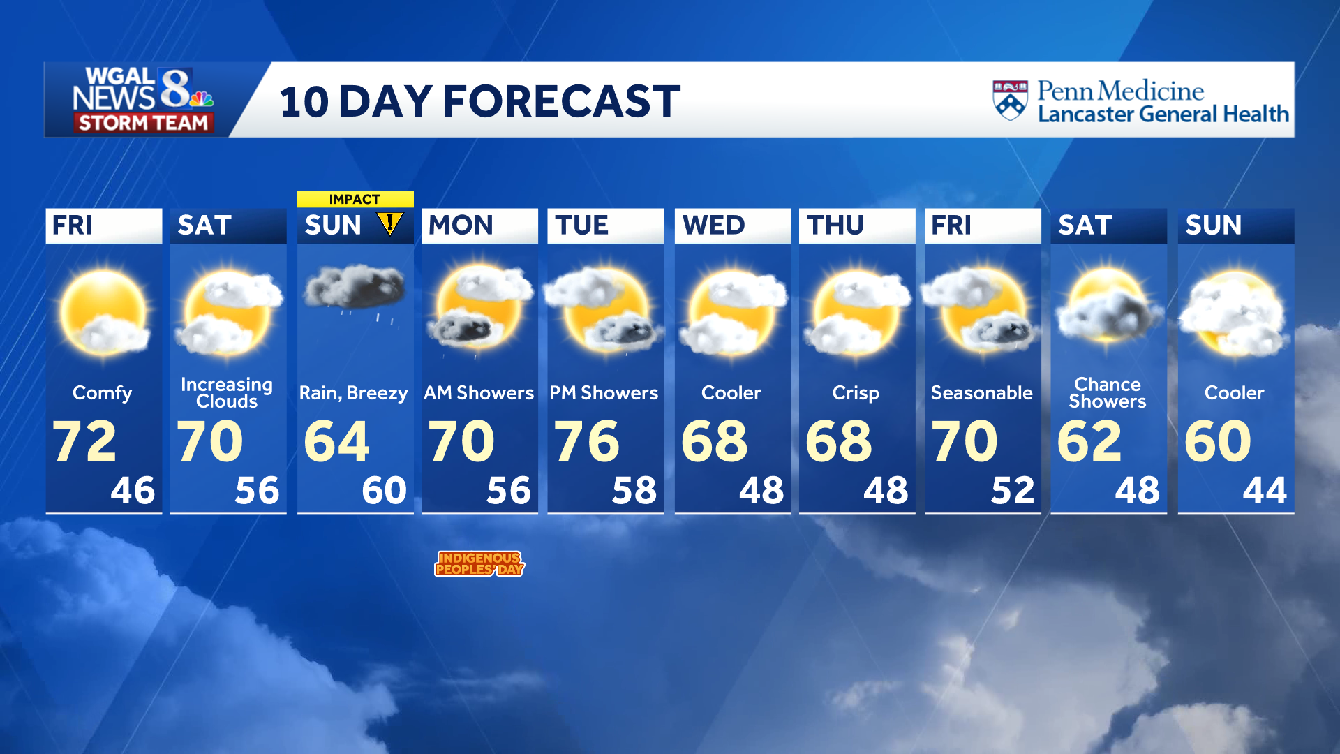
Isolated showers will linger early Monday before temperatures climb to around 70 degrees. Tuesday will be warmer, with highs in the mid-70s and a few showers possible in the evening.
Cooler highs in the 60s will return Wednesday and Thursday. Another cold front could bring showers late Friday, followed by cooler weather for the weekend.
Do you have photos or videos of the weather and would like to share them with News 8? Send them to https://www.wgal.com/upload.