
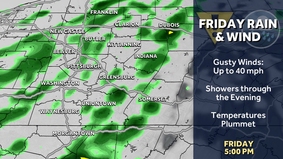
Friday is an Impact Day with showers through the day.
 PITTSBURGH —
After seeing showers on Wednesday, more rain returns on Friday with a cold front that will drop our temperatures and usher in a mid-November feel for the weekend.
Gusty winds, more showers for Friday’s Impact Day
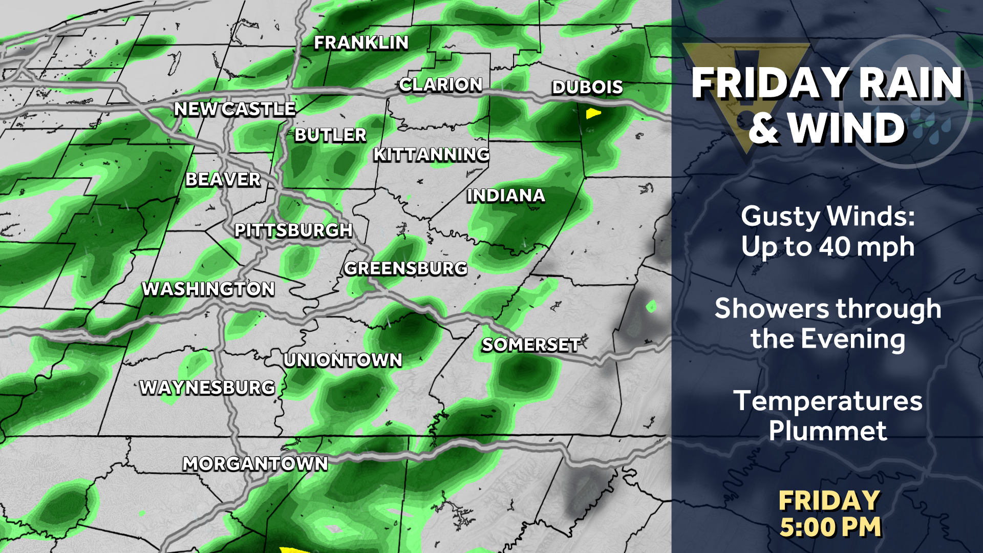
A potent cold front sweeps through the Pittsburgh area, prompting our next Impact Day on Friday. More showers are expected, especially through the early afternoon. Gusty winds will be more problematic with gusts of 35 to 45 mph. You may want to consider tying down your fall and Halloween decorations. Rain showers will generally be scattered in nature, but they will be possible through the day. Temperatures will fall through the day with our high occurring at midnight.
Hearst Owned
Showers and gusty winds will accompany our Friday cold front.
The growing season likely ends this weekend
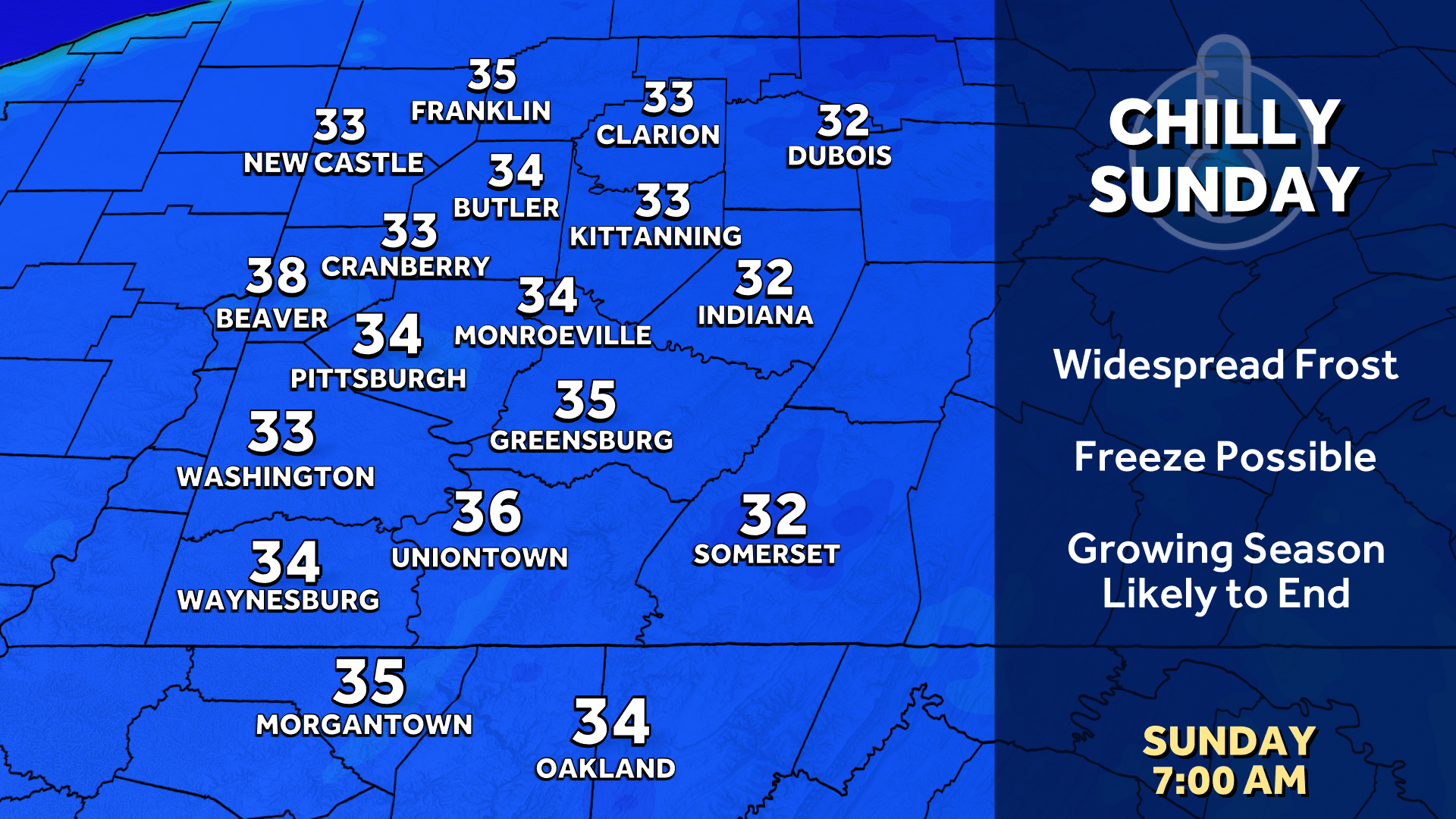
Temperatures plummet behind Friday’s cold front. Many of us will likely stay in the 40s through the day on Saturday. The cold settles in Sunday morning as we wake up in the middle 30s to prompt widespread frost concerns. It is possible the first freeze of the year shows up in the Laurel Highlands and sheltered valleys.
Hearst Owned
The first freeze of the season is possible for parts of Western PA with widespread frost elsewhere.
With ample sunshine, highs begin warming as we head through next week. Ample sunshine will push highs back towards 70 by the end of the week.
Hearst Owned
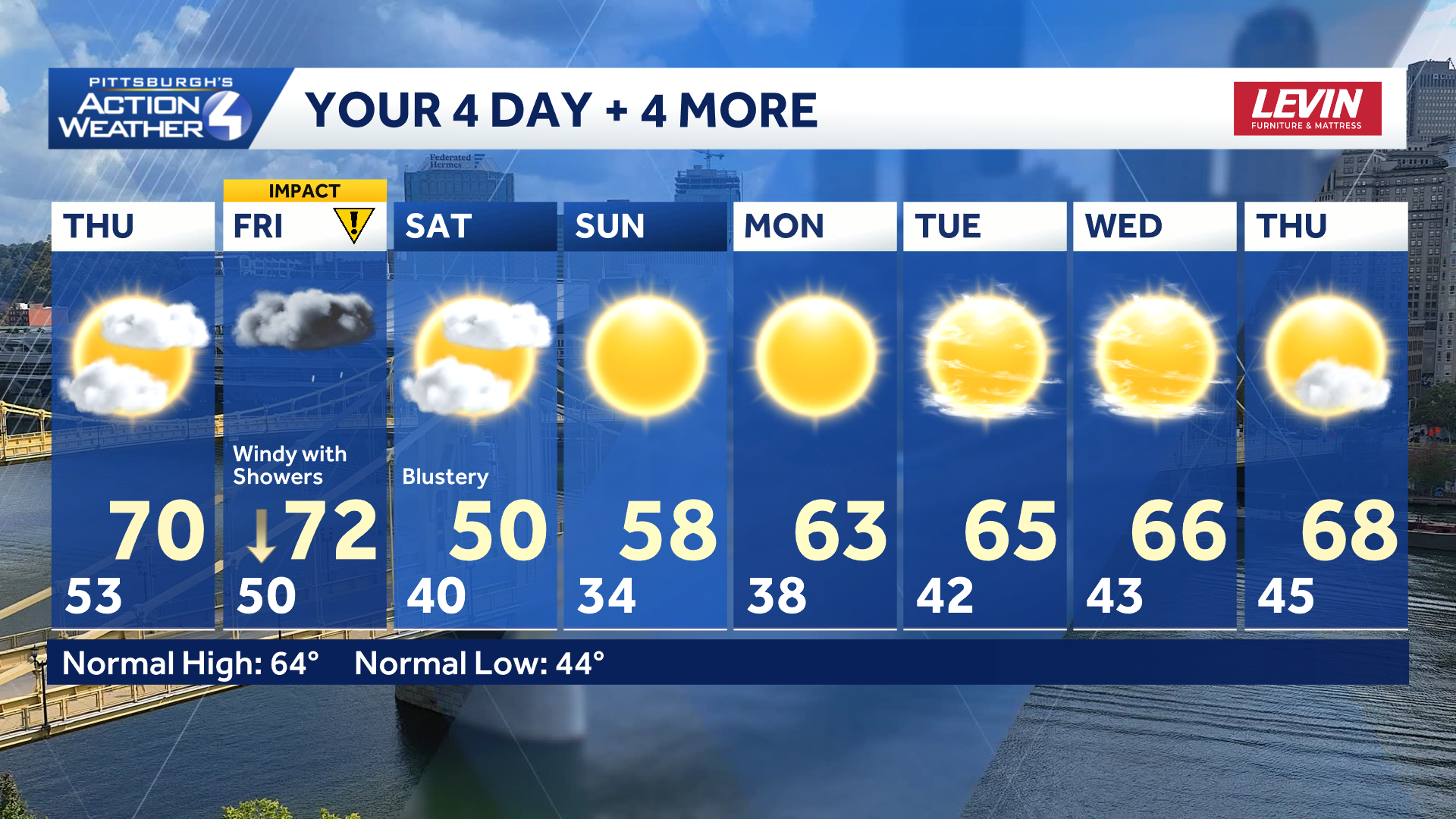
Falling temperatures usher in a November-like weekend with more seasonal temperatures next week.
TONIGHT: Evening showers South. Mostly cloudy. Low 53°
THURSDAY: Mild and mostly cloudy. High: 70°, low: 50°.
FRIDAY – Impact Day: Windy with showers. Dropping afternoon temperatures. High: 72°, low: 40°.
SATURDAY: Blustery and chilly with clouds and sun. High: 50°, low: 34°.