
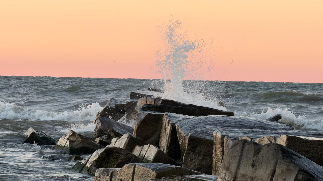
CLEVELAND, Ohio — Powerful winds could whip up waves reaching 13 feet on Lake Erie Friday night, creating dangerous conditions along Northeast Ohio’s shoreline.
The National Weather Service in Cleveland expects waves to generally build to 7 to 11 feet as a cold front moves through the region. Winds could reach 30 knots — or 35 mph — with gusts potentially reaching gale force.
The rough conditions could make boating dangerous and create hazards along beaches, piers and breakwalls, with the worst weather expected Friday night into early Saturday.
Weather service meteorologist Salix Iverson said people visiting shoreline locations such as Edgewater Park can expect crashing waves and whitecaps as conditions deteriorate.
“You’ll have very strong and high waves,” Iverson said, explaining that whitecaps are common when waves reach these heights.
When will Lake Erie’s waves be at their highest?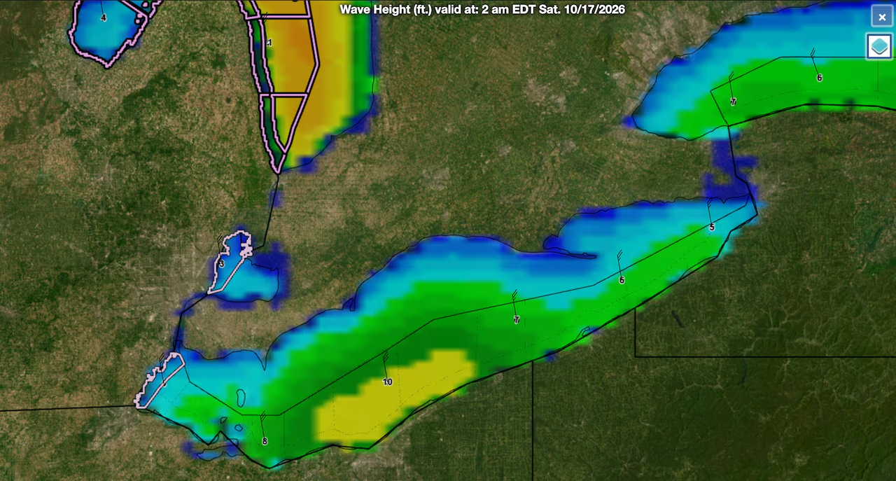 Waves are forecast to build to around 10 feet across portions of central Lake Erie by 2 a.m. Saturday, Oct. 17, as strong northerly winds churn the lake. Occasional waves could reach around 13 feet in some nearshore waters, according to the National Weather Service.National Weather Service
Lake Erie should remain relatively calm Thursday afternoon, with waves generally running 1 to 3 feet along Northeast Ohio’s shoreline.
Conditions will begin to deteriorate Thursday night as a warm front crosses the region, followed by a stronger cold front Friday morning.
Winds will shift from the east to the southwest overnight, increasing to 15 to 25 knots — or roughly 20 to 30 mph. As the cold front moves across Lake Erie Friday, winds will turn west and northwest, strengthening to around 30 knots.
That will cause waves to build rapidly, particularly along the central and eastern portions of the lake.
By Friday afternoon, the weather service expects waves of 5 to 8 feet from Vermilion through the Cleveland area, with occasional waves around 10 feet. Farther east, from Lake County through Ashtabula County, waves could reach 5 to 9 feet, occasionally around 11 feet.
The roughest conditions are expected Friday night as winds turn more northerly. Waves are forecast to reach 6 to 10 feet from Lorain County east through Ashtabula County, with occasional waves around 13 feet.
Those figures represent conditions in nearshore waters extending up to five nautical miles from shore, rather than necessarily the height of waves breaking directly on beaches.
Why Lake Erie’s waves will build so high
The approaching cold front will bring strong northerly winds across Lake Erie, pushing waves toward Ohio’s shoreline and allowing them to build as the winds strengthen.
Iverson said some of the lake’s stronger wind events typically occur during the fall and early winter, when powerful weather systems move through the Great Lakes.
“It’s a strong low pressure system,” she said, although Lake Erie has experienced more extreme wind events in the past, including storms powerful enough to push large amounts of water toward Buffalo at the lake’s eastern end.
Even if the conditions aren’t particularly unusual for the season, the expected waves will be impressive — and potentially dangerous for boaters and anyone venturing too close to the water.
Some wind gusts could reach gale force, which begins at 34 knots — or about 39 mph. However, forecasters have become less confident that gale conditions will develop because the approaching low-pressure system has trended weaker in recent forecasts.
Dangerous conditions could linger into Saturday
Although the strongest winds are expected Friday night, rough conditions could continue into Saturday morning before gradually improving.
North winds could remain near 30 knots early Saturday before weakening as high pressure builds into the region. Waves should gradually subside throughout the day, with much calmer conditions expected by Sunday.
The hazards won’t be limited to people on boats.
Large breaking waves can create dangerous conditions along Lake Erie’s shoreline, particularly around piers, breakwalls and other structures extending into the water.
The Ohio Department of Natural Resources warns that currents near those structures can be especially strong.
Anyone planning to visit the shoreline to watch the waves should remain a safe distance from the water and avoid exposed piers and breakwalls.
Iverson said the weather service’s seasonal beach hazard statement program ended Sept. 30, meaning no such statements will be issued for this event. However, small craft advisories are expected as conditions deteriorate.
The absence of a beach hazard statement does not mean conditions will be safe.
Boaters should monitor the latest marine forecasts and advisories before heading onto the lake, while shoreline visitors should exercise caution until the winds and waves subside.