
A weak cold front will move across the region late Thursday morning, bringing gusty northwest winds and slightly cooler temperatures to the Lehigh Valley and Pocono Mountains.
Residents can expect partly cloudy to mostly sunny skies with highs in the upper 40s to low 50s, and northwest winds of 10 to 20 mph with gusts up to 30 mph.
The National Weather Service forecast indicates that some higher elevations in the southern Poconos and far-northwestern New Jersey might experience brief sprinkles or light flurries during the front’s passage.
Winds across the region are expected to diminish Thursday evening, with temperatures dropping into the low to mid-30s overnight. Friday will continue the cool trend with a mix of clouds and sun and highs around 50 degrees.
A more significant weather system is expected to approach Saturday night, bringing increasing cloud cover and a chance of rain.
By Sunday, a warm front will move through the region, followed by a cold front that could produce light rainfall into early Sunday afternoon. Precipitation chances will range from 30% to 80%, with most areas expecting less than a quarter-inch of rain.
Early next week will feature partly to mostly clear skies and temperatures below seasonal averages. Winds are forecast to gradually diminish, transitioning from northwest to more westerly flow by Monday and Tuesday.
Long-range forecasts suggest a relatively stable weather pattern will persist through mid-week, with temperatures remaining close to normal for mid-November in eastern Pennsylvania.
Current weather radar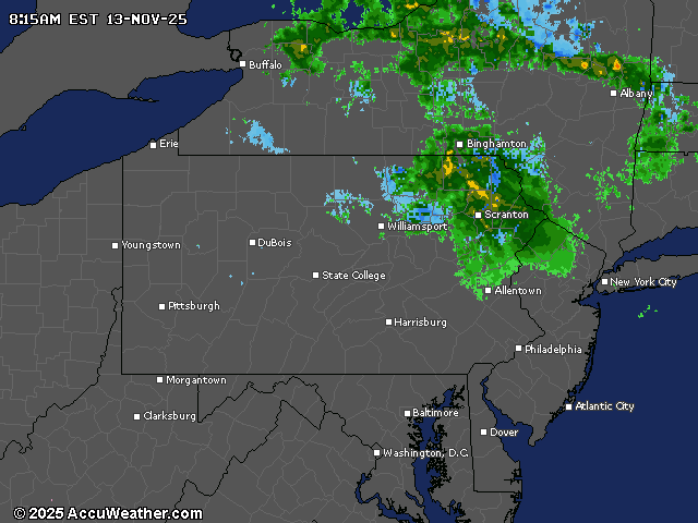
If you purchase a product or register for an account through a link on our site, we may receive compensation. By using this site, you consent to our User Agreement and agree that your clicks, interactions, and personal information may be collected, recorded, and/or stored by us and social media and other third-party partners in accordance with our Privacy Policy.