
SHORT TERM FORECAST
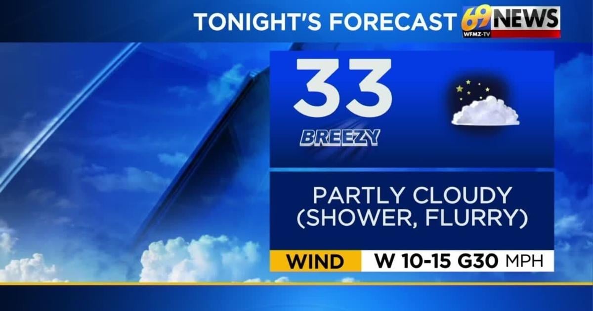
TONIGHT: Partly cloudy, brisk, and chilly; there might be a shower or even some snowflakes, especially for areas north and west of the Lehigh Valley. Low: 33
MONDAY: Partly sunny, brisk, and chilly. High: 46
MONDAY NIGHT: Partly cloudy and cold with diminishing winds. Low: 29
_______________________________________________________________________________________________________________________________________________________________________________________________________________________________
FORECAST SUMMARY
The region saw a warm front followed by a cold front pass through last night bringing with it a bit of rain which was largely gone by the wee hours of Sunday morning. While a few locations saw some brief downpours and maybe even experienced a little lightning and thunder, rainfall totals for many generally got no higher than a tenth of an inch. In the wake of the cold front, gusty winds out of the west ramped up on our Sunday with many seeing gusts of 35 to 45 miles-per-hour from late morning onward. But besides those gusty winds, Sunday was an otherwise largely dry day with a mix of sun and clouds. High temperatures mostly occurred in the morning Sunday, in the low 50s before falling a few degrees into the upper 40s during the afternoon. Some areas, mostly those north and west of the Lehigh Valley, did see some brief showers or perhaps even a snow shower later Sunday afternoon. Winds will calm down somewhat over the next 24 hours, but we’ll still keep things brisk as we move into the start of the new week. High temperatures will also be chilly to start the new week only reaching the mid to upper 40s and nighttime lows will dip down into the upper 20s to low 30s. It will be dry otherwise though with a mix of sun and clouds. A weak disturbance passes by to our south Tuesday night possibly bringing a few showers, especially the further south one travels from the Lehigh Valley. High pressure then returns for Wednesday and Thursday leading to more dry weather and fair skies. But clouds will be on the increase moving through Thursday and that will eventually give way to the next storm system which looks to impact us Friday with a return to some rainfall. Despite the cloudier and wetter weather returning at the end of the week, high temperatures look to rebound to milder levels topping out in the upper 50s.
DETAILED FORECAST
TONIGHT
Early on this evening we’ll still be dealing with those gusty west winds with perhaps a few spots still occasionally seeing a gust or two to 40 miles-per-hour. Eventually however, look for the winds to calm down a little later tonight becoming sustained 10 to 15 miles-per-hour with gusts only up to 30 miles-per-hour. It will still be a brisk breeze for sure and it will add an extra chill to the air as overnight lows drop back close to 32 degrees. Partly cloudy skies can be expected, but at least early on tonight, a few showers or even a flurry or snow shower can’t entirely be ruled out, mainly the further north and west one travels from the Lehigh Valley.
MONDAY AND TUESDAY
The new week will start on a brisk and chilly note, but otherwise dry. High temperatures between Monday and Tuesday only look to be in the mid and upper 40s, and nighttime lows likely dip down to the upper 20s to low 30s. Look for partly sunny skies on Monday with winds still gusting at times up to 30mph adding an extra chill to the air. In fact, wind chill values first thing Monday morning will likely be in the 20s followed by mid to upper 30s for the afternoon. The breeze will finally ease up for Tuesday as clouds gradually thicken and increase as the day progresses. A weak disturbance looks to slide by to our south Tuesday night and this will lead to at least a slight chance for some showers with the greatest odds coming the further south one travels from I-78.
WEDNESDAY THROUGH FRIDAY
The weak disturbance that tracks by to our south Tuesday night will exit out to sea for Wednesday. High pressure will then build in from the Great Lakes and settle atop the region for Wednesday and Thursday leading to dry conditions and fair skies. Expect clouds to break for some decent sun Wednesday however high temperatures remain on the cool side topping out in the upper 40s to near 50 degrees. Skies turn mostly cloudy for Thursday, and once again temperatures don’t rise much as highs top out at seasonably cool levels near 50 degrees. A warm front will approach from our south and west for Friday leading to plenty of clouds along with a good chance for showers. With the warm front lifting through though early in the day, we should see a slightly milder surge of air push into the region bringing high temperatures back to the upper 50s.
TRACK THE WEATHER:
LINKS: HOUR BY HOUR | RADAR | TRAFFIC