
As the calendar turns to December, the Lehigh Valley could see its first snowfall of the season early next week.
A coastal low pressure system Tuesday is set to bring widespread precipitation to the region. The storm, combined with a colder weather pattern, has the “potential for measurable snowfall for eastern PA,” according to the National Weather Service’s office in Mount Holly, New Jersey.
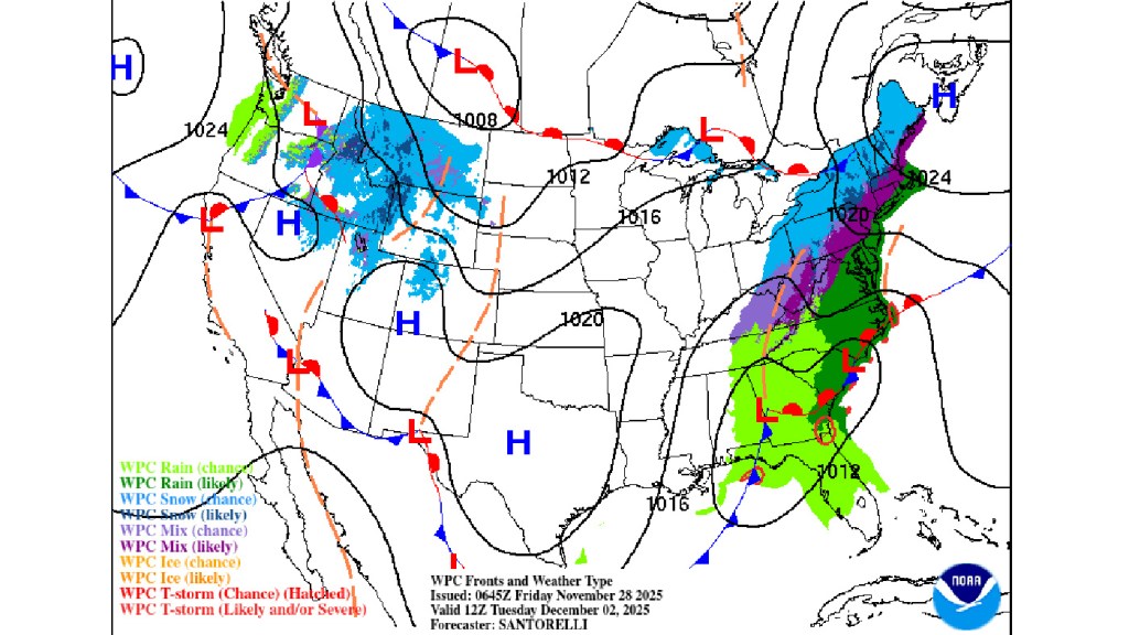
There’s still a “large amount of uncertainty surrounding the storm,” the weather service notes in its daily forecast briefing, with different forecast models showing differences in storm track, speed and strength.
“Some models track the low closer to the coast,” which would bring warmer temperatures and rain, “while others are more offshore,” meaning colder temperatures and a greater chance of snow, the weather service said in its forecast briefing.
Regardless, areas closer to the coast should see mostly rain, while areas northwest of the Interstate 95 corridor, “and especially near and north of the I-78 corridor,” have the greatest chance of seeing snow, according to the weather service.
Still, “the overall uncertainty in these specific details remains high, so forecast confidence in them is still relatively low,” the weather service cautions.
As of now, the extended weather service forecast for the Allentown area is calling for “a chance of rain and snow” Tuesday. A high of 38 is expected, but the overnight low will plunge to around 26, well below freezing.
Looking to this weekend, below average temperatures will continue through Sunday, according to the weather service. Friday’s high will be around 40, but the overnight low will drop to 27.
Sunday could also bring a prelude to next week’s possible winter storm, with a chance of rain and snow in the morning, according to the weather service forecast. However, any snow accumulation should be less than half an inch.
Here is the extended forecast from the National Weather Service:
Friday Night: Mostly clear, with a low around 27. West wind 10 to 15 mph, with gusts as high as 25 mph.
Saturday: Sunny, with a high near 42. West wind 5 to 10 mph.
Saturday Night: Increasing clouds, with a low around 29. Calm wind.
Sunday: Rain and snow likely before 10am, then rain. High near 45. Southeast wind 5 to 10 mph, with gusts as high as 20 mph. Chance of precipitation is 80% New snow accumulation of less than a half inch possible.
Sunday Night: A slight chance of rain before 1am. Mostly cloudy, with a low around 30. Chance of precipitation is 20%.
Monday: Mostly sunny, with a high near 41.
Monday Night: Mostly cloudy, with a low around 26.
Tuesday: A chance of rain and snow. Cloudy, with a high near 38. Chance of precipitation is 50%.
Tuesday Night: A chance of rain and snow before 1am. Mostly cloudy, with a low around 26. Chance of precipitation is 40%.
Wednesday: Mostly sunny, with a high near 38.