
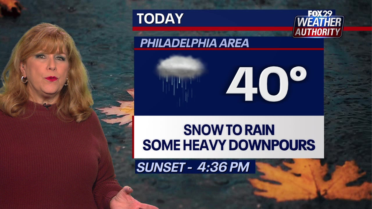
PHILADELPHIA – A messy Tuesday morning commute is on tap for the Philadelphia area as a coastal storm will bring snow, rain and a wintry mix.
What we know:
Tuesday’s storm will begin to creep into the Philadelphia area around 6 a.m., with the rain-snow line pushing north along the I-95 corridor.
Philadelphia and surrounding areas will see a wintry mix during the early hours of the storm, while places to the north and west will see snow.
Rain will become more widespread and heavy at times – especially in parts of South Jersey and Delaware – by 10 a.m. as the rain-snow line moves north.
Showers will continue through the morning and afternoon before the storm pulls away from our area during the mid-afternoon.
Where will it snow?
Local perspective:
The best chance to see snow will be in areas north and west of Philadelphia, especially Berks, Bucks, Chester and Montgomery counties.
The National Weather Service has issued a Winter Weather Advisory for the Lehigh Valley and neighboring parts of Bucks, Chester and Montgomery counties.
How much will it snow?
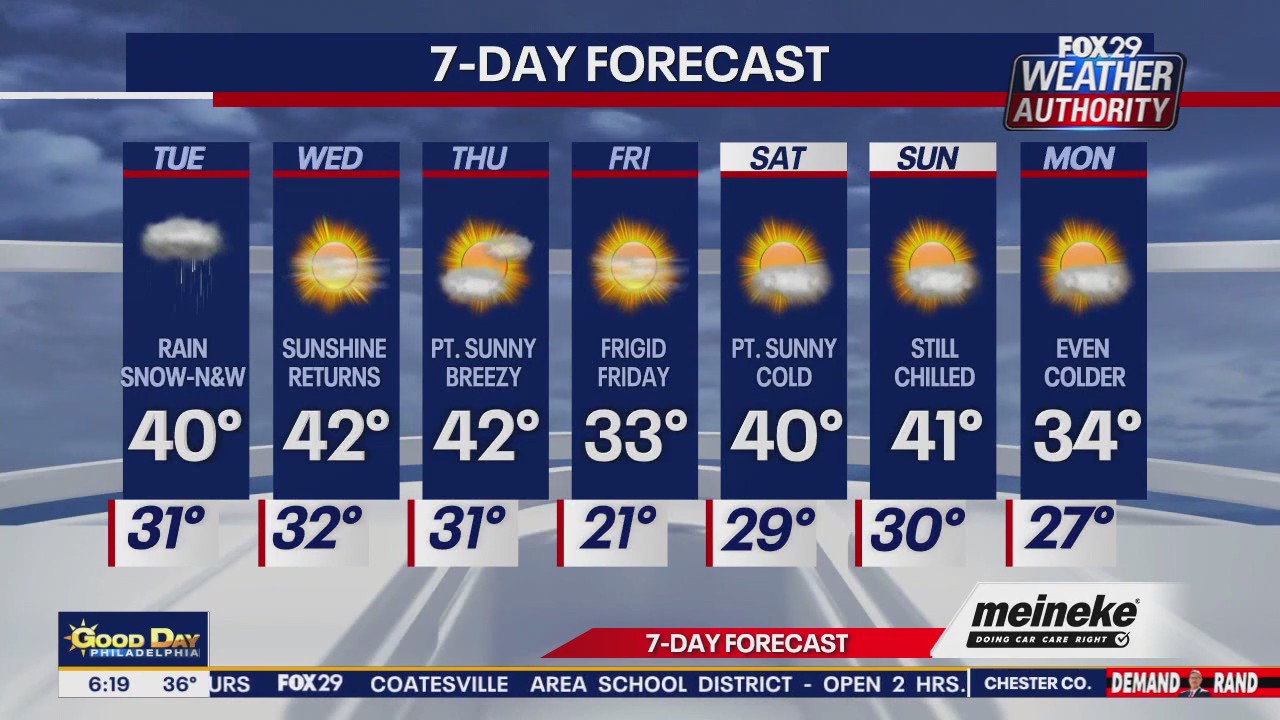
Accumulations from Tuesday’s storm are expected to be minimal, but northern areas could see several inches.
Parts of the Lehigh Valley could see 3-4 inches, while areas closer to the city will get a dusting to 2 inches.
School closures and delays
Philadelphia and areas close to it will be mostly spared from the snow, but a wintry mix will be possible throughout the morning.
Areas closer to Philadelphia, like Chester and Bucks counties, could also see a dusting of snow from Tuesday’s storm.
The following schools have reported delays in the Philadelphia area for Tuesday.