
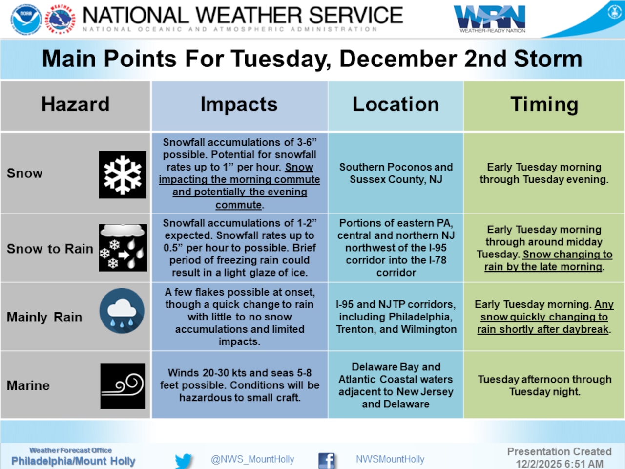
A winter storm is impacting the Lehigh Valley and Poconos on Tuesday, with widespread snowfall creating challenging travel conditions.
Areas north of Interstate 78 are most likely to see accumulating snow, with potential for 1-3 inches and higher elevations possibly receiving up to 6 inches, according to the National Weather Service forecast.
Precipitation began as snow shortly after dawn Tuesday morning in the Lehigh Valley, with snow also likely in the Poconos and northwestern New Jersey. High temperatures are forecast to range from the mid-30s to low 40s. The precipitation is expected to transition from snow to rain as temperatures rise, particularly along the I-95 corridor and coastal areas.
A Winter Weather Advisory is in effect Tuesday for the Lehigh Valley and northwestern New Jersey until 1 p.m. and in the Poconos until 6 p.m. Residents should expect potentially hazardous morning commute conditions, with snow and possible light ice accumulation. Roads may become slippery, especially in areas experiencing a snow-to-rain transition.
The Pennsylvania Department of Transportation on Tuesday morning urged motorists to avoid unnecessary travel. Speed limits were reduced to 45 mph on Interstates 78, 80, 81 and 380, plus Routes 22 and 33.
Road crews have been treating roadways, PennDOT said, with a primary goal to keep roads passable. Roads will not completely free of ice and snow, however, the department said in a news release: “PennDOT will continue to treat roadways throughout the storm until precipitation stops and roads are clear.”
The storm system will move out by Tuesday evening, with high pressure building in Wednesday. Temperatures will remain below normal for the next several days, with Wednesday’s highs in the mid-30s to low 40s. Thursday will bring clearing skies and the coldest temperatures of the season so far, with overnight lows potentially dropping into the teens.
Looking ahead, Friday and the weekend may see another chance of precipitation, with temperatures remaining well below seasonal averages. Residents should be prepared for continued winter-like conditions and potential additional precipitation through the weekend.
Current weather radar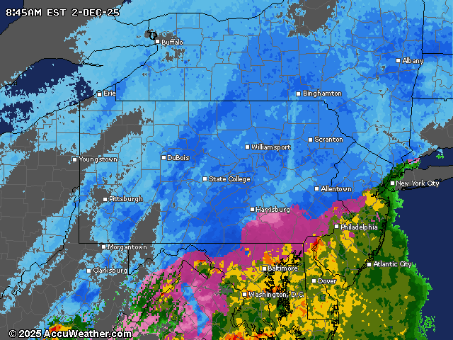
Generative AI was used to produce an initial draft of this story, which was reviewed and edited by lehighvalleylive.com staff.